![](/images/other/stat-length.png)
![Tour Wandern Chazelles-sur-Lavieu - Randonnée au dessus de Chazelles sur Lavieu - Photo](https://media.geolcdn.com/t/1900/400/b6692ae6-3e2b-4a04-9819-14d2f06cb08a.jpg&format=pjpeg&maxdim=2)
Randonnée au dessus de Chazelles sur Lavieu
dudu42
Benutzer GUIDE
![Länge](/images/other/stat-length.png)
Länge
15,4 km
![Maximale Höhe](https://static1.geolcdn.com/siteimages/upload/files/1508320355ic_sort_altitude_max_24dp.png)
Maximale Höhe
1127 m
![Positive Höhendifferenz](https://static1.geolcdn.com/siteimages/upload/files/1508320355ic_sort_den_pos_24dp.png)
Positive Höhendifferenz
503 m
![Km-Effort](/images/other/stat-length.png)
Km-Effort
22 km
![Min. Höhe](https://static1.geolcdn.com/siteimages/upload/files/1508320355ic_sort_altitude_min_24dp.png)
Min. Höhe
813 m
![Negative Höhendifferenz](https://static1.geolcdn.com/siteimages/upload/files/1508320355ic_sort_den_neg_24dp.png)
Negative Höhendifferenz
503 m
![Boucle](https://static1.geolcdn.com/siteimages/upload/files/16400158638029165_repeat_loop_refresh_sync_direction_icon.png)
Boucle
Ja
Erstellungsdatum :
2023-04-23 07:16:42.837
Letzte Änderung :
2023-04-23 11:12:29.068
![Wandern](https://static1.geolcdn.com/sitytour/trail-icons/101.png)
3h38
Schwierigkeit : Medium
![Scannen Sie diesen QR-Code, um die Tour in der SityTrail-Anwendung zu öffnen](https://capi.geolives.com/qq0zvz2zws4bq2lad0pu/sitytour/trails/3632129/qr.png?size=200)
Kostenlosegpshiking-Anwendung
Über SityTrail
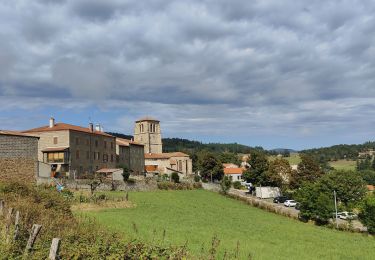
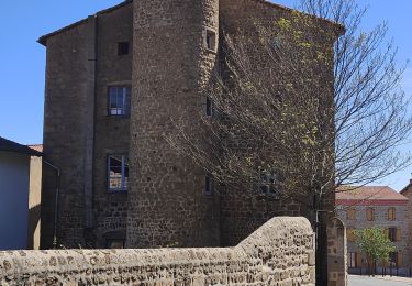
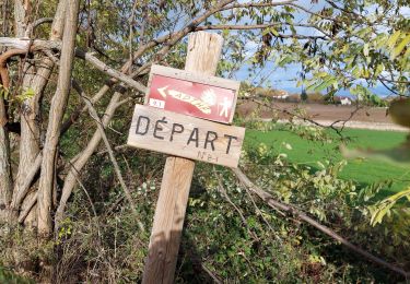
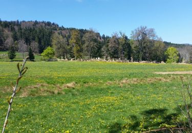
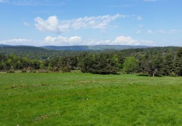
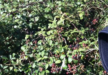
Tour Wandern von 15,4 km verfügbar auf Auvergne-Rhone-Alpen, Loire, Chazelles-sur-Lavieu. Diese Tour wird von dudu42 vorgeschlagen.
Beschreibung
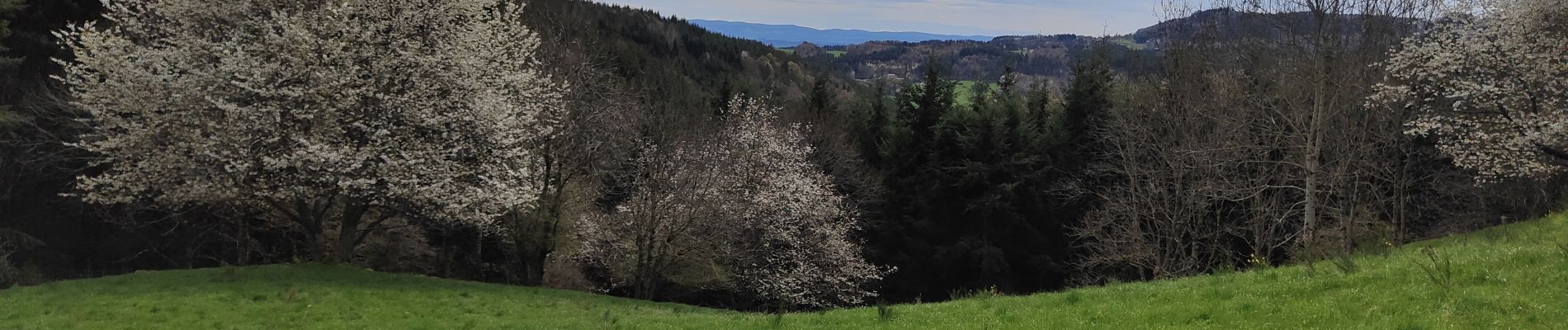
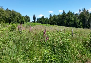
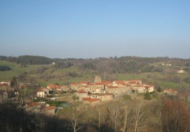
Randonnée alternant chemin de terre et de bitume. Beaux points de vue sur la plaine et du Mont Pilat.
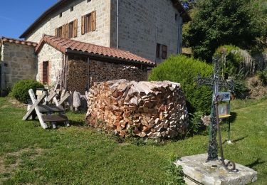
Ort
Land:
France
Region :
Auvergne-Rhone-Alpen
Abteilung/Provinz :
Loire
Kommune :
Chazelles-sur-Lavieu
Standort:
Unknown
Gehen Sie:(Dec)
Gehen Sie:(UTM)
577991 ; 5043454 (31T) N.
Kommentare
Touren in der Umgebung
![Tour Wandern Gumières - boucle du Col des Limites - Photo](https://media.geolcdn.com/t/375/260/ext.jpg?maxdim=2&url=https%3A%2F%2Fservices.sitytrail.com%2FGeolivesWS%2FDownloadMedia.ashx%3FTrailID%3D601087%26Media%3Dfix__20160710150459.jpg)
![Wandern Wandern](https://static1.geolcdn.com/sitytour/trail-icons/101.png)
boucle du Col des Limites
Wandern
Einfach
(2)
Gumières,
Auvergne-Rhone-Alpen,
Loire,
France
![](/images/other/stat-length.png)
11,8 km | 15,5 km-effort
2h 32min
![](https://static1.geolcdn.com/siteimages/upload/files/16400158638029165_repeat_loop_refresh_sync_direction_icon.png)
Ja
![Tour Wandern Verrières-en-Forez - Au dessus de Verriéres en Forez - Photo](https://media.geolcdn.com/t/375/260/abf03ef9-04b0-4647-bee0-d855afd6c2cb.jpg&format=jpg&maxdim=2)
![Wandern Wandern](https://static1.geolcdn.com/sitytour/trail-icons/101.png)
Au dessus de Verriéres en Forez
Wandern
Medium
Verrières-en-Forez,
Auvergne-Rhone-Alpen,
Loire,
France
![](/images/other/stat-length.png)
13,5 km | 19,4 km-effort
3h 23min
![](https://static1.geolcdn.com/siteimages/upload/files/16400158638029165_repeat_loop_refresh_sync_direction_icon.png)
Ja
![Tour Wandern Soleymieux - Au dessus de St Jean Soleymieux - Photo](https://media.geolcdn.com/t/375/260/078ea8f8-b8fb-4f15-aaa5-84b1d4debae2.jpg&format=jpg&maxdim=2)
![Wandern Wandern](https://static1.geolcdn.com/sitytour/trail-icons/101.png)
Au dessus de St Jean Soleymieux
Wandern
Medium
Soleymieux,
Auvergne-Rhone-Alpen,
Loire,
France
![](/images/other/stat-length.png)
13,7 km | 20 km-effort
3h 24min
![](https://static1.geolcdn.com/siteimages/upload/files/16400158638029165_repeat_loop_refresh_sync_direction_icon.png)
Ja
![Tour Wandern Lavieu - Lavieu D 101 parking - Photo](https://media.geolcdn.com/t/375/260/801b04a0-2e98-457e-b5cf-20c29f6479d2.jpg&format=jpg&maxdim=2)
![Wandern Wandern](https://static1.geolcdn.com/sitytour/trail-icons/101.png)
Lavieu D 101 parking
Wandern
Sehr schwierig
Lavieu,
Auvergne-Rhone-Alpen,
Loire,
France
![](/images/other/stat-length.png)
14 km | 19,7 km-effort
5h 19min
![](https://static1.geolcdn.com/siteimages/upload/files/16400158638029165_repeat_loop_refresh_sync_direction_icon.png)
Ja
![Tour Wandern Chazelles-sur-Lavieu - Chazelle sur Lavieu - Photo](https://media.geolcdn.com/t/375/260/ext.jpg?maxdim=2&url=https%3A%2F%2Fservices.sitytrail.com%2FGeolivesWS%2FDownloadMedia.ashx%3FTrailID%3D738302%26Media%3Dfix__20170423131742.jpg)
![Wandern Wandern](https://static1.geolcdn.com/sitytour/trail-icons/101.png)
Chazelle sur Lavieu
Wandern
Medium
Chazelles-sur-Lavieu,
Auvergne-Rhone-Alpen,
Loire,
France
![](/images/other/stat-length.png)
14,8 km | 21 km-effort
2h 56min
![](https://static1.geolcdn.com/siteimages/upload/files/16400158638029165_repeat_loop_refresh_sync_direction_icon.png)
Ja
![Tour Wandern Gumières - Boucle du col de Baracuchet - Photo](https://media.geolcdn.com/t/375/260/ext.jpg?maxdim=2&url=https%3A%2F%2Fservices.sitytrail.com%2FGeolivesWS%2FDownloadMedia.ashx%3FTrailID%3D575998%26Media%3Dfix__20160528113655.jpg)
![Wandern Wandern](https://static1.geolcdn.com/sitytour/trail-icons/101.png)
Boucle du col de Baracuchet
Wandern
Einfach
Gumières,
Auvergne-Rhone-Alpen,
Loire,
France
![](/images/other/stat-length.png)
14,3 km | 18,2 km-effort
3h 11min
![](https://static1.geolcdn.com/siteimages/upload/files/16400158638029165_repeat_loop_refresh_sync_direction_icon.png)
Ja
![Tour Wandern Verrières-en-Forez - Madonne de Verrières - Photo](https://media.geolcdn.com/t/375/260/ext.jpg?maxdim=2&url=https%3A%2F%2Fservices.sitytrail.com%2FGeolivesWS%2FDownloadMedia.ashx%3FTrailID%3D345749%26Media%3D20140916163833.jpg)
![Wandern Wandern](https://static1.geolcdn.com/sitytour/trail-icons/101.png)
Madonne de Verrières
Wandern
Einfach
Verrières-en-Forez,
Auvergne-Rhone-Alpen,
Loire,
France
![](/images/other/stat-length.png)
7,3 km | 10,1 km-effort
2h 9min
![](https://static1.geolcdn.com/siteimages/upload/files/16400158638029165_repeat_loop_refresh_sync_direction_icon.png)
Ja
![Tour Mountainbike Gumières - Gumières - Montagne de Courreau - Gumières - Photo](https://media.geolcdn.com/t/375/260/ext.jpg?maxdim=2&url=https%3A%2F%2Fservices.sitytrail.com%2FGeolivesWS%2FDownloadMedia.ashx%3FTrailID%3D102977%26Media%3D4474_3.jpg)
![Mountainbike Mountainbike](https://static1.geolcdn.com/sitytour/trail-icons/202.png)
Gumières - Montagne de Courreau - Gumières
Mountainbike
Schwierig
Gumières,
Auvergne-Rhone-Alpen,
Loire,
France
![](/images/other/stat-length.png)
49 km | 68 km-effort
5h 30min
![](https://static1.geolcdn.com/siteimages/upload/files/16400158638029165_repeat_loop_refresh_sync_direction_icon.png)
Nein
![Tour Wandern Gumières - les montagnes du soir - Photo](https://media.geolcdn.com/t/375/260/ed5be034-7ba9-4213-a188-3f0eb1939c43.jpg&format=jpg&maxdim=2)
![Wandern Wandern](https://static1.geolcdn.com/sitytour/trail-icons/101.png)
les montagnes du soir
Wandern
Einfach
Gumières,
Auvergne-Rhone-Alpen,
Loire,
France
![](/images/other/stat-length.png)
9,5 km | 14,2 km-effort
3h 4min
![](https://static1.geolcdn.com/siteimages/upload/files/16400158638029165_repeat_loop_refresh_sync_direction_icon.png)
Ja