![](/images/other/stat-length.png)
![Tour Fahrrad Draguignan - Bargemon,Seillans,Fayence - Photo](https://media.geolcdn.com/t/1900/400/ext.pjpeg?maxdim=2&url=https%3A%2F%2Fstatic1.geolcdn.com%2Fsiteimages%2Fupload%2Ffiles%2F1524743154velo.jpg)
Bargemon,Seillans,Fayence
Sugg
Benutzer
![Länge](/images/other/stat-length.png)
![Maximale Höhe](https://static1.geolcdn.com/siteimages/upload/files/1508320355ic_sort_altitude_max_24dp.png)
![Positive Höhendifferenz](https://static1.geolcdn.com/siteimages/upload/files/1508320355ic_sort_den_pos_24dp.png)
![Km-Effort](/images/other/stat-length.png)
![Min. Höhe](https://static1.geolcdn.com/siteimages/upload/files/1508320355ic_sort_altitude_min_24dp.png)
![Negative Höhendifferenz](https://static1.geolcdn.com/siteimages/upload/files/1508320355ic_sort_den_neg_24dp.png)
![Boucle](https://static1.geolcdn.com/siteimages/upload/files/16400158638029165_repeat_loop_refresh_sync_direction_icon.png)
![Fahrrad](https://static1.geolcdn.com/sitytour/trail-icons/200.png)
5h27
Schwierigkeit : Medium
![Scannen Sie diesen QR-Code, um die Tour in der SityTrail-Anwendung zu öffnen](https://capi.geolives.com/qq0zvz2zws4bq2lad0pu/sitytour/trails/362358/qr.png?size=200)
Kostenlosegpshiking-Anwendung
Über SityTrail
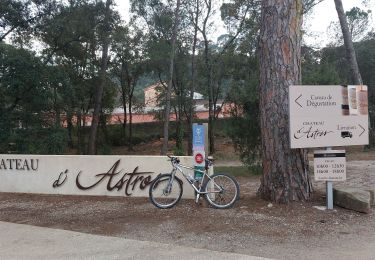
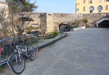
Tour Fahrrad von 78 km verfügbar auf Provence-Alpes-Côte d'Azur, Var, Draguignan. Diese Tour wird von Sugg vorgeschlagen.
Beschreibung
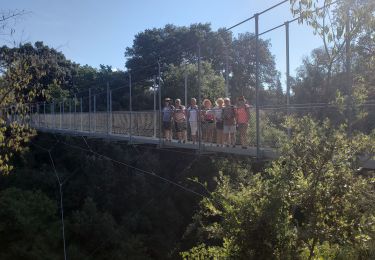
Sortie du 13 Novembre 2014.
Groupe 1 , 8 cyclistes.
Départ : 13h15
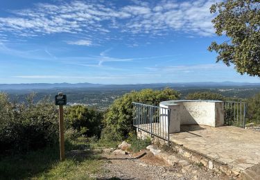
83 Kms - Dénivelé : 970 m environ
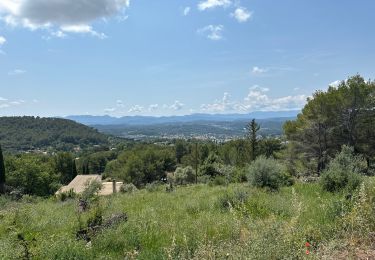
DRAGUIGNAN
D562 (Rte de Grasse)
D225 - D25 - CALLAS ……….. 17
BARGEMON 23
COL DE ST ARNOUX 30
SEILLANS ………… 35
D19 - FAYENCE (bas) 40
D563/D4 St Paul-en-forêt 48
Bagnols-en-forêt……………… 53
Côte du Blavet ………………
La Motte 71
le petit Galibier ou
Trans (pour les fainéants !)
DRAGUIGNAN ……………… 83
Voilà nous avons été deux à rentrer direct.
Il commence à faire froid à 16h30 !!!
Soit : 78 kms, 3h21 de roulage, 23.7km/h de moyenne, il y avait de la bosse...
Ort
Kommentare
Touren in der Umgebung
![Tour Wandern Draguignan - Draguignan Malmont 10 km - Photo](https://media.geolcdn.com/t/375/260/d1a2a54e-903f-461c-ac9a-777d73202ad8.jpg&format=jpg&maxdim=2)
![Wandern Wandern](https://static1.geolcdn.com/sitytour/trail-icons/101.png)
Wandern
![](/images/other/stat-length.png)
![](https://static1.geolcdn.com/siteimages/upload/files/16400158638029165_repeat_loop_refresh_sync_direction_icon.png)
![Tour Wandern Draguignan - Draguignan Roche aux Fées Malmont 17 km - Photo](https://media.geolcdn.com/t/375/260/f159f27b-5b1e-45be-88d4-c4333d86164c.jpg&format=jpg&maxdim=2)
![Wandern Wandern](https://static1.geolcdn.com/sitytour/trail-icons/101.png)
Wandern
![](/images/other/stat-length.png)
![](https://static1.geolcdn.com/siteimages/upload/files/16400158638029165_repeat_loop_refresh_sync_direction_icon.png)
![Tour Wandern Figanières - Figanières 01 - Photo](https://media.geolcdn.com/t/375/260/ext.jpg?maxdim=2&url=https%3A%2F%2Fstatic1.geolcdn.com%2Fsiteimages%2Fupload%2Ffiles%2F1553511878bg_sport_marche.png)
![Wandern Wandern](https://static1.geolcdn.com/sitytour/trail-icons/101.png)
Wandern
![](/images/other/stat-length.png)
![](https://static1.geolcdn.com/siteimages/upload/files/16400158638029165_repeat_loop_refresh_sync_direction_icon.png)
![Tour Wandern Draguignan - Musée de l’artillerie et cimetière américain 7 km - Photo](https://media.geolcdn.com/t/375/260/778163a7-819c-4bb6-a61f-19371b647e3b.jpg&format=jpg&maxdim=2)
![Wandern Wandern](https://static1.geolcdn.com/sitytour/trail-icons/101.png)
Wandern
![](/images/other/stat-length.png)
![](https://static1.geolcdn.com/siteimages/upload/files/16400158638029165_repeat_loop_refresh_sync_direction_icon.png)
![Tour Wandern Draguignan - Rebouillon le long de la Nartuby - Photo](https://media.geolcdn.com/t/375/260/5546167f-335f-4958-9f3e-7305fd054196.jpg&format=jpg&maxdim=2)
![Wandern Wandern](https://static1.geolcdn.com/sitytour/trail-icons/101.png)
Wandern
![](/images/other/stat-length.png)
![](https://static1.geolcdn.com/siteimages/upload/files/16400158638029165_repeat_loop_refresh_sync_direction_icon.png)
![Tour Wandern Draguignan - Malmont 10 km - Photo](https://media.geolcdn.com/t/375/260/da456918-fb68-4e05-ab32-80af50d67781.jpg&format=jpg&maxdim=2)
![Wandern Wandern](https://static1.geolcdn.com/sitytour/trail-icons/101.png)
Wandern
![](/images/other/stat-length.png)
![](https://static1.geolcdn.com/siteimages/upload/files/16400158638029165_repeat_loop_refresh_sync_direction_icon.png)
![Tour Wandern Trans-en-Provence - TRANS-Le puits aérien et la passerelle hymalayenne -MBO - Photo](https://media.geolcdn.com/t/375/260/52faf0f7-6a43-44b3-98ad-47b606885080.jpg&format=jpg&maxdim=2)
![Wandern Wandern](https://static1.geolcdn.com/sitytour/trail-icons/101.png)
Wandern
![](/images/other/stat-length.png)
![](https://static1.geolcdn.com/siteimages/upload/files/16400158638029165_repeat_loop_refresh_sync_direction_icon.png)
![Tour Mountainbike Draguignan - 20220308 vtt route - Photo](https://media.geolcdn.com/t/375/260/f158cf40-388a-495c-9de7-d89e468d92c8.jpg&format=jpg&maxdim=2)
![Mountainbike Mountainbike](https://static1.geolcdn.com/sitytour/trail-icons/202.png)
Mountainbike
![](/images/other/stat-length.png)
![](https://static1.geolcdn.com/siteimages/upload/files/16400158638029165_repeat_loop_refresh_sync_direction_icon.png)
![Tour Mountainbike Draguignan - 20220301 vtt route - Photo](https://media.geolcdn.com/t/375/260/d0f2d217-7e6a-4760-8c6c-914bc0336dc2.jpg&format=jpg&maxdim=2)
![Mountainbike Mountainbike](https://static1.geolcdn.com/sitytour/trail-icons/202.png)
Mountainbike
![](/images/other/stat-length.png)
![](https://static1.geolcdn.com/siteimages/upload/files/16400158638029165_repeat_loop_refresh_sync_direction_icon.png)