


7,7 km | 9,1 km-effort


Benutzer


Kostenlosegpshiking-Anwendung
 SityTrail
IGN / Geografische Institute
SityTrail World
Die Welt öffnet sich für Sie
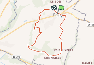
Tour Wandern von 8,8 km verfügbar auf Auvergne-Rhone-Alpen, Isère, Pajay. Diese Tour wird von raymondfn vorgeschlagen.
Départ : parking de la mairie et de l'église de Pajay
Tour de l'Étang du Loup
Sentier qui serpente dans la zone cultivée, modérément vallonée, des Antées
Passage aux hameaux des Bruyères et de Gourras ; le bois de Gourras abrite un sous-bois dense de fragon.
La chapelle du Truchaud
Le coteau des Blaches
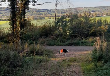
Animaux rencontrés en période hivernale : héron cendré, grande aigrette, wallabies (!)

Wandern
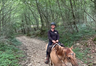
Reiten
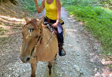
Reiten
Wandern
Wandern
Reiten
Wandern

Zu Fuß
Wandern