


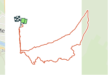

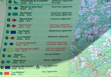
23 km | 33 km-effort


Benutzer


Kostenlosegpshiking-Anwendung
 SityTrail
IGN / Geografische Institute
SityTrail World
Die Welt öffnet sich für Sie
Tour Wandern von 3 km verfügbar auf Wallonien, Namur, Vresse-sur-Semois. Diese Tour wird von Hallaert-Devos vorgeschlagen.
Belle balade et superbe vue depuis la tour.
Pas praticable en buggie.
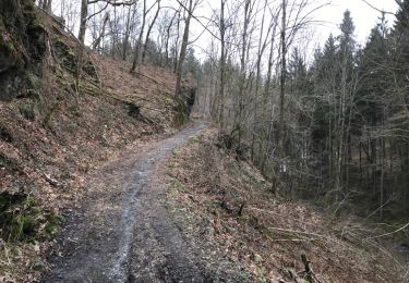
Au début et jusqu´à la tour, très forte montée sur petit chemin.

Wandern

Wandern

Wandern

Wandern

Wandern

Wandern

Wandern
Wandern
Wandern