![](/images/other/stat-length.png)
![Tour Zu Fuß Venouse - Randonnée Ascension 2023 - Grange de Beauvais - Photo](https://media.geolcdn.com/t/1900/400/ext.pjpeg?maxdim=2&url=https%3A%2F%2Fstatic1.geolcdn.com%2Fsiteimages%2Fupload%2Ffiles%2F1545311037marcheuse_200dpi.jpg)
Randonnée Ascension 2023 - Grange de Beauvais
JMC89
Benutzer
![Länge](/images/other/stat-length.png)
![Maximale Höhe](https://static1.geolcdn.com/siteimages/upload/files/1508320355ic_sort_altitude_max_24dp.png)
![Positive Höhendifferenz](https://static1.geolcdn.com/siteimages/upload/files/1508320355ic_sort_den_pos_24dp.png)
![Km-Effort](/images/other/stat-length.png)
![Min. Höhe](https://static1.geolcdn.com/siteimages/upload/files/1508320355ic_sort_altitude_min_24dp.png)
![Negative Höhendifferenz](https://static1.geolcdn.com/siteimages/upload/files/1508320355ic_sort_den_neg_24dp.png)
![Boucle](https://static1.geolcdn.com/siteimages/upload/files/16400158638029165_repeat_loop_refresh_sync_direction_icon.png)
![Zu Fuß](https://static1.geolcdn.com/sitytour/trail-icons/100.png)
3h38
Schwierigkeit : Einfach
![Scannen Sie diesen QR-Code, um die Tour in der SityTrail-Anwendung zu öffnen](https://capi.geolives.com/qq0zvz2zws4bq2lad0pu/sitytour/trails/3618462/qr.png?size=200)
Kostenlosegpshiking-Anwendung
Über SityTrail
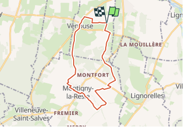
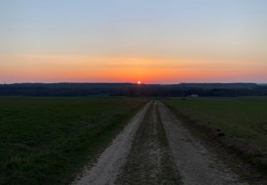
Tour Zu Fuß von 13,7 km verfügbar auf Burgund und Freigrafschaft, Yonne, Venouse. Diese Tour wird von JMC89 vorgeschlagen.
Beschreibung
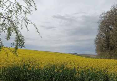
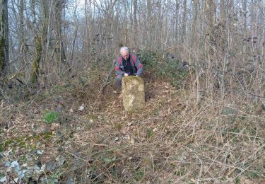
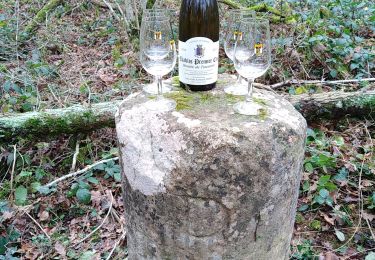
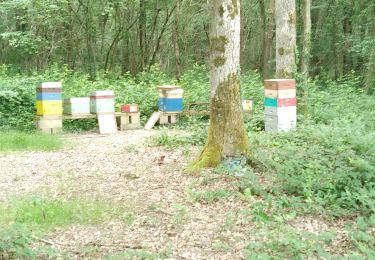
Départ de La Grange de Beauvais direction Venouse par derrière le village, traversée du village en direction de Montigny la Resle par le chemin communal. Traversée du bois du Roi. Au lieudit la Berthole prendre à droite et suivre la rue passer derrière le village par les ruelles. Arrivée sur la place de l'église traverser la N77 en direction du cimetière, point de ravitaillement direction la ferme de Malville et la ferme de SOUILLY Traversé du bois des Cinquantaines rejoindre la N77 puis traverser celle ci en direction de l'homme mort suivre le chemin jusqu'au bois blanc et retour à la Ferme deBeauvais
Ort
Kommentare
Touren in der Umgebung
![Tour Zu Fuß Venouse - Venouse la Grange - Photo](https://media.geolcdn.com/t/375/260/ext.jpg?maxdim=2&url=https%3A%2F%2Fstatic1.geolcdn.com%2Fsiteimages%2Fupload%2Ffiles%2F1545311037marcheuse_200dpi.jpg)
![Zu Fuß Zu Fuß](https://static1.geolcdn.com/sitytour/trail-icons/100.png)
Zu Fuß
![](/images/other/stat-length.png)
![](https://static1.geolcdn.com/siteimages/upload/files/16400158638029165_repeat_loop_refresh_sync_direction_icon.png)
![Tour Wandern Vergigny - BORNES BLEUES BAUDIERES - Photo](https://media.geolcdn.com/t/375/260/21a5846f-4293-445d-bd77-be98ab22f854.jpg&format=jpg&maxdim=2)
![Wandern Wandern](https://static1.geolcdn.com/sitytour/trail-icons/101.png)
Wandern
![](/images/other/stat-length.png)
![](https://static1.geolcdn.com/siteimages/upload/files/16400158638029165_repeat_loop_refresh_sync_direction_icon.png)
![Tour Wandern Montigny-la-Resle - Randonnée Montigny la Resle - Photo](https://media.geolcdn.com/t/375/260/1f607010-ae8f-40b5-959b-769cec615d7a.jpg&format=jpg&maxdim=2)
![Wandern Wandern](https://static1.geolcdn.com/sitytour/trail-icons/101.png)
Wandern
![](/images/other/stat-length.png)
![](https://static1.geolcdn.com/siteimages/upload/files/16400158638029165_repeat_loop_refresh_sync_direction_icon.png)
![Tour Wandern Héry - Bornes ZC 16 -17 - 18 le 070524 - Photo](https://media.geolcdn.com/t/375/260/877ef72e-032c-45d0-bd47-d79ab15b7a18.jpg&format=jpg&maxdim=2)
![Wandern Wandern](https://static1.geolcdn.com/sitytour/trail-icons/101.png)
Wandern
![](/images/other/stat-length.png)
![](https://static1.geolcdn.com/siteimages/upload/files/16400158638029165_repeat_loop_refresh_sync_direction_icon.png)
![Tour Wandern Maligny - Boucle autour de Maligny 89 - Photo](https://media.geolcdn.com/t/375/260/9319b577-f2bb-481f-a3d2-e359ca61a66c.jpg&format=jpg&maxdim=2)
![Wandern Wandern](https://static1.geolcdn.com/sitytour/trail-icons/101.png)
Wandern
![](/images/other/stat-length.png)
![](https://static1.geolcdn.com/siteimages/upload/files/16400158638029165_repeat_loop_refresh_sync_direction_icon.png)
![Tour Wandern Montigny-la-Resle - ZB9 et ZB10 - Bornage 1728 - 13022024 - Photo](https://media.geolcdn.com/t/375/260/73aa85f0-a874-4032-9b16-848bef49981d.jpg&format=jpg&maxdim=2)
![Wandern Wandern](https://static1.geolcdn.com/sitytour/trail-icons/101.png)
Wandern
![](/images/other/stat-length.png)
![](https://static1.geolcdn.com/siteimages/upload/files/16400158638029165_repeat_loop_refresh_sync_direction_icon.png)
![Tour Wandern Montigny-la-Resle - Borne Cistercienne 10 - Photo](https://media.geolcdn.com/t/375/260/d81c1d3f-7f69-4fbd-8e9b-772ccfb2e09d.jpg&format=jpg&maxdim=2)
![Wandern Wandern](https://static1.geolcdn.com/sitytour/trail-icons/101.png)
Wandern
![](/images/other/stat-length.png)
![](https://static1.geolcdn.com/siteimages/upload/files/16400158638029165_repeat_loop_refresh_sync_direction_icon.png)
![Tour Wandern Venouse - G Beauvais 260522 - Photo](https://media.geolcdn.com/t/375/260/a3372e38-7d40-420b-ab74-98e75f0d117a.jpg&format=jpg&maxdim=2)
![Wandern Wandern](https://static1.geolcdn.com/sitytour/trail-icons/101.png)
Wandern
![](/images/other/stat-length.png)
![](https://static1.geolcdn.com/siteimages/upload/files/16400158638029165_repeat_loop_refresh_sync_direction_icon.png)
![Tour Laufen Ligny-le-Châtel - Circuit autour de Ligny le chatel - Photo](https://media.geolcdn.com/t/375/260/4d315fb9-ce48-4fb2-9e83-7d23fdc2fc32.jpg&format=jpg&maxdim=2)
![Laufen Laufen](https://static1.geolcdn.com/sitytour/trail-icons/103.png)
Laufen
![](/images/other/stat-length.png)
![](https://static1.geolcdn.com/siteimages/upload/files/16400158638029165_repeat_loop_refresh_sync_direction_icon.png)