![](/images/other/stat-length.png)
![Tour Wandern Écrouves - Ecrouves - Photo](https://media.geolcdn.com/t/1900/400/ext.pjpeg?maxdim=2&url=https%3A%2F%2Fstatic1.geolcdn.com%2Fsiteimages%2Fupload%2Ffiles%2F1553511878bg_sport_marche.png)
Ecrouves
DanielROLLET
Benutzer
![Länge](/images/other/stat-length.png)
Länge
12,1 km
![Maximale Höhe](https://static1.geolcdn.com/siteimages/upload/files/1508320355ic_sort_altitude_max_24dp.png)
Maximale Höhe
382 m
![Positive Höhendifferenz](https://static1.geolcdn.com/siteimages/upload/files/1508320355ic_sort_den_pos_24dp.png)
Positive Höhendifferenz
283 m
![Km-Effort](/images/other/stat-length.png)
Km-Effort
15,9 km
![Min. Höhe](https://static1.geolcdn.com/siteimages/upload/files/1508320355ic_sort_altitude_min_24dp.png)
Min. Höhe
262 m
![Negative Höhendifferenz](https://static1.geolcdn.com/siteimages/upload/files/1508320355ic_sort_den_neg_24dp.png)
Negative Höhendifferenz
284 m
![Boucle](https://static1.geolcdn.com/siteimages/upload/files/16400158638029165_repeat_loop_refresh_sync_direction_icon.png)
Boucle
Ja
Erstellungsdatum :
2016-12-28 00:00:00.0
Letzte Änderung :
2016-12-28 00:00:00.0
![Wandern](https://static1.geolcdn.com/sitytour/trail-icons/101.png)
3h23
Schwierigkeit : Einfach
![Scannen Sie diesen QR-Code, um die Tour in der SityTrail-Anwendung zu öffnen](https://capi.geolives.com/qq0zvz2zws4bq2lad0pu/sitytour/trails/361844/qr.png?size=200)
Kostenlosegpshiking-Anwendung
Über SityTrail
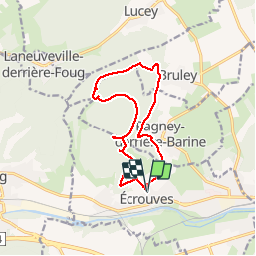
Tour Wandern von 12,1 km verfügbar auf Großer Osten, Mörthe und Mosel, Écrouves. Diese Tour wird von DanielROLLET vorgeschlagen.
Beschreibung
11.11.2014
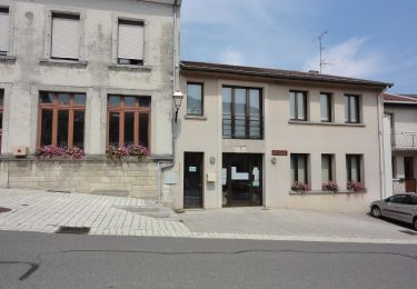
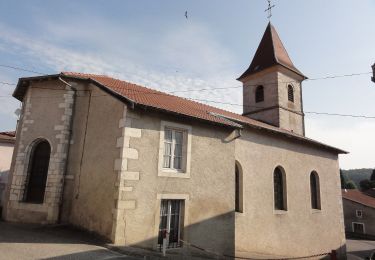
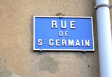
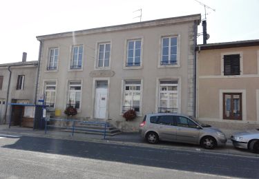
Départ et retour à l'église d'Ecrouves.
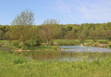
Boucle par le fort de Lucey, le Val des Nonnes, Bruley et Pagney derrière Barine
Ort
Land:
France
Region :
Großer Osten
Abteilung/Provinz :
Mörthe und Mosel
Kommune :
Écrouves
Standort:
Unknown
Gehen Sie:(Dec)
Gehen Sie:(UTM)
709061 ; 5395889 (31U) N.
Kommentare
Touren in der Umgebung
![Tour Zu Fuß Bruley - Circuit de la Petite Linotte - Photo](https://media.geolcdn.com/t/375/260/c8d38300-38c0-4b90-af2c-ff730d2ffb15.jpeg&format=jpg&maxdim=2)
![Zu Fuß Zu Fuß](https://static1.geolcdn.com/sitytour/trail-icons/100.png)
Circuit de la Petite Linotte
Zu Fuß
Einfach
Bruley,
Großer Osten,
Mörthe und Mosel,
France
![](/images/other/stat-length.png)
9,2 km | 12 km-effort
2h 43min
![](https://static1.geolcdn.com/siteimages/upload/files/16400158638029165_repeat_loop_refresh_sync_direction_icon.png)
Nein
![Tour Mountainbike Toul - Côtes de Toul 50k 2012 - Photo](https://media.geolcdn.com/t/375/260/ext.jpg?maxdim=2&url=https%3A%2F%2Fstatic1.geolcdn.com%2Fsiteimages%2Fupload%2Ffiles%2F1524743154velo.jpg)
![Mountainbike Mountainbike](https://static1.geolcdn.com/sitytour/trail-icons/202.png)
Côtes de Toul 50k 2012
Mountainbike
Schwierig
(2)
Toul,
Großer Osten,
Mörthe und Mosel,
France
![](/images/other/stat-length.png)
59 km | 75 km-effort
5h 15min
![](https://static1.geolcdn.com/siteimages/upload/files/16400158638029165_repeat_loop_refresh_sync_direction_icon.png)
Ja
![Tour Mountainbike Écrouves - 1 ère rando VTT - Photo](https://media.geolcdn.com/t/375/260/ext.jpg?maxdim=2&url=https%3A%2F%2Fstatic1.geolcdn.com%2Fsiteimages%2Fupload%2Ffiles%2F1524743154velo.jpg)
![Mountainbike Mountainbike](https://static1.geolcdn.com/sitytour/trail-icons/202.png)
1 ère rando VTT
Mountainbike
Sehr leicht
(1)
Écrouves,
Großer Osten,
Mörthe und Mosel,
France
![](/images/other/stat-length.png)
7,5 km | 9,5 km-effort
Unbekannt
![](https://static1.geolcdn.com/siteimages/upload/files/16400158638029165_repeat_loop_refresh_sync_direction_icon.png)
Ja
![Tour Zu Fuß Laneuveville-derrière-Foug - Circuit de Domfontaine - Photo](https://media.geolcdn.com/t/375/260/93f65dee-64e5-4ca3-9bc3-5701a8dbad57.jpeg&format=jpg&maxdim=2)
![Zu Fuß Zu Fuß](https://static1.geolcdn.com/sitytour/trail-icons/100.png)
Circuit de Domfontaine
Zu Fuß
Einfach
Laneuveville-derrière-Foug,
Großer Osten,
Mörthe und Mosel,
France
![](/images/other/stat-length.png)
9,5 km | 12,6 km-effort
2h 51min
![](https://static1.geolcdn.com/siteimages/upload/files/16400158638029165_repeat_loop_refresh_sync_direction_icon.png)
Ja
![Tour Zu Fuß Trondes - Circuit du Romont - Photo](https://media.geolcdn.com/t/375/260/07a99b10-d59a-4513-b094-c282117c9672.jpeg&format=jpg&maxdim=2)
![Zu Fuß Zu Fuß](https://static1.geolcdn.com/sitytour/trail-icons/100.png)
Circuit du Romont
Zu Fuß
Einfach
Trondes,
Großer Osten,
Mörthe und Mosel,
France
![](/images/other/stat-length.png)
6,8 km | 8,1 km-effort
1h 50min
![](https://static1.geolcdn.com/siteimages/upload/files/16400158638029165_repeat_loop_refresh_sync_direction_icon.png)
Ja
![Tour Zu Fuß Foug - Circuit de Grammont - Photo](https://media.geolcdn.com/t/375/260/d7a9625f-1b4f-4d64-86f5-7a590416d8ca.jpeg&format=jpg&maxdim=2)
![Zu Fuß Zu Fuß](https://static1.geolcdn.com/sitytour/trail-icons/100.png)
Circuit de Grammont
Zu Fuß
Einfach
Foug,
Großer Osten,
Mörthe und Mosel,
France
![](/images/other/stat-length.png)
15,6 km | 19,3 km-effort
4h 23min
![](https://static1.geolcdn.com/siteimages/upload/files/16400158638029165_repeat_loop_refresh_sync_direction_icon.png)
Nein
![Tour Zu Fuß Choloy-Ménillot - Boucle des Sources - Photo](https://media.geolcdn.com/t/375/260/ac86fb3f-3e84-4c34-b460-6a4b9dab63b7.jpeg&format=jpg&maxdim=2)
![Zu Fuß Zu Fuß](https://static1.geolcdn.com/sitytour/trail-icons/100.png)
Boucle des Sources
Zu Fuß
Einfach
Choloy-Ménillot,
Großer Osten,
Mörthe und Mosel,
France
![](/images/other/stat-length.png)
10,4 km | 11,9 km-effort
2h 42min
![](https://static1.geolcdn.com/siteimages/upload/files/16400158638029165_repeat_loop_refresh_sync_direction_icon.png)
Nein
![Tour Zu Fuß Lucey - Circuit des Vignes - Photo](https://media.geolcdn.com/t/375/260/e81c5232-ac1b-4f67-955e-d25a321053a6.jpeg&format=jpg&maxdim=2)
![Zu Fuß Zu Fuß](https://static1.geolcdn.com/sitytour/trail-icons/100.png)
Circuit des Vignes
Zu Fuß
Einfach
Lucey,
Großer Osten,
Mörthe und Mosel,
France
![](/images/other/stat-length.png)
4,2 km | 5,2 km-effort
1h 11min
![](https://static1.geolcdn.com/siteimages/upload/files/16400158638029165_repeat_loop_refresh_sync_direction_icon.png)
Ja
![Tour Zu Fuß Laneuveville-derrière-Foug - Circuit du Point du Jour - Photo](https://media.geolcdn.com/t/375/260/b1cded44-ffa4-4904-97ef-f463ee03586b.jpeg&format=jpg&maxdim=2)
![Zu Fuß Zu Fuß](https://static1.geolcdn.com/sitytour/trail-icons/100.png)
Circuit du Point du Jour
Zu Fuß
Einfach
Laneuveville-derrière-Foug,
Großer Osten,
Mörthe und Mosel,
France
![](/images/other/stat-length.png)
6,8 km | 8 km-effort
1h 49min
![](https://static1.geolcdn.com/siteimages/upload/files/16400158638029165_repeat_loop_refresh_sync_direction_icon.png)
Nein