![](/images/other/stat-length.png)
![Tour Wandern Beauraing - Balade à Winenne - Beauraing - Photo](https://media.geolcdn.com/t/1900/400/8bfd43ea-288d-45ae-81cb-56021fe3f6e3.jpeg&format=pjpeg&maxdim=2)
Balade à Winenne - Beauraing
Desrumaux
Benutzer GUIDE
![Länge](/images/other/stat-length.png)
Länge
11,7 km
![Maximale Höhe](https://static1.geolcdn.com/siteimages/upload/files/1508320355ic_sort_altitude_max_24dp.png)
Maximale Höhe
366 m
![Positive Höhendifferenz](https://static1.geolcdn.com/siteimages/upload/files/1508320355ic_sort_den_pos_24dp.png)
Positive Höhendifferenz
223 m
![Km-Effort](/images/other/stat-length.png)
Km-Effort
14,7 km
![Min. Höhe](https://static1.geolcdn.com/siteimages/upload/files/1508320355ic_sort_altitude_min_24dp.png)
Min. Höhe
223 m
![Negative Höhendifferenz](https://static1.geolcdn.com/siteimages/upload/files/1508320355ic_sort_den_neg_24dp.png)
Negative Höhendifferenz
223 m
![Boucle](https://static1.geolcdn.com/siteimages/upload/files/16400158638029165_repeat_loop_refresh_sync_direction_icon.png)
Boucle
Ja
Erstellungsdatum :
2023-04-03 08:19:53.943
Letzte Änderung :
2023-04-05 05:42:37.949
![Wandern](https://static1.geolcdn.com/sitytour/trail-icons/101.png)
3h20
Schwierigkeit : Schwierig
![Scannen Sie diesen QR-Code, um die Tour in der SityTrail-Anwendung zu öffnen](https://capi.geolives.com/qq0zvz2zws4bq2lad0pu/sitytour/trails/3607617/qr.png?size=200)
Kostenlosegpshiking-Anwendung
Über SityTrail
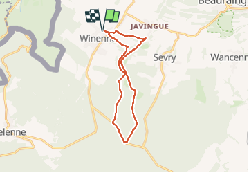
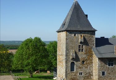
Tour Wandern von 11,7 km verfügbar auf Wallonien, Namur, Beauraing. Diese Tour wird von Desrumaux vorgeschlagen.
Beschreibung
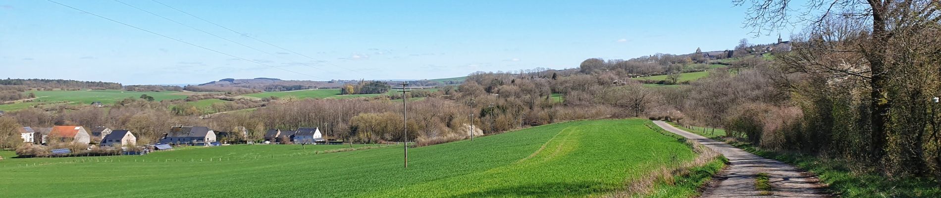
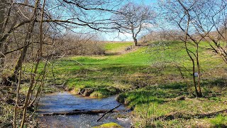
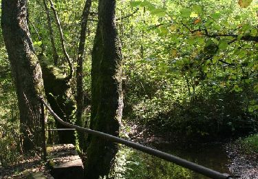
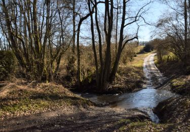
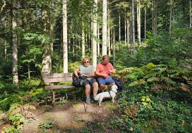
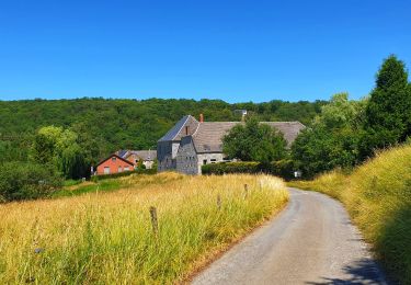
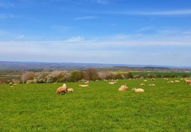
Jolie balade forestière au confins de la Famenne et de l'Ardenne au départ du village de Winenne dans l'entité de Beauraing.
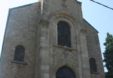
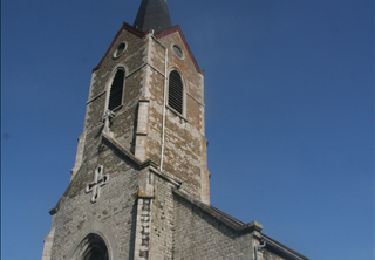
Départ: place de la Libération
Ort
Land:
Belgium
Region :
Wallonien
Abteilung/Provinz :
Namur
Kommune :
Beauraing
Standort:
Unknown
Gehen Sie:(Dec)
Gehen Sie:(UTM)
635553 ; 5551498 (31U) N.
Kommentare
Touren in der Umgebung
![Tour Wandern Beauraing - Winenne - Nature: trip to the countryside - Photo](https://media.geolcdn.com/t/375/260/ext.jpg?maxdim=2&url=https%3A%2F%2Fservices.sitytrail.com%2FGeolivesWS%2FDownloadMedia.ashx%3FTrailID%3D208730%26Media%3Dec2b8399-61b2-47f0-8c4e-ffe9506b5f79.jpg)
![Wandern Wandern](https://static1.geolcdn.com/sitytour/trail-icons/101.png)
Winenne - Nature: trip to the countryside
Wandern
Schwierig
(7)
Beauraing,
Wallonien,
Namur,
Belgium
![](/images/other/stat-length.png)
20 km | 26 km-effort
6h 0min
![](https://static1.geolcdn.com/siteimages/upload/files/16400158638029165_repeat_loop_refresh_sync_direction_icon.png)
Ja
![Wandern Wandern](https://static1.geolcdn.com/sitytour/trail-icons/101.png)
RB-Na-28-En Famenne occidentale
Wandern
Sehr schwierig
(5)
Beauraing,
Wallonien,
Namur,
Belgium
![](/images/other/stat-length.png)
19,4 km | 24 km-effort
5h 33min
![](https://static1.geolcdn.com/siteimages/upload/files/16400158638029165_repeat_loop_refresh_sync_direction_icon.png)
Ja
![Tour Wandern Beauraing - Javingue-Sevry - Roadbook discovering villages & landscapes - Photo](https://media.geolcdn.com/t/375/260/ext.jpg?maxdim=2&url=https%3A%2F%2Fservices.sitytrail.com%2FGeolivesWS%2FDownloadMedia.ashx%3FTrailID%3D230063%26Media%3D65d10601-99c2-4ec7-afa5-e6b7caea9bd6.jpg)
![Wandern Wandern](https://static1.geolcdn.com/sitytour/trail-icons/101.png)
Javingue-Sevry - Roadbook discovering villages & landscapes
Wandern
Einfach
(6)
Beauraing,
Wallonien,
Namur,
Belgium
![](/images/other/stat-length.png)
7,7 km | 10,2 km-effort
2h 0min
![](https://static1.geolcdn.com/siteimages/upload/files/16400158638029165_repeat_loop_refresh_sync_direction_icon.png)
Ja
![Tour Wandern Beauraing - Beauraing - Discover its natural and architectural treasures - Photo](https://media.geolcdn.com/t/375/260/ext.jpg?maxdim=2&url=https%3A%2F%2Fservices.sitytrail.com%2FGeolivesWS%2FDownloadMedia.ashx%3FTrailID%3D179304%26Media%3D8042c99a-cbb1-4b71-ba1e-520d449245b8.jpg)
![Wandern Wandern](https://static1.geolcdn.com/sitytour/trail-icons/101.png)
Beauraing - Discover its natural and architectural treasures
Wandern
Einfach
(6)
Beauraing,
Wallonien,
Namur,
Belgium
![](/images/other/stat-length.png)
6,5 km | 8,6 km-effort
1h 43min
![](https://static1.geolcdn.com/siteimages/upload/files/16400158638029165_repeat_loop_refresh_sync_direction_icon.png)
Ja
![Tour Wandern Givet - Balade à Givet - Photo](https://media.geolcdn.com/t/375/260/ext.jpg?maxdim=2&url=https%3A%2F%2Fservices.sitytrail.com%2FGeolivesWS%2FDownloadMedia.ashx%3FTrailID%3D110616%26Media%3D6179_5.jpg)
![Wandern Wandern](https://static1.geolcdn.com/sitytour/trail-icons/101.png)
Balade à Givet
Wandern
Medium
(3)
Givet,
Großer Osten,
Ardennes,
France
![](/images/other/stat-length.png)
8 km | 9,4 km-effort
2h 0min
![](https://static1.geolcdn.com/siteimages/upload/files/16400158638029165_repeat_loop_refresh_sync_direction_icon.png)
Ja
![Tour Mountainbike Beauraing - Winenne - Nature: trip to the countryside - Photo](https://media.geolcdn.com/t/375/260/ext.jpg?maxdim=2&url=https%3A%2F%2Fservices.sitytrail.com%2FGeolivesWS%2FDownloadMedia.ashx%3FTrailID%3D225225%26Media%3D30a4a7fc-abda-4afa-ad3f-06c878f2db6f.jpg)
![Mountainbike Mountainbike](https://static1.geolcdn.com/sitytour/trail-icons/202.png)
Winenne - Nature: trip to the countryside
Mountainbike
Medium
(3)
Beauraing,
Wallonien,
Namur,
Belgium
![](/images/other/stat-length.png)
20 km | 26 km-effort
1h 41min
![](https://static1.geolcdn.com/siteimages/upload/files/16400158638029165_repeat_loop_refresh_sync_direction_icon.png)
Ja
![Tour Wandern Beauraing - Balade dans la forêt de Felenne-Beauraing - Photo](https://media.geolcdn.com/t/375/260/e48c272a-3458-4139-8269-670b69d7c90a.jpg&format=jpg&maxdim=2)
![Wandern Wandern](https://static1.geolcdn.com/sitytour/trail-icons/101.png)
Balade dans la forêt de Felenne-Beauraing
Wandern
Schwierig
Beauraing,
Wallonien,
Namur,
Belgium
![](/images/other/stat-length.png)
10,5 km | 14,4 km-effort
3h 16min
![](https://static1.geolcdn.com/siteimages/upload/files/16400158638029165_repeat_loop_refresh_sync_direction_icon.png)
Ja
![Tour Wandern Beauraing - Balade de Dion à Winenne - Beauraing - Photo](https://media.geolcdn.com/t/375/260/5c1dc6e2-7e96-43cd-a912-ceabbaabe8bc.jpeg&format=jpg&maxdim=2)
![Wandern Wandern](https://static1.geolcdn.com/sitytour/trail-icons/101.png)
Balade de Dion à Winenne - Beauraing
Wandern
Medium
(2)
Beauraing,
Wallonien,
Namur,
Belgium
![](/images/other/stat-length.png)
6,5 km | 8,5 km-effort
1h 55min
![](https://static1.geolcdn.com/siteimages/upload/files/16400158638029165_repeat_loop_refresh_sync_direction_icon.png)
Ja
![Tour Wandern Beauraing - Balade à Wancennes - Beauraing - Photo](https://media.geolcdn.com/t/375/260/877374a2-9300-4cad-a497-0be966c89aea.jpeg&format=jpg&maxdim=2)
![Wandern Wandern](https://static1.geolcdn.com/sitytour/trail-icons/101.png)
Balade à Wancennes - Beauraing
Wandern
Medium
Beauraing,
Wallonien,
Namur,
Belgium
![](/images/other/stat-length.png)
8,5 km | 11,2 km-effort
2h 32min
![](https://static1.geolcdn.com/siteimages/upload/files/16400158638029165_repeat_loop_refresh_sync_direction_icon.png)
Ja