![](/images/other/stat-length.png)
![Tour Mountainbike Souillac - Entre causse et Dordogne - Photo](https://media.geolcdn.com/t/1900/400/ext.pjpeg?maxdim=2&url=https%3A%2F%2Fservices.sitytrail.com%2FGeolivesWS%2FDownloadMedia.ashx%3FTrailID%3D359561%26Media%3Dfix__20141102115009.jpg)
Entre causse et Dordogne
sdroneau
Benutzer
![Länge](/images/other/stat-length.png)
Länge
26 km
![Maximale Höhe](https://static1.geolcdn.com/siteimages/upload/files/1508320355ic_sort_altitude_max_24dp.png)
Maximale Höhe
341 m
![Positive Höhendifferenz](https://static1.geolcdn.com/siteimages/upload/files/1508320355ic_sort_den_pos_24dp.png)
Positive Höhendifferenz
739 m
![Km-Effort](/images/other/stat-length.png)
Km-Effort
36 km
![Min. Höhe](https://static1.geolcdn.com/siteimages/upload/files/1508320355ic_sort_altitude_min_24dp.png)
Min. Höhe
83 m
![Negative Höhendifferenz](https://static1.geolcdn.com/siteimages/upload/files/1508320355ic_sort_den_neg_24dp.png)
Negative Höhendifferenz
739 m
![Boucle](https://static1.geolcdn.com/siteimages/upload/files/16400158638029165_repeat_loop_refresh_sync_direction_icon.png)
Boucle
Ja
Erstellungsdatum :
2014-12-10 00:00:00.0
Letzte Änderung :
2014-12-10 00:00:00.0
![Mountainbike](https://static1.geolcdn.com/sitytour/trail-icons/202.png)
3h00
Schwierigkeit : Medium
![Scannen Sie diesen QR-Code, um die Tour in der SityTrail-Anwendung zu öffnen](https://capi.geolives.com/qq0zvz2zws4bq2lad0pu/sitytour/trails/359561/qr.png?size=200)
Kostenlosegpshiking-Anwendung
Über SityTrail
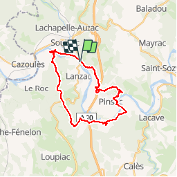
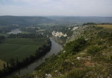
Tour Mountainbike von 26 km verfügbar auf Okzitanien, Lot, Souillac. Diese Tour wird von sdroneau vorgeschlagen.
Beschreibung
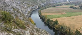
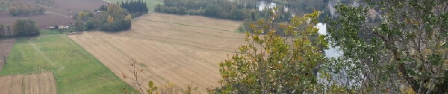
Au départ du Port de Souillac, cette randonnée est très variée...en paysages et en chemins! De belles montées, une descente technique aux Fages et de nombreux singles sont au programme. Bonne balade...
Ort
Land:
France
Region :
Okzitanien
Abteilung/Provinz :
Lot
Kommune :
Souillac
Standort:
Unknown
Gehen Sie:(Dec)
Gehen Sie:(UTM)
380398 ; 4971185 (31T) N.
Kommentare
Touren in der Umgebung
![Tour Wandern Lachapelle-Auzac - La balade du Mas Soubrot - Photo](https://media.geolcdn.com/t/375/260/ext.jpg?maxdim=2&url=https%3A%2F%2Fservices.sitytrail.com%2FGeolivesWS%2FDownloadMedia.ashx%3FTrailID%3D705239%26Media%3D4ee4f478-c00f-45ec-854e-8e7ca7e1a99a.JPG)
![Wandern Wandern](https://static1.geolcdn.com/sitytour/trail-icons/101.png)
La balade du Mas Soubrot
Wandern
Medium
Lachapelle-Auzac,
Okzitanien,
Lot,
France
![](/images/other/stat-length.png)
4,5 km | 6,6 km-effort
1h 22min
![](https://static1.geolcdn.com/siteimages/upload/files/16400158638029165_repeat_loop_refresh_sync_direction_icon.png)
Ja
![Tour Wandern Souillac - souillac bord de la dordogne - Photo](https://media.geolcdn.com/t/375/260/ext.jpg?maxdim=2&url=https%3A%2F%2Fstatic1.geolcdn.com%2Fsiteimages%2Fupload%2Ffiles%2F1553511878bg_sport_marche.png)
![Wandern Wandern](https://static1.geolcdn.com/sitytour/trail-icons/101.png)
souillac bord de la dordogne
Wandern
Sehr leicht
(2)
Souillac,
Okzitanien,
Lot,
France
![](/images/other/stat-length.png)
7,9 km | 9,8 km-effort
2h 13min
![](https://static1.geolcdn.com/siteimages/upload/files/16400158638029165_repeat_loop_refresh_sync_direction_icon.png)
Ja
![Tour Mountainbike Souillac - Transsouillagaise 2013 - Souillac - Photo](https://media.geolcdn.com/t/375/260/ext.jpg?maxdim=2&url=https%3A%2F%2Fservices.sitytrail.com%2FGeolivesWS%2FDownloadMedia.ashx%3FTrailID%3D191577%26Media%3D15201_2.jpg)
![Mountainbike Mountainbike](https://static1.geolcdn.com/sitytour/trail-icons/202.png)
Transsouillagaise 2013 - Souillac
Mountainbike
Sehr schwierig
Souillac,
Okzitanien,
Lot,
France
![](/images/other/stat-length.png)
39 km | 51 km-effort
3h 30min
![](https://static1.geolcdn.com/siteimages/upload/files/16400158638029165_repeat_loop_refresh_sync_direction_icon.png)
Ja
![Tour Wandern Souillac - Souillac_Pipou - Photo](https://media.geolcdn.com/t/375/260/09940ea1-8034-4b97-ac02-661f2704b56f.jpg&format=jpg&maxdim=2)
![Wandern Wandern](https://static1.geolcdn.com/sitytour/trail-icons/101.png)
Souillac_Pipou
Wandern
Medium
(2)
Souillac,
Okzitanien,
Lot,
France
![](/images/other/stat-length.png)
13,5 km | 18,1 km-effort
4h 15min
![](https://static1.geolcdn.com/siteimages/upload/files/16400158638029165_repeat_loop_refresh_sync_direction_icon.png)
Ja
![Tour Wandern Souillac - Souillac_Viaduc - Photo](https://media.geolcdn.com/t/375/260/3276dbaf-c603-4620-99ed-0ee02ae8cec0.jpg&format=jpg&maxdim=2)
![Wandern Wandern](https://static1.geolcdn.com/sitytour/trail-icons/101.png)
Souillac_Viaduc
Wandern
Medium
Souillac,
Okzitanien,
Lot,
France
![](/images/other/stat-length.png)
12,6 km | 16,3 km-effort
3h 45min
![](https://static1.geolcdn.com/siteimages/upload/files/16400158638029165_repeat_loop_refresh_sync_direction_icon.png)
Ja
![Tour Rennrad Cazoulès - VALLÉE DE LA DORDOGNE- EST DEPUIS CALVIAC EN PÉRIGORD - Photo](https://media.geolcdn.com/t/375/260/457fab30-e1e8-41dc-bc64-bf1135061b10.jpg&format=jpg&maxdim=2)
![Rennrad Rennrad](https://static1.geolcdn.com/sitytour/trail-icons/201.png)
VALLÉE DE LA DORDOGNE- EST DEPUIS CALVIAC EN PÉRIGORD
Rennrad
Schwierig
Cazoulès,
Neu-Aquitanien,
Dordogne,
France
![](/images/other/stat-length.png)
73 km | 91 km-effort
6h 55min
![](https://static1.geolcdn.com/siteimages/upload/files/16400158638029165_repeat_loop_refresh_sync_direction_icon.png)
Nein
![Motorrad Motorrad](https://static1.geolcdn.com/sitytour/trail-icons/402.png)
Souillac-St Cirq-Vallée du Célé-St Céré-Carennac-Turenne
Motorrad
Einfach
Souillac,
Okzitanien,
Lot,
France
![](/images/other/stat-length.png)
224 km | 273 km-effort
5h 0min
![](https://static1.geolcdn.com/siteimages/upload/files/16400158638029165_repeat_loop_refresh_sync_direction_icon.png)
Nein
![Tour Wandern Lanzac - rouffillac - souillac sud part 2 - Photo](https://media.geolcdn.com/t/375/260/6cc34aa6-2498-4e9c-b0d6-3273d458078b.jpg&format=jpg&maxdim=2)
![Wandern Wandern](https://static1.geolcdn.com/sitytour/trail-icons/101.png)
rouffillac - souillac sud part 2
Wandern
Sehr leicht
Lanzac,
Okzitanien,
Lot,
France
![](/images/other/stat-length.png)
4,8 km | 5,5 km-effort
1h 3min
![](https://static1.geolcdn.com/siteimages/upload/files/16400158638029165_repeat_loop_refresh_sync_direction_icon.png)
Nein
![Tour Wandern Cazoulès - hauts de Cazoules - Photo](https://media.geolcdn.com/t/375/260/ext.jpg?maxdim=2&url=https%3A%2F%2Fservices.sitytrail.com%2FGeolivesWS%2FDownloadMedia.ashx%3FTrailID%3D815990%26Media%3Dfix__20170823191316.jpg)
![Wandern Wandern](https://static1.geolcdn.com/sitytour/trail-icons/101.png)
hauts de Cazoules
Wandern
Medium
Cazoulès,
Neu-Aquitanien,
Dordogne,
France
![](/images/other/stat-length.png)
17,4 km | 24 km-effort
9h 14min
![](https://static1.geolcdn.com/siteimages/upload/files/16400158638029165_repeat_loop_refresh_sync_direction_icon.png)
Ja