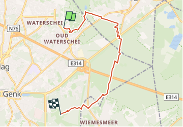
![](/images/other/stat-length.png)
![Tour Zu Fuß Genk - Etappe 5: Thorpark (Genk) – Kattevennen (Genk): 11 km - Photo](https://media.geolcdn.com/t/1900/400/ext.pjpeg?maxdim=2&url=https%3A%2F%2Fstatic1.geolcdn.com%2Fsiteimages%2Fupload%2Ffiles%2F1545311037marcheuse_200dpi.jpg)
Etappe 5: Thorpark (Genk) – Kattevennen (Genk): 11 km
National Park Trail
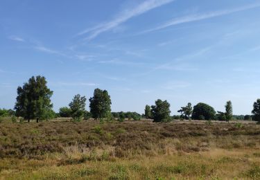
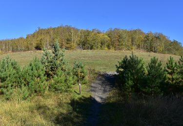
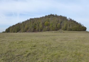
The Hoge Kempen National Park
![Länge](/images/other/stat-length.png)
![Maximale Höhe](https://static1.geolcdn.com/siteimages/upload/files/1508320355ic_sort_altitude_max_24dp.png)
![Positive Höhendifferenz](https://static1.geolcdn.com/siteimages/upload/files/1508320355ic_sort_den_pos_24dp.png)
![Km-Effort](/images/other/stat-length.png)
![Min. Höhe](https://static1.geolcdn.com/siteimages/upload/files/1508320355ic_sort_altitude_min_24dp.png)
![Negative Höhendifferenz](https://static1.geolcdn.com/siteimages/upload/files/1508320355ic_sort_den_neg_24dp.png)
![Boucle](https://static1.geolcdn.com/siteimages/upload/files/16400158638029165_repeat_loop_refresh_sync_direction_icon.png)
![Zu Fuß](https://static1.geolcdn.com/sitytour/trail-icons/100.png)
2h46
Schwierigkeit : Einfach
![Scannen Sie diesen QR-Code, um die Tour in der SityTrail-Anwendung zu öffnen](https://capi.geolives.com/qq0zvz2zws4bq2lad0pu/sitytour/trails/3591394/qr.png?size=200)
Kostenlosegpshiking-Anwendung
Über SityTrail
Tour Zu Fuß von 11 km verfügbar auf Flandern, Limburg, Genk. Diese Tour wird von National Park Trail vorgeschlagen.
Beschreibung
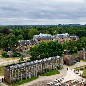
This short, flat connecting stage runs through the former Waterschei entrenchment to the Stiemerbeek valley, and then through extensive woodland. About halfway you pass a former children's colony, now a pleasant café/restaurant (De Kolonie).
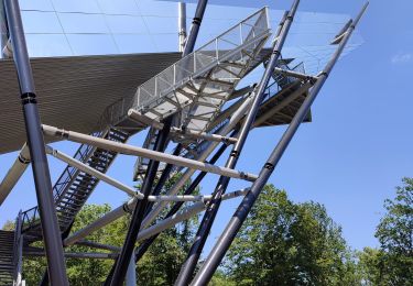
You cross the highway via the first 'Eco-recreaduct' in Flanders and after the golf course Spiegelven, you reach Kattevennen.
Ort
Kommentare
Touren in der Umgebung
![Tour Fahrrad Genk - Verrassende vergezichten - Photo](https://media.geolcdn.com/t/375/260/31227550-2d1e-474d-a121-b2a405d0d5b9.jpg&format=jpg&maxdim=2)
![Fahrrad Fahrrad](https://static1.geolcdn.com/sitytour/trail-icons/200.png)
Fahrrad
![](/images/other/stat-length.png)
![](https://static1.geolcdn.com/siteimages/upload/files/16400158638029165_repeat_loop_refresh_sync_direction_icon.png)
![Tour Wandern Genk - Promenade de Kattevennen - Photo](https://media.geolcdn.com/t/375/260/89f9be8b-be87-4190-884b-d7d87ca5b9ad.jpg&format=jpg&maxdim=2)
![Wandern Wandern](https://static1.geolcdn.com/sitytour/trail-icons/101.png)
Wandern
![](/images/other/stat-length.png)
![](https://static1.geolcdn.com/siteimages/upload/files/16400158638029165_repeat_loop_refresh_sync_direction_icon.png)
![Tour Zu Fuß As - Mechelse Heide Noord - Photo](https://media.geolcdn.com/t/375/260/6c3d6be9-86c4-472e-82c2-64c07d2c49aa.jpeg&format=jpg&maxdim=2)
![Zu Fuß Zu Fuß](https://static1.geolcdn.com/sitytour/trail-icons/100.png)
Zu Fuß
![](/images/other/stat-length.png)
![](https://static1.geolcdn.com/siteimages/upload/files/16400158638029165_repeat_loop_refresh_sync_direction_icon.png)
![Tour Zu Fuß Oudsbergen - Moorsberg Paarse trapezium - Photo](https://media.geolcdn.com/t/375/260/4c7fd886-c3d5-4662-96ec-c951a3de83c7.jpeg&format=jpg&maxdim=2)
![Zu Fuß Zu Fuß](https://static1.geolcdn.com/sitytour/trail-icons/100.png)
Zu Fuß
![](/images/other/stat-length.png)
![](https://static1.geolcdn.com/siteimages/upload/files/16400158638029165_repeat_loop_refresh_sync_direction_icon.png)
![Tour Zu Fuß As - Heiderbos blauwe ruit - Photo](https://media.geolcdn.com/t/375/260/e65c145e-dca4-4d58-ae17-fc8ca78c84c8.jpeg&format=jpg&maxdim=2)
![Zu Fuß Zu Fuß](https://static1.geolcdn.com/sitytour/trail-icons/100.png)
Zu Fuß
![](/images/other/stat-length.png)
![](https://static1.geolcdn.com/siteimages/upload/files/16400158638029165_repeat_loop_refresh_sync_direction_icon.png)
![Tour Zu Fuß Genk - Thorpark Groene rechthoek - Photo](https://media.geolcdn.com/t/375/260/5d7a6518-21eb-43eb-96c3-b85d7a924753.jpeg&format=jpg&maxdim=2)
![Zu Fuß Zu Fuß](https://static1.geolcdn.com/sitytour/trail-icons/100.png)
Zu Fuß
![](/images/other/stat-length.png)
![](https://static1.geolcdn.com/siteimages/upload/files/16400158638029165_repeat_loop_refresh_sync_direction_icon.png)
![Tour Zu Fuß Genk - Thorpark - De Kolonie Rode driehoek - Photo](https://media.geolcdn.com/t/375/260/1c715178-bd32-42a8-8c79-dfbf5aac80a5.jpeg&format=jpg&maxdim=2)
![Zu Fuß Zu Fuß](https://static1.geolcdn.com/sitytour/trail-icons/100.png)
Zu Fuß
![](/images/other/stat-length.png)
![](https://static1.geolcdn.com/siteimages/upload/files/16400158638029165_repeat_loop_refresh_sync_direction_icon.png)
![Tour Zu Fuß Genk - Thorpark Blauwe ruit - Photo](https://media.geolcdn.com/t/375/260/5d7a6518-21eb-43eb-96c3-b85d7a924753.jpeg&format=jpg&maxdim=2)
![Zu Fuß Zu Fuß](https://static1.geolcdn.com/sitytour/trail-icons/100.png)
Zu Fuß
![](/images/other/stat-length.png)
![](https://static1.geolcdn.com/siteimages/upload/files/16400158638029165_repeat_loop_refresh_sync_direction_icon.png)
![Tour Zu Fuß Genk - Thorpark - Heiderbos Gele zeshoek - Photo](https://media.geolcdn.com/t/375/260/c6f79672-6cbb-4c88-882a-ca6add2e9582.jpeg&format=jpg&maxdim=2)
![Zu Fuß Zu Fuß](https://static1.geolcdn.com/sitytour/trail-icons/100.png)
Zu Fuß
![](/images/other/stat-length.png)
![](https://static1.geolcdn.com/siteimages/upload/files/16400158638029165_repeat_loop_refresh_sync_direction_icon.png)