![](/images/other/stat-length.png)
20230314-Auzouville sur Ry
doudet
Benutzer
![Länge](/images/other/stat-length.png)
Länge
13,2 km
![Maximale Höhe](https://static1.geolcdn.com/siteimages/upload/files/1508320355ic_sort_altitude_max_24dp.png)
Maximale Höhe
160 m
![Positive Höhendifferenz](https://static1.geolcdn.com/siteimages/upload/files/1508320355ic_sort_den_pos_24dp.png)
Positive Höhendifferenz
174 m
![Km-Effort](/images/other/stat-length.png)
Km-Effort
15,6 km
![Min. Höhe](https://static1.geolcdn.com/siteimages/upload/files/1508320355ic_sort_altitude_min_24dp.png)
Min. Höhe
76 m
![Negative Höhendifferenz](https://static1.geolcdn.com/siteimages/upload/files/1508320355ic_sort_den_neg_24dp.png)
Negative Höhendifferenz
174 m
![Boucle](https://static1.geolcdn.com/siteimages/upload/files/16400158638029165_repeat_loop_refresh_sync_direction_icon.png)
Boucle
Ja
Erstellungsdatum :
2023-03-14 13:13:49.349
Letzte Änderung :
2023-03-18 17:16:31.51
![Wandern](https://static1.geolcdn.com/sitytour/trail-icons/101.png)
3h14
Schwierigkeit : Medium
![Scannen Sie diesen QR-Code, um die Tour in der SityTrail-Anwendung zu öffnen](https://capi.geolives.com/qq0zvz2zws4bq2lad0pu/sitytour/trails/3584934/qr.png?size=200)
Kostenlosegpshiking-Anwendung
Über SityTrail
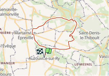
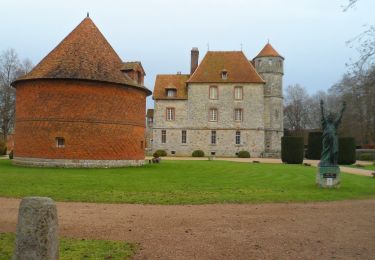
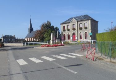
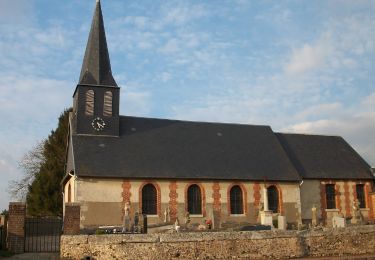
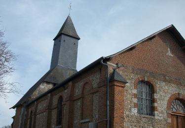
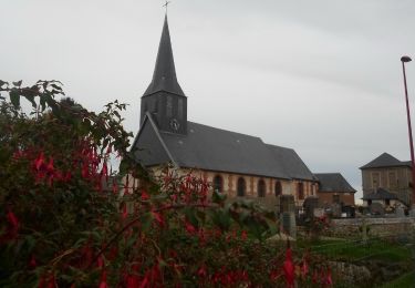
Tour Wandern von 13,2 km verfügbar auf Normandie, Seine-Maritime, Auzouville-sur-Ry. Diese Tour wird von doudet vorgeschlagen.
Beschreibung
Boucle A-R au départ de l'Eglise
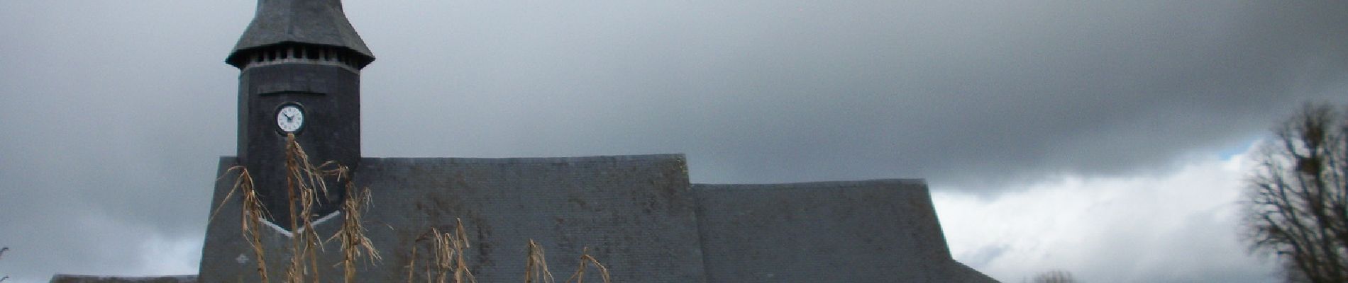
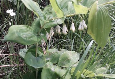
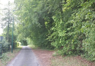
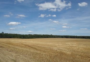
Ort
Land:
France
Region :
Normandie
Abteilung/Provinz :
Seine-Maritime
Kommune :
Auzouville-sur-Ry
Standort:
Unknown
Gehen Sie:(Dec)
Gehen Sie:(UTM)
377551 ; 5478079 (31U) N.
Kommentare
Touren in der Umgebung
![Tour Wandern Bois-d'Ennebourg - Bois d'Ennebourg _ Bois l'Eveque - Photo](https://media.geolcdn.com/t/375/260/d8467feb-476d-475d-9376-52c6f09af87b.jpg&format=jpg&maxdim=2)
![Wandern Wandern](https://static1.geolcdn.com/sitytour/trail-icons/101.png)
Bois d'Ennebourg _ Bois l'Eveque
Wandern
Sehr leicht
(1)
Bois-d'Ennebourg,
Normandie,
Seine-Maritime,
France
![](/images/other/stat-length.png)
9,2 km | 10,2 km-effort
3h 39min
![](https://static1.geolcdn.com/siteimages/upload/files/16400158638029165_repeat_loop_refresh_sync_direction_icon.png)
Ja
![Tour Wandern Bois-l'Évêque - Bois-L'Evêque - Martainville - PT - Photo](https://media.geolcdn.com/t/375/260/ext.jpg?maxdim=2&url=https%3A%2F%2Fstatic1.geolcdn.com%2Fsiteimages%2Fupload%2Ffiles%2F1553511878bg_sport_marche.png)
![Wandern Wandern](https://static1.geolcdn.com/sitytour/trail-icons/101.png)
Bois-L'Evêque - Martainville - PT
Wandern
Medium
(1)
Bois-l'Évêque,
Normandie,
Seine-Maritime,
France
![](/images/other/stat-length.png)
7,1 km | 7,6 km-effort
1h 43min
![](https://static1.geolcdn.com/siteimages/upload/files/16400158638029165_repeat_loop_refresh_sync_direction_icon.png)
Nein
![Tour Wandern Ry - 20180717 Ry - Photo](https://media.geolcdn.com/t/375/260/b30395c9-0797-4cee-b9f6-edfda2e59801.jpg&format=jpg&maxdim=2)
![Wandern Wandern](https://static1.geolcdn.com/sitytour/trail-icons/101.png)
20180717 Ry
Wandern
Medium
(1)
Ry,
Normandie,
Seine-Maritime,
France
![](/images/other/stat-length.png)
12,3 km | 0 m-effort
3h 22min
![](https://static1.geolcdn.com/siteimages/upload/files/16400158638029165_repeat_loop_refresh_sync_direction_icon.png)
Ja
![Wandern Wandern](https://static1.geolcdn.com/sitytour/trail-icons/101.png)
20231207-Vascoeuil
Wandern
Medium
Vascœuil,
Normandie,
Eure,
France
![](/images/other/stat-length.png)
10,9 km | 14,1 km-effort
3h 6min
![](https://static1.geolcdn.com/siteimages/upload/files/16400158638029165_repeat_loop_refresh_sync_direction_icon.png)
Ja
![Wandern Wandern](https://static1.geolcdn.com/sitytour/trail-icons/101.png)
20231007-bois d ennebourg
Wandern
Medium
Bois-d'Ennebourg,
Normandie,
Seine-Maritime,
France
![](/images/other/stat-length.png)
10,3 km | 11,9 km-effort
3h 3min
![](https://static1.geolcdn.com/siteimages/upload/files/16400158638029165_repeat_loop_refresh_sync_direction_icon.png)
Ja
![Wandern Wandern](https://static1.geolcdn.com/sitytour/trail-icons/101.png)
20230228-Bois d ennebourg ennebourg
Wandern
Medium
Bois-d'Ennebourg,
Normandie,
Seine-Maritime,
France
![](/images/other/stat-length.png)
12,8 km | 14,9 km-effort
3h 32min
![](https://static1.geolcdn.com/siteimages/upload/files/16400158638029165_repeat_loop_refresh_sync_direction_icon.png)
Ja
![Wandern Wandern](https://static1.geolcdn.com/sitytour/trail-icons/101.png)
20230221-Fresne Le Plan
Wandern
Medium
Fresne-le-Plan,
Normandie,
Seine-Maritime,
France
![](/images/other/stat-length.png)
13,5 km | 15,3 km-effort
3h 22min
![](https://static1.geolcdn.com/siteimages/upload/files/16400158638029165_repeat_loop_refresh_sync_direction_icon.png)
Ja
![Wandern Wandern](https://static1.geolcdn.com/sitytour/trail-icons/101.png)
20221025-bois d'ennenbourg
Wandern
Medium
Bois-d'Ennebourg,
Normandie,
Seine-Maritime,
France
![](/images/other/stat-length.png)
12,8 km | 14,8 km-effort
3h 32min
![](https://static1.geolcdn.com/siteimages/upload/files/16400158638029165_repeat_loop_refresh_sync_direction_icon.png)
Ja
![Wandern Wandern](https://static1.geolcdn.com/sitytour/trail-icons/101.png)
20220802-Perriers sur Andelle
Wandern
Medium
Perriers-sur-Andelle,
Normandie,
Eure,
France
![](/images/other/stat-length.png)
12,7 km | 16,3 km-effort
3h 33min
![](https://static1.geolcdn.com/siteimages/upload/files/16400158638029165_repeat_loop_refresh_sync_direction_icon.png)
Ja