9,4 km | 10,4 km-effort
2023-03-12_09h35m43_SityTrail - 3559870 - la-chambaudiere-01x03x23-axm (2)
cyrillerandonneur
Benutzer
Länge
7 km
Maximale Höhe
57 m
Positive Höhendifferenz
87 m
Km-Effort
8,2 km
Min. Höhe
12 m
Negative Höhendifferenz
87 m
Boucle
Ja
Erstellungsdatum :
2023-03-12 08:35:43.193
Letzte Änderung :
2023-03-12 08:35:44.995
Kostenlosegpshiking-Anwendung
Über SityTrail
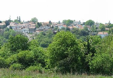
Tour von 7 km verfügbar auf Pays de la Loire, Loire-Atlantique, Saint-Lumine-de-Clisson. Diese Tour wird von cyrillerandonneur vorgeschlagen.
Beschreibung
Départ La Chambaudière et dégustation goûter parcelle Cyril
Ort
Land:
France
Region :
Pays de la Loire
Abteilung/Provinz :
Loire-Atlantique
Kommune :
Saint-Lumine-de-Clisson
Standort:
Unknown
Gehen Sie:(Dec)
Gehen Sie:(UTM)
621614 ; 5216086 (30T) N.
Kommentare
Touren in der Umgebung
Entre Maine et Gorgeat
Zu Fuß
Einfach
Remouillé,
Pays de la Loire,
Loire-Atlantique,
France
2h 21min
Ja
Le Bois Joly
Zu Fuß
Einfach
Château-Thébaud,
Pays de la Loire,
Loire-Atlantique,
France
6,9 km | 8,2 km-effort
1h 51min
Ja
Entre Bourg et Maine
Zu Fuß
Einfach
Château-Thébaud,
Pays de la Loire,
Loire-Atlantique,
France
5,9 km | 7 km-effort
1h 35min
Nein
Soif de Nature
Zu Fuß
Einfach
Maisdon-sur-Sèvre,
Pays de la Loire,
Loire-Atlantique,
France
14,7 km | 17,1 km-effort
3h 53min
Ja
Château Thébaud_Le bois joli
Wandern
Medium
(2)
Château-Thébaud,
Pays de la Loire,
Loire-Atlantique,
France
6,8 km | 8,1 km-effort
1h 46min
Ja
Maisdon_Route de la soif
Wandern
Medium
(1)
Maisdon-sur-Sèvre,
Pays de la Loire,
Loire-Atlantique,
France
13,8 km | 16,1 km-effort
3h 30min
Ja
Sèvre et Maine - Monnières
Mountainbike
Schwierig
(1)
Monnières,
Pays de la Loire,
Loire-Atlantique,
France
34 km | 39 km-effort
2h 30min
Ja
Circuit des Coteaux Luminais
Zu Fuß
Einfach
Saint-Lumine-de-Clisson,
Pays de la Loire,
Loire-Atlantique,
France
4,6 km | 5,3 km-effort
1h 12min
Ja
Aigrefeuille sur Maine
Wandern
Einfach
(1)
Aigrefeuille-sur-Maine,
Pays de la Loire,
Loire-Atlantique,
France
10,1 km | 11,4 km-effort
2h 36min
Ja