![](/images/other/stat-length.png)
![Tour Elektrofahrrad Rousson - Tour du Mont-Bouquet - Photo](https://media.geolcdn.com/t/1900/400/6cb0bff4-b846-4486-8ff2-e6201a86b912.jpeg&format=pjpeg&maxdim=2)
Tour du Mont-Bouquet
asclier0
Benutzer
![Länge](/images/other/stat-length.png)
Länge
28 km
![Maximale Höhe](https://static1.geolcdn.com/siteimages/upload/files/1508320355ic_sort_altitude_max_24dp.png)
Maximale Höhe
356 m
![Positive Höhendifferenz](https://static1.geolcdn.com/siteimages/upload/files/1508320355ic_sort_den_pos_24dp.png)
Positive Höhendifferenz
437 m
![Km-Effort](/images/other/stat-length.png)
Km-Effort
34 km
![Min. Höhe](https://static1.geolcdn.com/siteimages/upload/files/1508320355ic_sort_altitude_min_24dp.png)
Min. Höhe
140 m
![Negative Höhendifferenz](https://static1.geolcdn.com/siteimages/upload/files/1508320355ic_sort_den_neg_24dp.png)
Negative Höhendifferenz
437 m
![Boucle](https://static1.geolcdn.com/siteimages/upload/files/16400158638029165_repeat_loop_refresh_sync_direction_icon.png)
Boucle
Ja
Erstellungsdatum :
2023-03-11 13:05:35.0
Letzte Änderung :
2023-03-12 15:45:45.426
![Elektrofahrrad](https://static1.geolcdn.com/sitytour/trail-icons/205.png)
1h25
Schwierigkeit : Medium
![Scannen Sie diesen QR-Code, um die Tour in der SityTrail-Anwendung zu öffnen](https://capi.geolives.com/qq0zvz2zws4bq2lad0pu/sitytour/trails/3580968/qr.png?size=200)
Kostenlosegpshiking-Anwendung
Über SityTrail
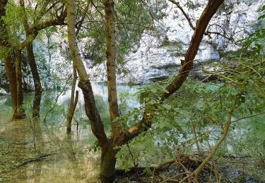
Tour Elektrofahrrad von 28 km verfügbar auf Okzitanien, Gard, Rousson. Diese Tour wird von asclier0 vorgeschlagen.
Beschreibung
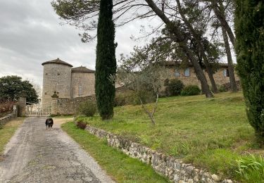
Départ de la station d'épuration du Mas Chabert. Possible de se garer au Mas Chabert.
Boucle roulante et non technique effectué en VTTAE.
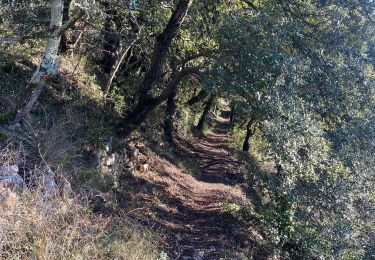
Plaine agricole, DFCI et route secondaire.
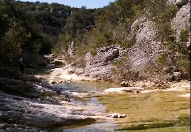
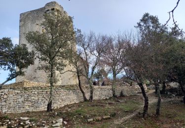
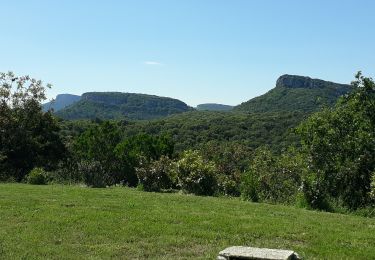
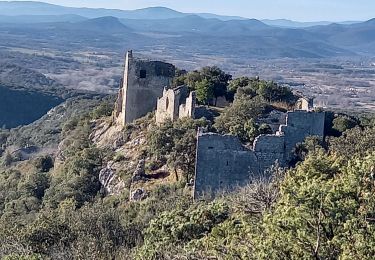
Garrigue et jolis villages traversés.
Ort
Land:
France
Region :
Okzitanien
Abteilung/Provinz :
Gard
Kommune :
Rousson
Standort:
Unknown
Gehen Sie:(Dec)
Gehen Sie:(UTM)
595899 ; 4892184 (31T) N.
Kommentare
Touren in der Umgebung
![Tour Wandern Navacelles - Les Aiguiéres au départ de Call - Photo](https://media.geolcdn.com/t/375/260/ceda67ec-d101-468c-8a83-e91809d135cb.jpg&format=jpg&maxdim=2)
![Wandern Wandern](https://static1.geolcdn.com/sitytour/trail-icons/101.png)
Les Aiguiéres au départ de Call
Wandern
Schwierig
(1)
Navacelles,
Okzitanien,
Gard,
France
![](/images/other/stat-length.png)
10,4 km | 14,9 km-effort
4h 39min
![](https://static1.geolcdn.com/siteimages/upload/files/16400158638029165_repeat_loop_refresh_sync_direction_icon.png)
Ja
![Tour Wandern Navacelles - Aiguieres par Cal - Photo](https://media.geolcdn.com/t/375/260/ext.jpg?maxdim=2&url=https%3A%2F%2Fservices.sitytrail.com%2FGeolivesWS%2FDownloadMedia.ashx%3FTrailID%3D406963%26Media%3Dfix__20150412123451.jpg)
![Wandern Wandern](https://static1.geolcdn.com/sitytour/trail-icons/101.png)
Aiguieres par Cal
Wandern
Medium
(2)
Navacelles,
Okzitanien,
Gard,
France
![](/images/other/stat-length.png)
8,9 km | 12,6 km-effort
2h 20min
![](https://static1.geolcdn.com/siteimages/upload/files/16400158638029165_repeat_loop_refresh_sync_direction_icon.png)
Ja
![Tour Wandern Brouzet-lès-Alès - Mont Bouquet - Photo](https://media.geolcdn.com/t/375/260/7ba04687-b363-48b1-b29f-006a975fa7e7.jpg&format=jpg&maxdim=2)
![Wandern Wandern](https://static1.geolcdn.com/sitytour/trail-icons/101.png)
Mont Bouquet
Wandern
Medium
Brouzet-lès-Alès,
Okzitanien,
Gard,
France
![](/images/other/stat-length.png)
14,5 km | 21 km-effort
3h 41min
![](https://static1.geolcdn.com/siteimages/upload/files/16400158638029165_repeat_loop_refresh_sync_direction_icon.png)
Ja
![Tour Wandern Navacelles - Château d'Allegre / Aiguières - Photo](https://media.geolcdn.com/t/375/260/3f553ed7-1a33-4856-a98a-164e5181c4df.jpg&format=jpg&maxdim=2)
![Wandern Wandern](https://static1.geolcdn.com/sitytour/trail-icons/101.png)
Château d'Allegre / Aiguières
Wandern
Schwierig
Navacelles,
Okzitanien,
Gard,
France
![](/images/other/stat-length.png)
20 km | 29 km-effort
7h 18min
![](https://static1.geolcdn.com/siteimages/upload/files/16400158638029165_repeat_loop_refresh_sync_direction_icon.png)
Ja
![Tour Wandern Rousson - Le plateau de Rousson - Photo](https://media.geolcdn.com/t/375/260/41c9e0a2-2597-4a1d-bdd7-df5fb4557267.jpg&format=jpg&maxdim=2)
![Wandern Wandern](https://static1.geolcdn.com/sitytour/trail-icons/101.png)
Le plateau de Rousson
Wandern
Sehr schwierig
Rousson,
Okzitanien,
Gard,
France
![](/images/other/stat-length.png)
15,5 km | 21 km-effort
5h 56min
![](https://static1.geolcdn.com/siteimages/upload/files/16400158638029165_repeat_loop_refresh_sync_direction_icon.png)
Ja
![Wandern Wandern](https://static1.geolcdn.com/sitytour/trail-icons/101.png)
Argensol, chapelle St Saturnin, Château d'Alègre
Wandern
Schwierig
Allègre-les-Fumades,
Okzitanien,
Gard,
France
![](/images/other/stat-length.png)
8,7 km | 12,1 km-effort
2h 44min
![](https://static1.geolcdn.com/siteimages/upload/files/16400158638029165_repeat_loop_refresh_sync_direction_icon.png)
Ja
![Tour Wandern Allègre-les-Fumades - Chateau d'Allegre par les crêtes et défilé d'Argensol - Photo](https://media.geolcdn.com/t/375/260/cf4de307-4e0a-401c-8a29-7a796fd485c8.jpg&format=jpg&maxdim=2)
![Wandern Wandern](https://static1.geolcdn.com/sitytour/trail-icons/101.png)
Chateau d'Allegre par les crêtes et défilé d'Argensol
Wandern
Medium
Allègre-les-Fumades,
Okzitanien,
Gard,
France
![](/images/other/stat-length.png)
9,5 km | 13 km-effort
3h 42min
![](https://static1.geolcdn.com/siteimages/upload/files/16400158638029165_repeat_loop_refresh_sync_direction_icon.png)
Ja
![Tour Wandern Navacelles - Aiguieres - Photo](https://media.geolcdn.com/t/375/260/19d58264-2201-47f9-81d9-199a44b0214c.jpg&format=jpg&maxdim=2)
![Wandern Wandern](https://static1.geolcdn.com/sitytour/trail-icons/101.png)
Aiguieres
Wandern
Schwierig
Navacelles,
Okzitanien,
Gard,
France
![](/images/other/stat-length.png)
8,4 km | 12,1 km-effort
2h 45min
![](https://static1.geolcdn.com/siteimages/upload/files/16400158638029165_repeat_loop_refresh_sync_direction_icon.png)
Ja
![Tour Wandern Allègre-les-Fumades - Château d'Allègre depuis la Bégude - Photo](https://media.geolcdn.com/t/375/260/c7ad5edd-37ff-4c16-8ee0-7374b4c05db7.jpg&format=jpg&maxdim=2)
![Wandern Wandern](https://static1.geolcdn.com/sitytour/trail-icons/101.png)
Château d'Allègre depuis la Bégude
Wandern
Medium
Allègre-les-Fumades,
Okzitanien,
Gard,
France
![](/images/other/stat-length.png)
5,2 km | 7,2 km-effort
2h 17min
![](https://static1.geolcdn.com/siteimages/upload/files/16400158638029165_repeat_loop_refresh_sync_direction_icon.png)
Ja