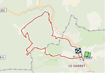
![](/images/other/stat-length.png)
![Tour Wandern Belgentier - Belgentier antennes escavalins - Photo](https://media.geolcdn.com/t/1900/400/4e3f42aa-f9f6-490c-a00f-812255613541.jpg&format=pjpeg&maxdim=2)
Belgentier antennes escavalins
cdanielrando
Benutzer
![Länge](/images/other/stat-length.png)
![Maximale Höhe](https://static1.geolcdn.com/siteimages/upload/files/1508320355ic_sort_altitude_max_24dp.png)
![Positive Höhendifferenz](https://static1.geolcdn.com/siteimages/upload/files/1508320355ic_sort_den_pos_24dp.png)
![Km-Effort](/images/other/stat-length.png)
![Min. Höhe](https://static1.geolcdn.com/siteimages/upload/files/1508320355ic_sort_altitude_min_24dp.png)
![Negative Höhendifferenz](https://static1.geolcdn.com/siteimages/upload/files/1508320355ic_sort_den_neg_24dp.png)
![Boucle](https://static1.geolcdn.com/siteimages/upload/files/16400158638029165_repeat_loop_refresh_sync_direction_icon.png)
![Wandern](https://static1.geolcdn.com/sitytour/trail-icons/101.png)
6h34
Schwierigkeit : Sehr schwierig
![Scannen Sie diesen QR-Code, um die Tour in der SityTrail-Anwendung zu öffnen](https://capi.geolives.com/qq0zvz2zws4bq2lad0pu/sitytour/trails/3558881/qr.png?size=200)
Kostenlosegpshiking-Anwendung
Über SityTrail
Tour Wandern von 11,9 km verfügbar auf Provence-Alpes-Côte d'Azur, Var, Belgentier. Diese Tour wird von cdanielrando vorgeschlagen.
Beschreibung
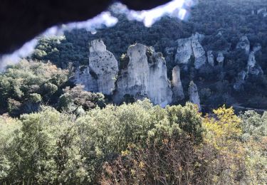
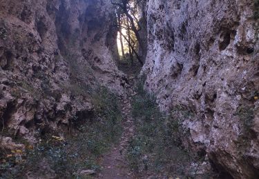
Circuit court mais qui comporte un passage très difficile.
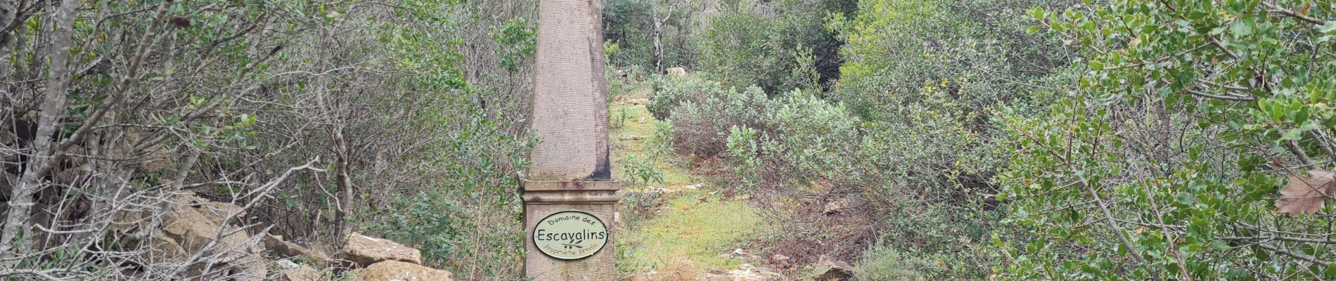
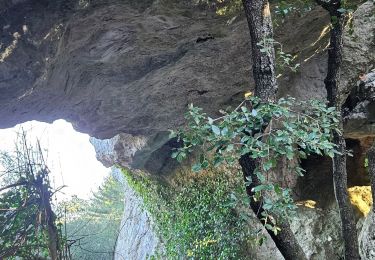
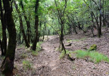
De la côte 541 jusqu'aux antennes, le sentier balisé jaune, parfois rouge et bleu est très vertical . Il y a des passages équipés de cordes qui sont bienvenues et d'autres passages qui obligent à utiliser les mains qu'ils faut protéger . aux antennes, magnifique point de vue puis le reste du trajet passe par la source de Montrieux le jeune ainsi que devant la chartreuse du même nom
Ort
Kommentare
Touren in der Umgebung
![Tour Wandern Solliès-Toucas - Morières : la Garoute et la Baume des Lumes - Photo](https://media.geolcdn.com/t/375/260/3e6ddcf9-f59d-47f4-a0ee-582c12a1d8d8.jpg&format=jpg&maxdim=2)
![Wandern Wandern](https://static1.geolcdn.com/sitytour/trail-icons/101.png)
Wandern
![](/images/other/stat-length.png)
![](https://static1.geolcdn.com/siteimages/upload/files/16400158638029165_repeat_loop_refresh_sync_direction_icon.png)
![Tour Wandern Belgentier - Chemin de la Foux - Pas de Belgentier - Pont de la Garoute - Photo](https://media.geolcdn.com/t/375/260/f8553ad8-25e7-40b0-a66a-b4ed67f04bdf.jpg&format=jpg&maxdim=2)
![Wandern Wandern](https://static1.geolcdn.com/sitytour/trail-icons/101.png)
Wandern
![](/images/other/stat-length.png)
![](https://static1.geolcdn.com/siteimages/upload/files/16400158638029165_repeat_loop_refresh_sync_direction_icon.png)
![Tour Wandern Solliès-Toucas - Valaury - Apier - Matheron - Photo](https://media.geolcdn.com/t/375/260/f02c0563-7d49-437f-98bb-e34f8a550dee.jpg&format=jpg&maxdim=2)
![Wandern Wandern](https://static1.geolcdn.com/sitytour/trail-icons/101.png)
Wandern
![](/images/other/stat-length.png)
![](https://static1.geolcdn.com/siteimages/upload/files/16400158638029165_repeat_loop_refresh_sync_direction_icon.png)
![Tour Wandern Solliès-Toucas - SityTrail - siou blanc - Photo](https://media.geolcdn.com/t/375/260/2137f2fb-f7c1-49df-9712-76654d4b67c0.jpg&format=jpg&maxdim=2)
![Wandern Wandern](https://static1.geolcdn.com/sitytour/trail-icons/101.png)
Wandern
![](/images/other/stat-length.png)
![](https://static1.geolcdn.com/siteimages/upload/files/16400158638029165_repeat_loop_refresh_sync_direction_icon.png)
![Tour Wandern Méounes-lès-Montrieux - SityTrail - montrieux gapeau - Photo](https://media.geolcdn.com/t/375/260/864c4f64-6bc1-49cf-aec6-4e1027a495ef.jpg&format=jpg&maxdim=2)
![Wandern Wandern](https://static1.geolcdn.com/sitytour/trail-icons/101.png)
Wandern
![](/images/other/stat-length.png)
![](https://static1.geolcdn.com/siteimages/upload/files/16400158638029165_repeat_loop_refresh_sync_direction_icon.png)
![Tour Wandern Méounes-lès-Montrieux - Chartreuse de Montreuil le jeune - Photo](https://media.geolcdn.com/t/375/260/ext.jpg?maxdim=2&url=https%3A%2F%2Fservices.sitytrail.com%2FGeolivesWS%2FDownloadMedia.ashx%3FTrailID%3D627194%26Media%3Dfix__20160906115209.jpg)
![Wandern Wandern](https://static1.geolcdn.com/sitytour/trail-icons/101.png)
Wandern
![](/images/other/stat-length.png)
![](https://static1.geolcdn.com/siteimages/upload/files/16400158638029165_repeat_loop_refresh_sync_direction_icon.png)
![Tour Wandern Solliès-Toucas - couvent St Hubert Valaury - Photo](https://media.geolcdn.com/t/375/260/ext.jpg?maxdim=2&url=https%3A%2F%2Fservices.sitytrail.com%2FGeolivesWS%2FDownloadMedia.ashx%3FTrailID%3D361125%26Media%3Dfix__20141108152604.jpg)
![Wandern Wandern](https://static1.geolcdn.com/sitytour/trail-icons/101.png)
Wandern
![](/images/other/stat-length.png)
![](https://static1.geolcdn.com/siteimages/upload/files/16400158638029165_repeat_loop_refresh_sync_direction_icon.png)
![Tour Laufen Belgentier - les aiguilles de Valberg - Photo](https://media.geolcdn.com/t/375/260/f7c55c4c-4111-46ce-a111-35050e9f4b06.jpg&format=jpg&maxdim=2)
![Laufen Laufen](https://static1.geolcdn.com/sitytour/trail-icons/103.png)
Laufen
![](/images/other/stat-length.png)
![](https://static1.geolcdn.com/siteimages/upload/files/16400158638029165_repeat_loop_refresh_sync_direction_icon.png)
![Tour Pfad Belgentier - Les aiguilles de Valberg et une arche - Photo](https://media.geolcdn.com/t/375/260/40abce3e-dd86-4ccf-960c-95975195eed4.jpg&format=jpg&maxdim=2)
![Pfad Pfad](https://static1.geolcdn.com/sitytour/trail-icons/104.png)
Pfad
![](/images/other/stat-length.png)
![](https://static1.geolcdn.com/siteimages/upload/files/16400158638029165_repeat_loop_refresh_sync_direction_icon.png)