


4 km | 5,6 km-effort


Benutzer


Kostenlosegpshiking-Anwendung
 SityTrail
IGN / Geografische Institute
SityTrail World
Die Welt öffnet sich für Sie
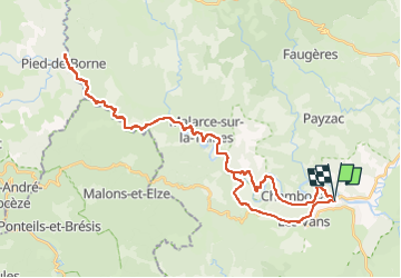
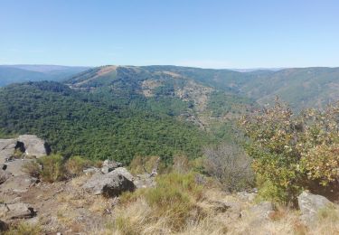
Tour Radtourismus von 47 km verfügbar auf Auvergne-Rhone-Alpen, Ardèche, Les Vans. Diese Tour wird von djetdail vorgeschlagen.
Remontée du Chassezac par petite route qui longe la rivière jusqu'à Pied de Borne (limite Ardeche Lozère).
Éviter les périodes d’affluence touristique.
A voir : paysage cévenoles, barrage de Malarce, ouvrages hydrauliques, anciens bâtiments de l'activité minière (https://journals.openedition.org/archeomed/9655), ouvrages routiers ...
Wandern
Wandern

Wandern
Wandern
Wandern
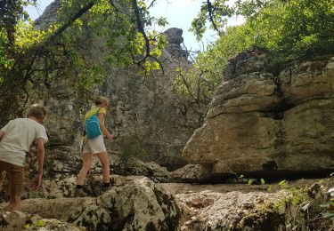
Wandern

Wandern

Wandern

Mountainbike