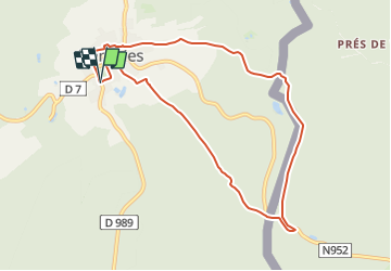
![](/images/other/stat-length.png)
![Tour Nordic Walking Hargnies - RESEAU ELFE La boucle de la frontière - Photo](https://media.geolcdn.com/t/1900/400/ext.pjpeg?maxdim=2&url=https%3A%2F%2Fstatic1.geolcdn.com%2Fsiteimages%2Fupload%2Ffiles%2F1545311037marcheuse_200dpi.jpg)
RESEAU ELFE La boucle de la frontière
denissculier
Benutzer
![Länge](/images/other/stat-length.png)
![Maximale Höhe](https://static1.geolcdn.com/siteimages/upload/files/1508320355ic_sort_altitude_max_24dp.png)
![Positive Höhendifferenz](https://static1.geolcdn.com/siteimages/upload/files/1508320355ic_sort_den_pos_24dp.png)
![Km-Effort](/images/other/stat-length.png)
![Min. Höhe](https://static1.geolcdn.com/siteimages/upload/files/1508320355ic_sort_altitude_min_24dp.png)
![Negative Höhendifferenz](https://static1.geolcdn.com/siteimages/upload/files/1508320355ic_sort_den_neg_24dp.png)
![Boucle](https://static1.geolcdn.com/siteimages/upload/files/16400158638029165_repeat_loop_refresh_sync_direction_icon.png)
![Nordic Walking](https://static1.geolcdn.com/sitytour/trail-icons/102.png)
2h19
Schwierigkeit : Medium
![Scannen Sie diesen QR-Code, um die Tour in der SityTrail-Anwendung zu öffnen](https://capi.geolives.com/qq0zvz2zws4bq2lad0pu/sitytour/trails/3544792/qr.png?size=200)
Kostenlosegpshiking-Anwendung
Über SityTrail
Tour Nordic Walking von 8,3 km verfügbar auf Großer Osten, Ardennes, Hargnies. Diese Tour wird von denissculier vorgeschlagen.
Beschreibung
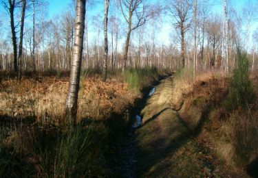
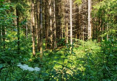
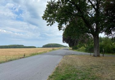
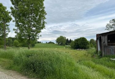
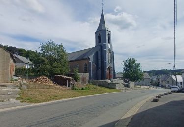
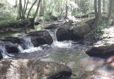
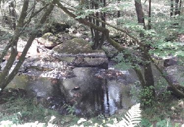
Découvrez au milieu de la forêt profonde de l’Ardenne, Hargnies et ses clairières, puis enjambez les eaux claires de la Hulle pour passer en Belgique dans ce secteur connu jadis comme lieu de contrebande du tabac et du café. Cette boucle du vaste réseau ELFE dispose de panneaux didactiques pour petits et grands.
Ort
Kommentare
Touren in der Umgebung
![Tour Wandern Hargnies - De Hargnies au Point de vue de la Roche à Fépin par la vallée du Risdoux - Photo](https://media.geolcdn.com/t/375/260/ext.jpg?maxdim=2&url=https%3A%2F%2Fservices.sitytrail.com%2FGeolivesWS%2FDownloadMedia.ashx%3FTrailID%3D108901%26Media%3D2491_6.jpg)
![Wandern Wandern](https://static1.geolcdn.com/sitytour/trail-icons/101.png)
Wandern
![](/images/other/stat-length.png)
![](https://static1.geolcdn.com/siteimages/upload/files/16400158638029165_repeat_loop_refresh_sync_direction_icon.png)
![Tour Wandern Hargnies - De Hargnies au Point de vue de la Roche à Fépin par la vallée du Risdoux - Photo](https://media.geolcdn.com/t/375/260/ext.jpg?maxdim=2&url=https%3A%2F%2Fstatic1.geolcdn.com%2Fsiteimages%2Fupload%2Ffiles%2F1553511878bg_sport_marche.png)
![Wandern Wandern](https://static1.geolcdn.com/sitytour/trail-icons/101.png)
Wandern
![](/images/other/stat-length.png)
![](https://static1.geolcdn.com/siteimages/upload/files/16400158638029165_repeat_loop_refresh_sync_direction_icon.png)
![Tour Wandern Gedinne - Balade à Willerzie - Gedinne - Photo](https://media.geolcdn.com/t/375/260/5ec22972-002a-40e1-b0ee-bd3232993f27.jpeg&format=jpg&maxdim=2)
![Wandern Wandern](https://static1.geolcdn.com/sitytour/trail-icons/101.png)
Wandern
![](/images/other/stat-length.png)
![](https://static1.geolcdn.com/siteimages/upload/files/16400158638029165_repeat_loop_refresh_sync_direction_icon.png)
![Tour Wandern Gedinne - Balade à Bourseigne-Neuve - Gedinne - Photo](https://media.geolcdn.com/t/375/260/f19f68c3-6956-44c1-8199-6f68e99309b9.jpeg&format=jpg&maxdim=2)
![Wandern Wandern](https://static1.geolcdn.com/sitytour/trail-icons/101.png)
Wandern
![](/images/other/stat-length.png)
![](https://static1.geolcdn.com/siteimages/upload/files/16400158638029165_repeat_loop_refresh_sync_direction_icon.png)
![Tour Wandern Gedinne - Rienne boucle presque complète 23,5 Km - Photo](https://media.geolcdn.com/t/375/260/5f3aeb8a-0c0a-4387-bd61-31283d8dcd64.jpg&format=jpg&maxdim=2)
![Wandern Wandern](https://static1.geolcdn.com/sitytour/trail-icons/101.png)
Wandern
![](/images/other/stat-length.png)
![](https://static1.geolcdn.com/siteimages/upload/files/16400158638029165_repeat_loop_refresh_sync_direction_icon.png)
![Tour Wandern Gedinne - Willerzie 26 km - Photo](https://media.geolcdn.com/t/375/260/e346506f-3881-4ba9-a68f-80ce0e1425ad.jpg&format=jpg&maxdim=2)
![Wandern Wandern](https://static1.geolcdn.com/sitytour/trail-icons/101.png)
![Tour Rennrad Hargnies - Rando Étienne 2 2022.08.21 - Photo](https://media.geolcdn.com/t/375/260/9f7443ce-1b21-41b9-b691-e9fb669f3213.jpg&format=jpg&maxdim=2)
![Rennrad Rennrad](https://static1.geolcdn.com/sitytour/trail-icons/201.png)
Rennrad
![](/images/other/stat-length.png)
![](https://static1.geolcdn.com/siteimages/upload/files/16400158638029165_repeat_loop_refresh_sync_direction_icon.png)
![Tour Wandern Gedinne - Vallée de la Hulle - 16 km - Photo](https://media.geolcdn.com/t/375/260/dab69988-d17d-4efe-99f2-91e96da7309f.jpg&format=jpg&maxdim=2)
![Wandern Wandern](https://static1.geolcdn.com/sitytour/trail-icons/101.png)
Wandern
![](/images/other/stat-length.png)
![](https://static1.geolcdn.com/siteimages/upload/files/16400158638029165_repeat_loop_refresh_sync_direction_icon.png)
![Tour Wandern Gedinne - Vallée de la Hulle en boucle - Bourseigne-Neuve - Photo](https://media.geolcdn.com/t/375/260/ext.jpg?maxdim=2&url=https%3A%2F%2Fservices.sitytrail.com%2FGeolivesWS%2FDownloadMedia.ashx%3FTrailID%3D1010923%26Media%3Dfix__20180725134349.jpg)
![Wandern Wandern](https://static1.geolcdn.com/sitytour/trail-icons/101.png)
Wandern
![](/images/other/stat-length.png)
![](https://static1.geolcdn.com/siteimages/upload/files/16400158638029165_repeat_loop_refresh_sync_direction_icon.png)