![](/images/other/stat-length.png)
![Tour Wandern Collobrières - SityTrail - chapelle st guillaume - Photo](https://media.geolcdn.com/t/1900/400/c6bacdd0-ee98-427d-aed4-896ac2a549a6.jpg&format=pjpeg&maxdim=2)
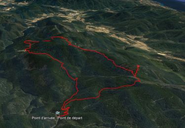
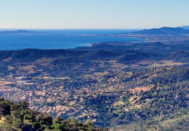
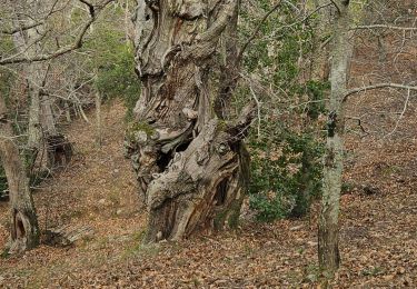
SityTrail - chapelle st guillaume
affinetataille
Benutzer GUIDE
![Länge](/images/other/stat-length.png)
Länge
14,1 km
![Maximale Höhe](https://static1.geolcdn.com/siteimages/upload/files/1508320355ic_sort_altitude_max_24dp.png)
Maximale Höhe
461 m
![Positive Höhendifferenz](https://static1.geolcdn.com/siteimages/upload/files/1508320355ic_sort_den_pos_24dp.png)
Positive Höhendifferenz
565 m
![Km-Effort](/images/other/stat-length.png)
Km-Effort
22 km
![Min. Höhe](https://static1.geolcdn.com/siteimages/upload/files/1508320355ic_sort_altitude_min_24dp.png)
Min. Höhe
115 m
![Negative Höhendifferenz](https://static1.geolcdn.com/siteimages/upload/files/1508320355ic_sort_den_neg_24dp.png)
Negative Höhendifferenz
571 m
![Boucle](https://static1.geolcdn.com/siteimages/upload/files/16400158638029165_repeat_loop_refresh_sync_direction_icon.png)
Boucle
Ja
Erstellungsdatum :
2023-01-03 15:34:28.671
Letzte Änderung :
2023-05-08 09:50:21.357
![Wandern](https://static1.geolcdn.com/sitytour/trail-icons/101.png)
6h00
Schwierigkeit : Schwierig
![Scannen Sie diesen QR-Code, um die Tour in der SityTrail-Anwendung zu öffnen](https://capi.geolives.com/qq0zvz2zws4bq2lad0pu/sitytour/trails/3503978/qr.png?size=200)
Kostenlosegpshiking-Anwendung
Über SityTrail
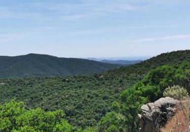
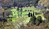
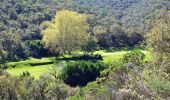
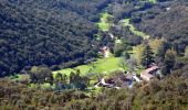
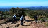
Tour Wandern von 14,1 km verfügbar auf Provence-Alpes-Côte d'Azur, Var, Collobrières. Diese Tour wird von affinetataille vorgeschlagen.
Beschreibung
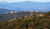
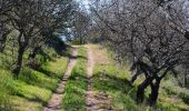
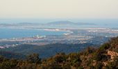
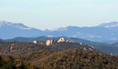
départ col de babaou
Ort
Land:
France
Region :
Provence-Alpes-Côte d'Azur
Abteilung/Provinz :
Var
Kommune :
Collobrières
Standort:
Unknown
Gehen Sie:(Dec)
Gehen Sie:(UTM)
280975 ; 4787018 (32T) N.
Kommentare
Touren in der Umgebung
![Wandern Wandern](https://static1.geolcdn.com/sitytour/trail-icons/101.png)
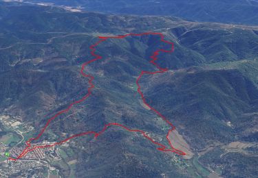
Les vallons de Valcros
Wandern
Schwierig
(2)
Bormes-les-Mimosas,
Provence-Alpes-Côte d'Azur,
Var,
France
![](/images/other/stat-length.png)
14 km | 22 km-effort
6h 0min
![](https://static1.geolcdn.com/siteimages/upload/files/16400158638029165_repeat_loop_refresh_sync_direction_icon.png)
Ja
![Tour Wandern Collobrières - 10881733-Collobrières - La Verne - radar - Photo](https://media.geolcdn.com/t/375/260/da9d634a-9911-4550-a6f3-bff27c212c6d.jpg&format=jpg&maxdim=2)
![Wandern Wandern](https://static1.geolcdn.com/sitytour/trail-icons/101.png)
10881733-Collobrières - La Verne - radar
Wandern
Medium
(1)
Collobrières,
Provence-Alpes-Côte d'Azur,
Var,
France
![](/images/other/stat-length.png)
14,4 km | 21 km-effort
6h 0min
![](https://static1.geolcdn.com/siteimages/upload/files/16400158638029165_repeat_loop_refresh_sync_direction_icon.png)
Ja
![Tour Wandern Collobrières - SityTrail - Collobriéres - Menhirs de Lambert - Photo](https://media.geolcdn.com/t/375/260/72b69c29-7d29-4189-adbb-316e95f51f98.jpg&format=jpg&maxdim=2)
![Wandern Wandern](https://static1.geolcdn.com/sitytour/trail-icons/101.png)
SityTrail - Collobriéres - Menhirs de Lambert
Wandern
Medium
(1)
Collobrières,
Provence-Alpes-Côte d'Azur,
Var,
France
![](/images/other/stat-length.png)
12,8 km | 20 km-effort
6h 0min
![](https://static1.geolcdn.com/siteimages/upload/files/16400158638029165_repeat_loop_refresh_sync_direction_icon.png)
Ja
![Tour Wandern Bormes-les-Mimosas - Col du Gratteloup - Piste domaniale Sud - Cols de Labade et Landon - Pierre d'Avenon - GR51/90 - Photo](https://media.geolcdn.com/t/375/260/a68a068d-d9c5-4471-8f2a-bbfabcb93eed.jpg&format=jpg&maxdim=2)
![Wandern Wandern](https://static1.geolcdn.com/sitytour/trail-icons/101.png)
Col du Gratteloup - Piste domaniale Sud - Cols de Labade et Landon - Pierre d...
Wandern
Einfach
(1)
Bormes-les-Mimosas,
Provence-Alpes-Côte d'Azur,
Var,
France
![](/images/other/stat-length.png)
15,1 km | 21 km-effort
6h 0min
![](https://static1.geolcdn.com/siteimages/upload/files/16400158638029165_repeat_loop_refresh_sync_direction_icon.png)
Ja
![Tour Wandern Bormes-les-Mimosas - Boucle : Pont des Caunes - Piste de l'Amandier - Piste de la Gourre - Piste Lambert - Col de la Citadelle - Pont des Caunes. - Photo](https://media.geolcdn.com/t/375/260/93e7f835-4806-4284-8793-c12d2410b0fc.jpg&format=jpg&maxdim=2)
![Wandern Wandern](https://static1.geolcdn.com/sitytour/trail-icons/101.png)
Boucle : Pont des Caunes - Piste de l'Amandier - Piste de la Gourre - Piste L...
Wandern
Medium
Bormes-les-Mimosas,
Provence-Alpes-Côte d'Azur,
Var,
France
![](/images/other/stat-length.png)
15,1 km | 21 km-effort
5h 6min
![](https://static1.geolcdn.com/siteimages/upload/files/16400158638029165_repeat_loop_refresh_sync_direction_icon.png)
Ja
![Tour Mountainbike Collobrières - Collobrières par pistes - Photo](https://media.geolcdn.com/t/375/260/ext.jpg?maxdim=2&url=https%3A%2F%2Fstatic1.geolcdn.com%2Fsiteimages%2Fupload%2Ffiles%2F1524743154velo.jpg)
![Mountainbike Mountainbike](https://static1.geolcdn.com/sitytour/trail-icons/202.png)
Collobrières par pistes
Mountainbike
Medium
(1)
Collobrières,
Provence-Alpes-Côte d'Azur,
Var,
France
![](/images/other/stat-length.png)
28 km | 35 km-effort
2h 20min
![](https://static1.geolcdn.com/siteimages/upload/files/16400158638029165_repeat_loop_refresh_sync_direction_icon.png)
Ja
![Tour Wandern Collobrières - Plateau Lambert 2 - Photo](https://media.geolcdn.com/t/375/260/ext.jpg?maxdim=2&url=https%3A%2F%2Fstatic1.geolcdn.com%2Fsiteimages%2Fupload%2Ffiles%2F1553511878bg_sport_marche.png)
![Wandern Wandern](https://static1.geolcdn.com/sitytour/trail-icons/101.png)
Plateau Lambert 2
Wandern
Einfach
(1)
Collobrières,
Provence-Alpes-Côte d'Azur,
Var,
France
![](/images/other/stat-length.png)
14,2 km | 21 km-effort
4h 40min
![](https://static1.geolcdn.com/siteimages/upload/files/16400158638029165_repeat_loop_refresh_sync_direction_icon.png)
Ja
![Tour Wandern Collobrières - Verne - plateau Lambert - Photo](https://media.geolcdn.com/t/375/260/c4a3a8a8-b423-4008-8407-4394445c8024.jpg&format=jpg&maxdim=2)
![Wandern Wandern](https://static1.geolcdn.com/sitytour/trail-icons/101.png)
Verne - plateau Lambert
Wandern
Sehr schwierig
Collobrières,
Provence-Alpes-Côte d'Azur,
Var,
France
![](/images/other/stat-length.png)
14,3 km | 19,3 km-effort
5h 3min
![](https://static1.geolcdn.com/siteimages/upload/files/16400158638029165_repeat_loop_refresh_sync_direction_icon.png)
Ja
![Tour Wandern Bormes-les-Mimosas - Vallons de la Gourre et des Caunes - Photo](https://media.geolcdn.com/t/375/260/1e74f8dd-3531-46df-bd25-c87eb6eff58d.jpg&format=jpg&maxdim=2)
![Wandern Wandern](https://static1.geolcdn.com/sitytour/trail-icons/101.png)
Vallons de la Gourre et des Caunes
Wandern
Schwierig
Bormes-les-Mimosas,
Provence-Alpes-Côte d'Azur,
Var,
France
![](/images/other/stat-length.png)
13,4 km | 18,8 km-effort
4h 16min
![](https://static1.geolcdn.com/siteimages/upload/files/16400158638029165_repeat_loop_refresh_sync_direction_icon.png)
Ja