![](/images/other/stat-length.png)
![Tour Wandern Sainte-Anastasie-sur-Issole - Ste Anastasie sur Issole-St-Quinis - Photo](https://media.geolcdn.com/t/1900/400/ext.pjpeg?maxdim=2&url=https%3A%2F%2Fstatic1.geolcdn.com%2Fsiteimages%2Fupload%2Ffiles%2F1553511878bg_sport_marche.png)
Ste Anastasie sur Issole-St-Quinis
Sugg
Benutzer
![Länge](/images/other/stat-length.png)
![Maximale Höhe](https://static1.geolcdn.com/siteimages/upload/files/1508320355ic_sort_altitude_max_24dp.png)
![Positive Höhendifferenz](https://static1.geolcdn.com/siteimages/upload/files/1508320355ic_sort_den_pos_24dp.png)
![Km-Effort](/images/other/stat-length.png)
![Min. Höhe](https://static1.geolcdn.com/siteimages/upload/files/1508320355ic_sort_altitude_min_24dp.png)
![Negative Höhendifferenz](https://static1.geolcdn.com/siteimages/upload/files/1508320355ic_sort_den_neg_24dp.png)
![Boucle](https://static1.geolcdn.com/siteimages/upload/files/16400158638029165_repeat_loop_refresh_sync_direction_icon.png)
![Wandern](https://static1.geolcdn.com/sitytour/trail-icons/101.png)
4h23
Schwierigkeit : Medium
![Scannen Sie diesen QR-Code, um die Tour in der SityTrail-Anwendung zu öffnen](https://capi.geolives.com/qq0zvz2zws4bq2lad0pu/sitytour/trails/350283/qr.png?size=200)
Kostenlosegpshiking-Anwendung
Über SityTrail
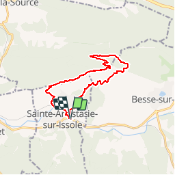
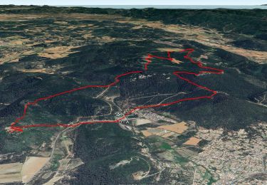
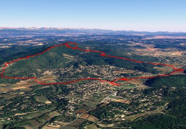
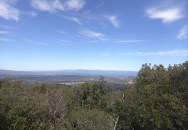
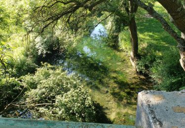
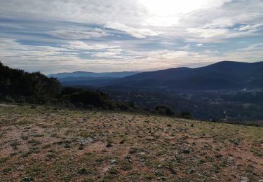
Tour Wandern von 14,4 km verfügbar auf Provence-Alpes-Côte d'Azur, Var, Sainte-Anastasie-sur-Issole. Diese Tour wird von Sugg vorgeschlagen.
Beschreibung
1 octobre 2014.Rando de Restons en forme sous la baguette de Pierre.
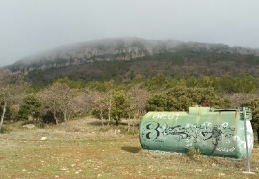
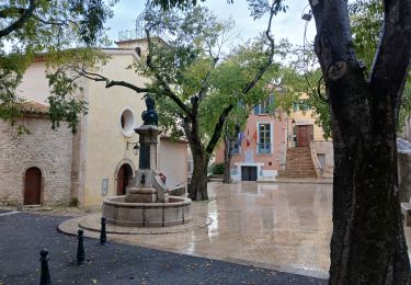
Parcours très intéressant, super pique-nique à la chapelle St Quinis, cheminement le long de la barre de St Quinis " un peu " délicat car les rochers étaient mouillés.
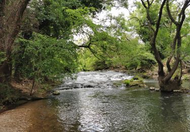
La descente de 461 à 277 pas mal non plus!!!
Belle sortie, très variée.
PS : la durée comprend les divers arrêts et le pique-nique.
Ort
Kommentare
Touren in der Umgebung
![Tour Wandern Rocbaron - SityTrail - rocbaron victor - Photo](https://media.geolcdn.com/t/375/260/65b9c34e-6588-477e-8f02-e7295c203708.jpg&format=jpg&maxdim=2)
![Wandern Wandern](https://static1.geolcdn.com/sitytour/trail-icons/101.png)
Wandern
![](/images/other/stat-length.png)
![](https://static1.geolcdn.com/siteimages/upload/files/16400158638029165_repeat_loop_refresh_sync_direction_icon.png)
![Tour Wandern Sainte-Anastasie-sur-Issole - SityTrail - 83 St Quinis grotte chapelle - Photo](https://media.geolcdn.com/t/375/260/855ac779-a3c7-4759-9622-72ff9450b7e1.jpg&format=jpg&maxdim=2)
![Wandern Wandern](https://static1.geolcdn.com/sitytour/trail-icons/101.png)
Wandern
![](/images/other/stat-length.png)
![](https://static1.geolcdn.com/siteimages/upload/files/16400158638029165_repeat_loop_refresh_sync_direction_icon.png)
![Tour Wandern Sainte-Anastasie-sur-Issole - St Anastasie St Quinis 2 - Photo](https://media.geolcdn.com/t/375/260/ext.jpg?maxdim=2&url=https%3A%2F%2Fservices.sitytrail.com%2FGeolivesWS%2FDownloadMedia.ashx%3FTrailID%3D901213%26Media%3Dfix__20180207101706.jpg)
![Wandern Wandern](https://static1.geolcdn.com/sitytour/trail-icons/101.png)
Wandern
![](/images/other/stat-length.png)
![](https://static1.geolcdn.com/siteimages/upload/files/16400158638029165_repeat_loop_refresh_sync_direction_icon.png)
![Tour Wandern Besse-sur-Issole - Ermitage de Saint Quinis 16.3.24 - Photo](https://media.geolcdn.com/t/375/260/dc71aa2c-2a52-4e81-901f-c8126950b626.jpg&format=jpg&maxdim=2)
![Wandern Wandern](https://static1.geolcdn.com/sitytour/trail-icons/101.png)
Wandern
![](/images/other/stat-length.png)
![](https://static1.geolcdn.com/siteimages/upload/files/16400158638029165_repeat_loop_refresh_sync_direction_icon.png)
![Tour Wandern Camps-la-Source - Rocher du Gueit- Camps la Source-06-11-2024 - Photo](https://media.geolcdn.com/t/375/260/e92a19e7-d25b-4cc7-a41e-f3e4999745e6.jpg&format=jpg&maxdim=2)
![Wandern Wandern](https://static1.geolcdn.com/sitytour/trail-icons/101.png)
Wandern
![](/images/other/stat-length.png)
![](https://static1.geolcdn.com/siteimages/upload/files/16400158638029165_repeat_loop_refresh_sync_direction_icon.png)
![Tour Wandern Besse-sur-Issole - Boucle entre Besse et Ste Anastasie sur Issole - Photo](https://media.geolcdn.com/t/375/260/06e3e46b-800e-4c1c-9551-df99b428495c.jpg&format=jpg&maxdim=2)
![Wandern Wandern](https://static1.geolcdn.com/sitytour/trail-icons/101.png)
Wandern
![](/images/other/stat-length.png)
![](https://static1.geolcdn.com/siteimages/upload/files/16400158638029165_repeat_loop_refresh_sync_direction_icon.png)
![Tour sport Camps-la-Source - Barres de St QUINIS - Photo](https://media.geolcdn.com/t/375/260/391272de-8951-4955-b204-f5a6128f76c6.jpg&format=jpg&maxdim=2)
sport
![](/images/other/stat-length.png)
![](https://static1.geolcdn.com/siteimages/upload/files/16400158638029165_repeat_loop_refresh_sync_direction_icon.png)
![Tour Wandern Sainte-Anastasie-sur-Issole - Les Ribas-la Clape - Photo](https://media.geolcdn.com/t/375/260/7e0b258a-94e3-48f6-911c-8fa6347d6a29.jpg&format=jpg&maxdim=2)
![Wandern Wandern](https://static1.geolcdn.com/sitytour/trail-icons/101.png)
Wandern
![](/images/other/stat-length.png)
![](https://static1.geolcdn.com/siteimages/upload/files/16400158638029165_repeat_loop_refresh_sync_direction_icon.png)
![Tour Wandern Sainte-Anastasie-sur-Issole - Chapelle Saint Quinis depuis Ste Anastasie - Photo](https://media.geolcdn.com/t/375/260/bda9e265-4c31-45c3-bb1e-1209e60a57a1.jpg&format=jpg&maxdim=2)
![Wandern Wandern](https://static1.geolcdn.com/sitytour/trail-icons/101.png)
Wandern
![](/images/other/stat-length.png)
![](https://static1.geolcdn.com/siteimages/upload/files/16400158638029165_repeat_loop_refresh_sync_direction_icon.png)