![](/images/other/stat-length.png)
![Tour Wandern Champs-sur-Yonne - Augy - Champs laPoire - Photo](https://media.geolcdn.com/t/1900/400/ext.pjpeg?maxdim=2&url=https%3A%2F%2Fstatic1.geolcdn.com%2Fsiteimages%2Fupload%2Ffiles%2F1553511878bg_sport_marche.png)
Augy - Champs laPoire
JMC89
Benutzer
![Länge](/images/other/stat-length.png)
Länge
8,2 km
![Maximale Höhe](https://static1.geolcdn.com/siteimages/upload/files/1508320355ic_sort_altitude_max_24dp.png)
Maximale Höhe
154 m
![Positive Höhendifferenz](https://static1.geolcdn.com/siteimages/upload/files/1508320355ic_sort_den_pos_24dp.png)
Positive Höhendifferenz
83 m
![Km-Effort](/images/other/stat-length.png)
Km-Effort
9,4 km
![Min. Höhe](https://static1.geolcdn.com/siteimages/upload/files/1508320355ic_sort_altitude_min_24dp.png)
Min. Höhe
97 m
![Negative Höhendifferenz](https://static1.geolcdn.com/siteimages/upload/files/1508320355ic_sort_den_neg_24dp.png)
Negative Höhendifferenz
84 m
![Boucle](https://static1.geolcdn.com/siteimages/upload/files/16400158638029165_repeat_loop_refresh_sync_direction_icon.png)
Boucle
Ja
Erstellungsdatum :
2022-11-28 09:15:28.451
Letzte Änderung :
2022-11-28 12:05:37.61
![Wandern](https://static1.geolcdn.com/sitytour/trail-icons/101.png)
2h28
Schwierigkeit : Medium
![Scannen Sie diesen QR-Code, um die Tour in der SityTrail-Anwendung zu öffnen](https://capi.geolives.com/qq0zvz2zws4bq2lad0pu/sitytour/trails/3468385/qr.png?size=200)
Kostenlosegpshiking-Anwendung
Über SityTrail
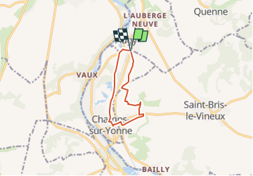
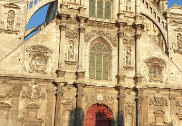
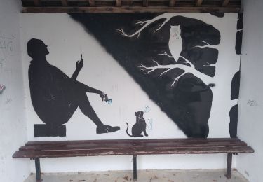
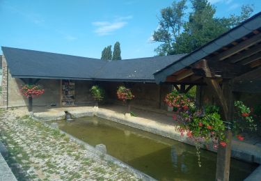
Tour Wandern von 8,2 km verfügbar auf Burgund und Freigrafschaft, Yonne, Champs-sur-Yonne. Diese Tour wird von JMC89 vorgeschlagen.
Beschreibung
départ d'Augy en direction de Champs sur Yonne à gauche de la
D 606 et retour par la voie cyclable et les bords de l'Yonne
Ort
Land:
France
Region :
Burgund und Freigrafschaft
Abteilung/Provinz :
Yonne
Kommune :
Champs-sur-Yonne
Standort:
Unknown
Gehen Sie:(Dec)
Gehen Sie:(UTM)
545819 ; 5290204 (31T) N.
Kommentare
Touren in der Umgebung
![Tour Wandern Jussy - JUSSY 07042024 AGE D'OR - Photo](https://media.geolcdn.com/t/375/260/2b04c576-26c0-4cf6-8318-b145d3910221.jpg&format=jpg&maxdim=2)
![Wandern Wandern](https://static1.geolcdn.com/sitytour/trail-icons/101.png)
JUSSY 07042024 AGE D'OR
Wandern
Medium
Jussy,
Burgund und Freigrafschaft,
Yonne,
France
![](/images/other/stat-length.png)
8,4 km | 10,7 km-effort
2h 21min
![](https://static1.geolcdn.com/siteimages/upload/files/16400158638029165_repeat_loop_refresh_sync_direction_icon.png)
Ja
![Tour Wandern Auxerre - auxerre vezelay - Photo](https://media.geolcdn.com/t/375/260/687c5337-260d-4260-a87d-3465a781d2bf.jpg&format=jpg&maxdim=2)
![Wandern Wandern](https://static1.geolcdn.com/sitytour/trail-icons/101.png)
auxerre vezelay
Wandern
Sehr schwierig
Auxerre,
Burgund und Freigrafschaft,
Yonne,
France
![](/images/other/stat-length.png)
57 km | 74 km-effort
9h 39min
![](https://static1.geolcdn.com/siteimages/upload/files/16400158638029165_repeat_loop_refresh_sync_direction_icon.png)
Nein
![Tour Wandern Jussy - Jussy Age d'Or 23042023 - Photo](https://media.geolcdn.com/t/375/260/bf39d1c5-78f5-421b-ad14-c45f95a9a1b5.jpg&format=jpg&maxdim=2)
![Wandern Wandern](https://static1.geolcdn.com/sitytour/trail-icons/101.png)
Jussy Age d'Or 23042023
Wandern
Medium
Jussy,
Burgund und Freigrafschaft,
Yonne,
France
![](/images/other/stat-length.png)
8,5 km | 10,9 km-effort
2h 19min
![](https://static1.geolcdn.com/siteimages/upload/files/16400158638029165_repeat_loop_refresh_sync_direction_icon.png)
Nein
![Tour Wandern Saint-Bris-le-Vineux - StBris le Vineux - Photo](https://media.geolcdn.com/t/375/260/a8a6419b-763d-42b2-927f-fdc022a917a6.jpg&format=jpg&maxdim=2)
![Wandern Wandern](https://static1.geolcdn.com/sitytour/trail-icons/101.png)
StBris le Vineux
Wandern
Schwierig
Saint-Bris-le-Vineux,
Burgund und Freigrafschaft,
Yonne,
France
![](/images/other/stat-length.png)
21 km | 29 km-effort
5h 39min
![](https://static1.geolcdn.com/siteimages/upload/files/16400158638029165_repeat_loop_refresh_sync_direction_icon.png)
Ja
![Tour Wandern Auxerre - Auxerre - Photo](https://media.geolcdn.com/t/375/260/f9310d5b-6fbc-4efc-80a1-631aeb22d0c7.jpg&format=jpg&maxdim=2)
![Wandern Wandern](https://static1.geolcdn.com/sitytour/trail-icons/101.png)
Auxerre
Wandern
Medium
Auxerre,
Burgund und Freigrafschaft,
Yonne,
France
![](/images/other/stat-length.png)
8,9 km | 10,3 km-effort
2h 37min
![](https://static1.geolcdn.com/siteimages/upload/files/16400158638029165_repeat_loop_refresh_sync_direction_icon.png)
Ja
![Tour Mountainbike Auxerre - auxerre chablis tonnerre gr 654 - Photo](https://media.geolcdn.com/t/375/260/ext.jpg?maxdim=2&url=https%3A%2F%2Fstatic1.geolcdn.com%2Fsiteimages%2Fupload%2Ffiles%2F1524743154velo.jpg)
![Mountainbike Mountainbike](https://static1.geolcdn.com/sitytour/trail-icons/202.png)
auxerre chablis tonnerre gr 654
Mountainbike
Einfach
(2)
Auxerre,
Burgund und Freigrafschaft,
Yonne,
France
![](/images/other/stat-length.png)
42 km | 52 km-effort
4h 17min
![](https://static1.geolcdn.com/siteimages/upload/files/16400158638029165_repeat_loop_refresh_sync_direction_icon.png)
Nein
![Tour Wandern Venoy - Nangis - Photo](https://media.geolcdn.com/t/375/260/79c4367a-b0b0-4849-9dad-2fd15731bb88.jpg&format=jpg&maxdim=2)
![Wandern Wandern](https://static1.geolcdn.com/sitytour/trail-icons/101.png)
Nangis
Wandern
Medium
Venoy,
Burgund und Freigrafschaft,
Yonne,
France
![](/images/other/stat-length.png)
8,1 km | 9,8 km-effort
2h 12min
![](https://static1.geolcdn.com/siteimages/upload/files/16400158638029165_repeat_loop_refresh_sync_direction_icon.png)
Ja
![Tour Elektrofahrrad Jussy - Vermenton 01092024 - Photo](https://media.geolcdn.com/t/375/260/e34c69ec-db31-449e-b333-63aabf4969ba.jpg&format=jpg&maxdim=2)
![Elektrofahrrad Elektrofahrrad](https://static1.geolcdn.com/sitytour/trail-icons/205.png)
Vermenton 01092024
Elektrofahrrad
Sehr leicht
Jussy,
Burgund und Freigrafschaft,
Yonne,
France
![](/images/other/stat-length.png)
37 km | 41 km-effort
1h 52min
![](https://static1.geolcdn.com/siteimages/upload/files/16400158638029165_repeat_loop_refresh_sync_direction_icon.png)
Ja
![Tour Elektrofahrrad Jussy - Auxerre - Photo](https://media.geolcdn.com/t/375/260/35647867-72d6-42d5-ae5f-8f7fff2ecc4e.jpg&format=jpg&maxdim=2)
![Elektrofahrrad Elektrofahrrad](https://static1.geolcdn.com/sitytour/trail-icons/205.png)
Auxerre
Elektrofahrrad
Sehr leicht
Jussy,
Burgund und Freigrafschaft,
Yonne,
France
![](/images/other/stat-length.png)
32 km | 36 km-effort
2h 0min
![](https://static1.geolcdn.com/siteimages/upload/files/16400158638029165_repeat_loop_refresh_sync_direction_icon.png)
Nein