![](/images/other/stat-length.png)
![Tour Wandern Maasgouw - Thorn - Kessenich - Photo](https://media.geolcdn.com/t/1900/400/6721e024-f911-400b-93a1-010902f29dc2.jpg&format=pjpeg&maxdim=2)
Thorn - Kessenich
mumu.larandonneuse
Benutzer GUIDE
![Länge](/images/other/stat-length.png)
![Maximale Höhe](https://static1.geolcdn.com/siteimages/upload/files/1508320355ic_sort_altitude_max_24dp.png)
![Positive Höhendifferenz](https://static1.geolcdn.com/siteimages/upload/files/1508320355ic_sort_den_pos_24dp.png)
![Km-Effort](/images/other/stat-length.png)
![Min. Höhe](https://static1.geolcdn.com/siteimages/upload/files/1508320355ic_sort_altitude_min_24dp.png)
![Negative Höhendifferenz](https://static1.geolcdn.com/siteimages/upload/files/1508320355ic_sort_den_neg_24dp.png)
![Boucle](https://static1.geolcdn.com/siteimages/upload/files/16400158638029165_repeat_loop_refresh_sync_direction_icon.png)
![Wandern](https://static1.geolcdn.com/sitytour/trail-icons/101.png)
2h38
Schwierigkeit : Sehr leicht
![Scannen Sie diesen QR-Code, um die Tour in der SityTrail-Anwendung zu öffnen](https://capi.geolives.com/qq0zvz2zws4bq2lad0pu/sitytour/trails/3443432/qr.png?size=200)
Kostenlosegpshiking-Anwendung
Über SityTrail
Tour Wandern von 11,3 km verfügbar auf Limburg, Unbekannt, Maasgouw. Diese Tour wird von mumu.larandonneuse vorgeschlagen.
Beschreibung
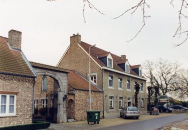
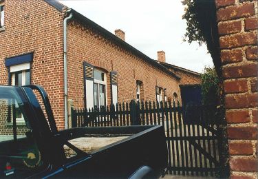
🇳🇱 🇧🇪 Nous entrons dans un monde de maisons blanches, de places nostalgiques et de jolies rues pavées, avec l'impression d'être dans un autre monde. Thorn est connue pour ses maisons blanchies à la chaux et ses édifices monumentaux.
La randonnée frontalière sillonne d'abord les belles rues blanches de la ville avant de traverser la presqu'île de Kollegreend jusqu'à "La fin de la Belgique". C'est le point le plus au nord-est de la Belgique.
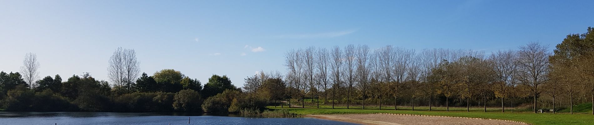
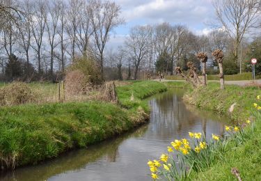
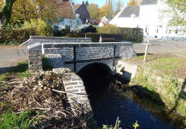
Le retour longe le Witbeek, jusqu'au village de Kessenich et passe à travers la magnifique réserve naturelle 't Vijverbroek.
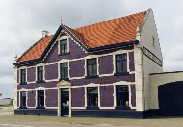
➕ L'Abbaye de Thorn, "Abdijkerk", fût autrefois à l’origine de la ville. La partie la plus ancienne remonte au 10e siècle.
Ort
Kommentare
Touren in der Umgebung
![Tour Zu Fuß Maasgouw - Molenplas - Photo](https://media.geolcdn.com/t/375/260/a9d73bcd-1373-4487-bc1e-2ba7100eaa25.jpeg&format=jpg&maxdim=2)
![Zu Fuß Zu Fuß](https://static1.geolcdn.com/sitytour/trail-icons/100.png)
Zu Fuß
![](/images/other/stat-length.png)
![](https://static1.geolcdn.com/siteimages/upload/files/16400158638029165_repeat_loop_refresh_sync_direction_icon.png)
![Tour Zu Fuß Kinrooi - Aldeneik & Maaseik Oranje bol - Photo](https://media.geolcdn.com/t/375/260/bc3af69e-279e-4557-9451-37c2a56c35ef.jpeg&format=jpg&maxdim=2)
![Zu Fuß Zu Fuß](https://static1.geolcdn.com/sitytour/trail-icons/100.png)
Zu Fuß
![](/images/other/stat-length.png)
![](https://static1.geolcdn.com/siteimages/upload/files/16400158638029165_repeat_loop_refresh_sync_direction_icon.png)
![Tour Zu Fuß Maasgouw - Kessenich en de Drie Eigen Rode driehoek - Photo](https://media.geolcdn.com/t/375/260/77b59905-a12f-4e43-9213-9afcc0b2276d.jpeg&format=jpg&maxdim=2)
![Zu Fuß Zu Fuß](https://static1.geolcdn.com/sitytour/trail-icons/100.png)
Zu Fuß
![](/images/other/stat-length.png)
![](https://static1.geolcdn.com/siteimages/upload/files/16400158638029165_repeat_loop_refresh_sync_direction_icon.png)
![Tour Zu Fuß Kinrooi - Kessenich en de Drie Eigen Paarse boot - Photo](https://media.geolcdn.com/t/375/260/24e2bd97-c890-4906-9b76-50b358b1ffd3.jpeg&format=jpg&maxdim=2)
![Zu Fuß Zu Fuß](https://static1.geolcdn.com/sitytour/trail-icons/100.png)
Zu Fuß
![](/images/other/stat-length.png)
![](https://static1.geolcdn.com/siteimages/upload/files/16400158638029165_repeat_loop_refresh_sync_direction_icon.png)
![Tour Zu Fuß Kinrooi - Kessenich en de Drie Eigen Groene rechthoek - Photo](https://media.geolcdn.com/t/375/260/d906b2b2-a7df-4af2-abfb-db8e706c3f74.jpeg&format=jpg&maxdim=2)
![Zu Fuß Zu Fuß](https://static1.geolcdn.com/sitytour/trail-icons/100.png)
Zu Fuß
![](/images/other/stat-length.png)
![](https://static1.geolcdn.com/siteimages/upload/files/16400158638029165_repeat_loop_refresh_sync_direction_icon.png)
![Tour Zu Fuß Maasgouw - Kessenich en de Drie Eigen Blauwe ruit - Photo](https://media.geolcdn.com/t/375/260/7a0d588c-2664-4335-b354-fe14498d3c96.jpeg&format=jpg&maxdim=2)
![Zu Fuß Zu Fuß](https://static1.geolcdn.com/sitytour/trail-icons/100.png)
Zu Fuß
![](/images/other/stat-length.png)
![](https://static1.geolcdn.com/siteimages/upload/files/16400158638029165_repeat_loop_refresh_sync_direction_icon.png)
![Tour Wandern Maasgouw - 2022-10-27_11h08m19_438 - Photo](https://media.geolcdn.com/t/375/260/ext.jpg?maxdim=2&url=https%3A%2F%2Fstatic1.geolcdn.com%2Fsiteimages%2Fupload%2Ffiles%2F1553511878bg_sport_marche.png)
![Wandern Wandern](https://static1.geolcdn.com/sitytour/trail-icons/101.png)
Wandern
![](/images/other/stat-length.png)
![](https://static1.geolcdn.com/siteimages/upload/files/16400158638029165_repeat_loop_refresh_sync_direction_icon.png)
![Tour Segelboot Kinrooi - boot op de Maas - Photo](https://media.geolcdn.com/t/375/260/ext.jpg?maxdim=2&url=https%3A%2F%2Fsecurestorage.geolives.com%2Fsitytour%2Ftrail-bg%2Fdefault.jpg)
![Segelboot Segelboot](https://static1.geolcdn.com/sitytour/trail-icons/702.png)
Segelboot
![](/images/other/stat-length.png)
![](https://static1.geolcdn.com/siteimages/upload/files/16400158638029165_repeat_loop_refresh_sync_direction_icon.png)
![Tour Fahrrad Leudal - Limburg - Leudalroute - Photo](https://media.geolcdn.com/t/375/260/ext.jpg?maxdim=2&url=https%3A%2F%2Fstatic1.geolcdn.com%2Fsiteimages%2Fupload%2Ffiles%2F1524743154velo.jpg)
![Fahrrad Fahrrad](https://static1.geolcdn.com/sitytour/trail-icons/200.png)
Fahrrad
![](/images/other/stat-length.png)
![](https://static1.geolcdn.com/siteimages/upload/files/16400158638029165_repeat_loop_refresh_sync_direction_icon.png)
Magnifique !