


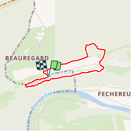


4,4 km | 5,9 km-effort

Randonnées de la Commune de Neupré PRO


Kostenlosegpshiking-Anwendung
 SityTrail
IGN / Geografische Institute
SityTrail World
Die Welt öffnet sich für Sie
Tour Wandern von 2,7 km verfügbar auf Wallonien, Lüttich, Neupré. Diese Tour wird von Commune de Neupré vorgeschlagen.
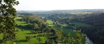
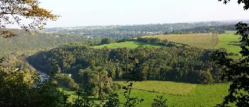
Découverte du Grand Site de la Boucle de l'Ourthe, paysage classé patrimoine exceptionnel de Wallonie s'étendant entre Esneux et Neupré.


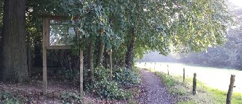
Wandern

Wandern

Wandern

Wandern

Wandern

Wandern

Wandern

Wandern

Wandern
très beau point de vue sur la vallée de l'Ourthe !
superbe
belle promenade le long d un crête. un peu court