


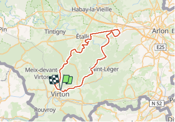


29 km | 35 km-effort

Benutzer


Kostenlosegpshiking-Anwendung
 SityTrail
IGN / Geografische Institute
SityTrail World
Die Welt öffnet sich für Sie
Tour Mountainbike von 53 km verfügbar auf Wallonien, Luxemburg, Wirten. Diese Tour wird von Pascal L vorgeschlagen.
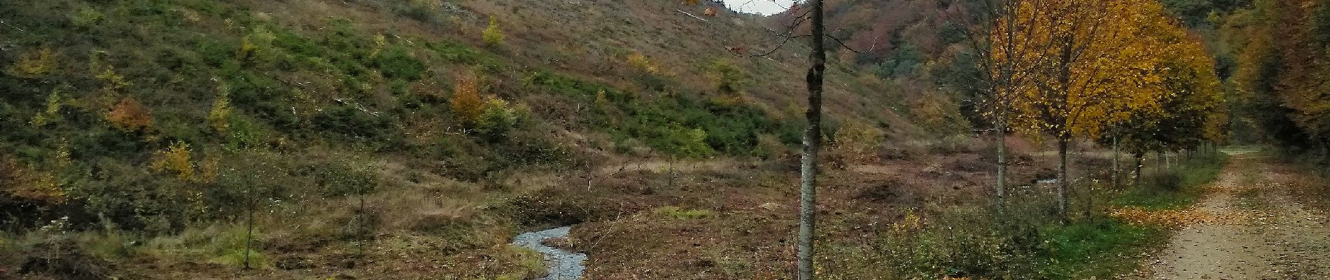
Belle balade automnale qui vous emène de Virton à la "Chaussée Brunehaut", en passant par ...
Départ/Retour: Virton (Rue d’Orvillers – Val d’Away)
Endroits de passage : TODO ...
Ref.
- ...
- https://www.cheminsdecampagne.be/Chaussee_Brunehaut.php
- Circuits gallor
- https://www.cirkwi.com/fr/point-interet/944628-chemin-des-romains
- https://www.luxembourg-belge.be/diffusio/fr/p/decouverte-et-divertissement/chateau-de-la-margelle-ou-grosse-tour-et-voie-romaine-etalle_TFOALD-01-08H4-3Q4A/
- voies romaines https://oar.onroerenderfgoed.be/publicaties/ABNR/5/ABNR005-029.pdf
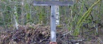
- croix kelner : https://www.sitytrail.com/fr/poi/1948428-etalle--la-croix-kelner/
- marais-de-villers-tortrue : http://biodiversite.wallonie.be/fr/81-marais-de-villers-tortrue.html?IDD=251659407&IDC=1881#
(2022.10.19)


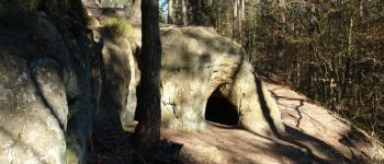
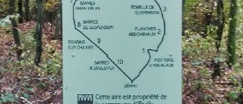
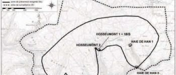
126 Fotos insgesamt. Klicken Sie auf ein Foto, um sie alle in der Galerie zu sehen.

Wandern

Mountainbike

Wandern

Zu Fuß

Wandern

Wandern

Mountainbike

Mountainbike

Mountainbike