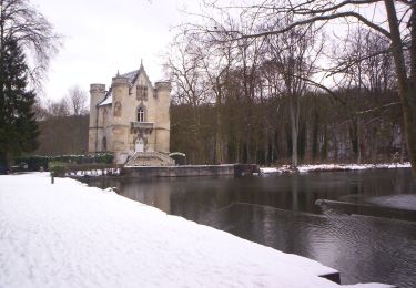
8,2 km | 9,2 km-effort
Chantilly 1
adellatorre
Benutzer
Länge
12,6 km
Maximale Höhe
74 m
Positive Höhendifferenz
116 m
Km-Effort
14,1 km
Min. Höhe
39 m
Negative Höhendifferenz
102 m
Boucle
Nein
Erstellungsdatum :
2022-09-15 17:38:55.439
Letzte Änderung :
2022-09-15 17:39:18.46
3h11
Schwierigkeit : Einfach
Kostenlosegpshiking-Anwendung
Über SityTrail
Tour Zu Fuß von 12,6 km verfügbar auf Nordfrankreich, Oise, Chantilly. Diese Tour wird von adellatorre vorgeschlagen.
Ort
Land:
France
Region :
Nordfrankreich
Abteilung/Provinz :
Oise
Kommune :
Chantilly
Standort:
Unknown
Gehen Sie:(Dec)
Gehen Sie:(UTM)
462532 ; 5449114 (31U) N.
Kommentare
Touren in der Umgebung
MR_PONTARME-OUEST_4.9Km
Wandern
Einfach
(2)
Pontarmé,
Nordfrankreich,
Oise,
France
4,9 km | 5,5 km-effort
1h 12min
Ja
SM_PONTARME_EST(Chateau)_8.6Km
Wandern
Medium
(6)
Pontarmé,
Nordfrankreich,
Oise,
France
8,6 km | 9,7 km-effort
2h 9min
Ja
Boucle autour des étangs de Commelles
Wandern
Sehr leicht
Coye-la-Forêt,
Nordfrankreich,
Oise,
France
23 km | 26 km-effort
5h 5min
Ja
Mongrésin Grand parcours
Wandern
Einfach
(1)
Orry-la-Ville,
Nordfrankreich,
Oise,
France
21 km | 24 km-effort
5h 12min
Ja
apremont 60300
Wandern
Schwierig
(1)
Apremont,
Nordfrankreich,
Oise,
France
20 km | 23 km-effort
4h 49min
Ja
chantilly Gouvieux
Wandern
Einfach
Chantilly,
Nordfrankreich,
Oise,
France
20 km | 0 m-effort
5h 59min
Ja
Du GR 655 au GR14
Zu Fuß
Einfach
Coye-la-Forêt,
Nordfrankreich,
Oise,
France
3,7 km | 4,1 km-effort
56min
Nein
Chantilly Etanf reine Blanche
Wandern
Schwierig
Coye-la-Forêt,
Nordfrankreich,
Oise,
France
14,9 km | 16,8 km-effort
3h 18min
Ja