


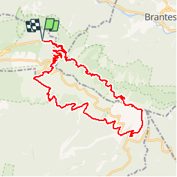

19,1 km | 30 km-effort


Benutzer


Kostenlosegpshiking-Anwendung
 SityTrail
IGN / Geografische Institute
SityTrail World
Die Welt öffnet sich für Sie
Tour Wandern von 23 km verfügbar auf Provence-Alpes-Côte d'Azur, Vaucluse, Beaumont-du-Ventoux. Diese Tour wird von makounet vorgeschlagen.
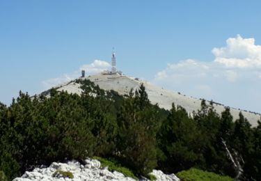
Le tour du Mont-Ventoux. Départ Mont-Serein, GR9, Chalet Reynard, Jas des pèlerins, sommet puis GR4 pour redescendre au Mont-Serein.

Wandern

Wandern

Mountainbike

Mountainbike

Mountainbike

Wandern

Wandern

Wandern
Wandern