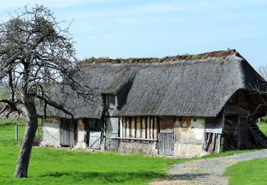
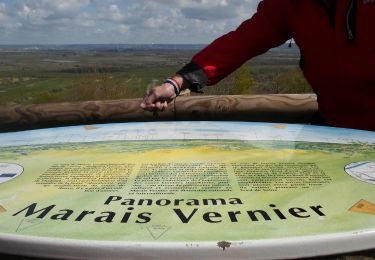
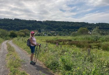
Tour Wandern Bouquelon - La Route des Chaumières au départ de Bouquelon - Photo

La Route des Chaumières au départ de Bouquelon

 philberard95
philberard95

Benutzer

© OpenStreetMap contributors
Länge
Länge
13,3 km
Maximale Höhe
Maximale Höhe
120 m
Positive Höhendifferenz
247 m
Km-Effort
Km-Effort  
16,6 km
Min. Höhe
Min. Höhe
2 m
Negative Höhendifferenz
246 m
Boucle
Boucle
Ja
Erstellungsdatum :
2022-09-05 12:35:16.872
Letzte Änderung :
2023-01-11 10:18:52.688

(0 Nachricht)

Wandern
Wandern
3h46
Schwierigkeit : Schwierig

Scannen Sie diesen QR-Code, um die Tour in der SityTrail-Anwendung zu öffnen

Kostenlosegpshiking-Anwendung

Logo SityTrail SityTrail

IGN / Geografische Institute

SityTrail aus dem App Store herunterladen SityTrail von Google Play herunterladen

Logo SityTrail SityTrail World

Die Welt öffnet sich für Sie

SityTrail aus dem App Store herunterladen SityTrail von Google Play herunterladen SityTrail auf Huawei AppGallery herunterladen

Über SityTrail

Tour Wandern von 13,3 km verfügbar auf Normandie, Eure, Bouquelon. Diese Tour wird von philberard95 vorgeschlagen.

Höhenprofil

POIs

POI Bouquelon - Parking de l'église - Photo
philberard95
POI Le Perrey - Traverser la route - Photo
philberard95
POI Le Perrey - Embranchement, obliquer à gauche - Photo
philberard95
POI Marais-Vernier - Le Bout d'Amon, fourche, prendre à droite - Photo
philberard95
POI Marais-Vernier - Tourner à gauche - Photo
philberard95
MARAIS-VERNIER 
POI Marais-Vernier - Croisement en Y, prendre chemin à gauche - Photo
philberard95
POI Bouquelon - D90, traverser, continuer en face - Photo
philberard95
POI Bouquelon - Quitter la route bifurquer à gauche dans le chemin - Photo
philberard95
POI Bouquelon - Bois du Plessis, embranchement, prendre à gauche - Photo
philberard95
POI Bouquelon - Patte d'oie, prendre chemin à gauche - Photo
philberard95
POI Bouquelon - Tourner à gauche - Photo
philberard95
POI Bouquelon - Parking de l'église - Photo
philberard95

Ort

Land:
France
Region :
Normandie
Abteilung/Provinz :
Eure
Kommune :
Bouquelon
Standort:
Unknown
Gehen Sie:(UTM)
317925 ; 5474511 (31U) N.

Touren in der Umgebung

Tour Wandern Marais-Vernier - 2022-04-08_19h09m39_SityTrail - 3194311 - 20220409xmarais-vernier-10km - Photo
Wandern
rvs147

Wandern

Schwierig
(1)
Marais-Vernier, Normandie, Eure, France
10,8 km | 13,8 km-effort
3h 7min
Ja
Tour Zu Fuß Sainte-Opportune-la-Mare - Chemin pédestre de l'Allée des Granges - Photo
Zu Fuß
GUIDE+

Zu Fuß

Einfach
Sainte-Opportune-la-Mare, Normandie, Eure, France
6,4 km | 8,1 km-effort
1h 49min
Ja
Tour Wandern Bouquelon - Boucle de Bouquelon V2 variante - Photo
Wandern
mlry

Wandern

Medium
(1)
Bouquelon, Normandie, Eure, France
9,1 km | 11,1 km-effort
2h 31min
Ja
Tour Wandern Bouquelon - Boucle de Bouquelon V1 - Photo
Wandern
mlry

Wandern

Schwierig
(1)
Bouquelon, Normandie, Eure, France
13,3 km | 16,6 km-effort
3h 46min
Ja
Tour Wandern Bouquelon - Boucle de Bouquelon V2  - Photo
Wandern
mlry

Wandern

Medium
(1)
Bouquelon, Normandie, Eure, France
9,4 km | 11,4 km-effort
2h 35min
Ja
Tour Wandern Marais-Vernier - 20220409-marais vernier  - Photo
Wandern
doudet

Wandern

Schwierig
Marais-Vernier, Normandie, Eure, France
10,8 km | 13,8 km-effort
2h 58min
Ja
Tour Wandern Marais-Vernier - marais vernier - Photo
Wandern
RoMo

Wandern

Einfach
(1)
Marais-Vernier, Normandie, Eure, France
11 km | 13,6 km-effort
3h 1min
Ja
Tour Wandern Saint-Samson-de-la-Roque - La Roque - Photo
Wandern
bergo

Wandern

Sehr leicht
Saint-Samson-de-la-Roque, Normandie, Eure, France
14,9 km | 17,7 km-effort
3h 25min
Nein
Tour Wandern Marais-Vernier - Sentier découverte du marais vernier  - Photo
Wandern
serleb

Wandern

Einfach
Marais-Vernier, Normandie, Eure, France
5,4 km | 5,7 km-effort
1h 39min
Ja


Schließen
Meine Abonnements