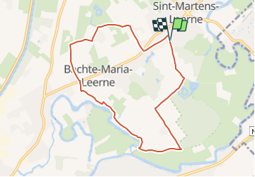
![](/images/other/stat-length.png)
![Tour Wandern Deinze - Le château d’Ooidonk à Deinze - Photo](https://media.geolcdn.com/t/1900/400/d255fdad-ee32-44cd-b7de-2c94d8b7f7ee.jpeg&format=pjpeg&maxdim=2)
Le château d’Ooidonk à Deinze
Benjamin27
Benutzer GUIDE
![Länge](/images/other/stat-length.png)
![Maximale Höhe](https://static1.geolcdn.com/siteimages/upload/files/1508320355ic_sort_altitude_max_24dp.png)
![Positive Höhendifferenz](https://static1.geolcdn.com/siteimages/upload/files/1508320355ic_sort_den_pos_24dp.png)
![Km-Effort](/images/other/stat-length.png)
![Min. Höhe](https://static1.geolcdn.com/siteimages/upload/files/1508320355ic_sort_altitude_min_24dp.png)
![Negative Höhendifferenz](https://static1.geolcdn.com/siteimages/upload/files/1508320355ic_sort_den_neg_24dp.png)
![Boucle](https://static1.geolcdn.com/siteimages/upload/files/16400158638029165_repeat_loop_refresh_sync_direction_icon.png)
![Wandern](https://static1.geolcdn.com/sitytour/trail-icons/101.png)
1h52
Schwierigkeit : Medium
![Scannen Sie diesen QR-Code, um die Tour in der SityTrail-Anwendung zu öffnen](https://capi.geolives.com/qq0zvz2zws4bq2lad0pu/sitytour/trails/3369594/qr.png?size=200)
Kostenlosegpshiking-Anwendung
Über SityTrail
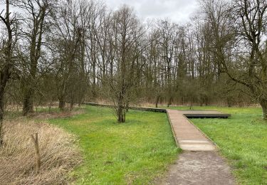
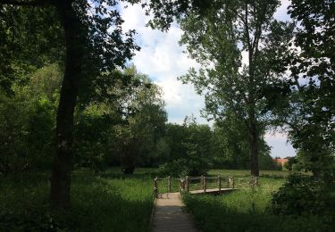
Tour Wandern von 7,7 km verfügbar auf Flandern, Ostflandern, Deinze. Diese Tour wird von Benjamin27 vorgeschlagen.
Beschreibung
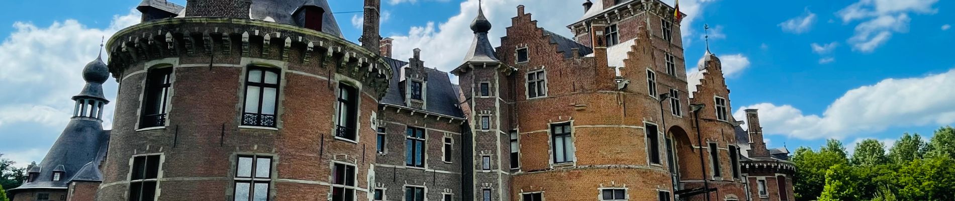
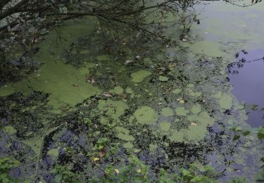
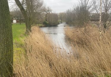
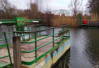
La région de la Lys flirte avec les frontières provinciales. Vous commencez la promenade dans la grande allée du majestueux château d’Ooidonk : visitez son parc, c’est une perle. Allez ensuite vous balader le long de la Lys avec de magnifiques paysages de cette région riche en surprises.
👣 Distance : 8km - balisage hexagone avec « Ooidonk wandelroute » écrit en vert.
📍Départ : parking prévu, ooidonkdreef 3 - 9800 Bachte-Maria-Leerne.
🚂🚍 Aller à la gare de Deinze, prendre le bus DE LIJN 14 jusqu’à l’arrêt « Barchte Maria Leerne - Mulderstraat » et marcher jusqu’au point de départ de la promenade.
⚠️ L’entrée dans le parc du château (et pour voir le château) est à 3euros à payer en liquide.
Ort
Kommentare
Touren in der Umgebung
![Tour Zu Fuß Deinze - Ooidonkroute - Photo](https://media.geolcdn.com/t/375/260/a989dc90-b267-4c71-9207-1c5a32844e07.jpeg&format=jpg&maxdim=2)
![Zu Fuß Zu Fuß](https://static1.geolcdn.com/sitytour/trail-icons/100.png)
Zu Fuß
![](/images/other/stat-length.png)
![](https://static1.geolcdn.com/siteimages/upload/files/16400158638029165_repeat_loop_refresh_sync_direction_icon.png)
![Tour Zu Fuß Sint-Martens-Latem - Albijn Van Den Abeele Route - Photo](https://media.geolcdn.com/t/375/260/bbfcb69d-666f-47bc-8c47-8c5c2ac7c6aa.jpeg&format=jpg&maxdim=2)
![Zu Fuß Zu Fuß](https://static1.geolcdn.com/sitytour/trail-icons/100.png)
Zu Fuß
![](/images/other/stat-length.png)
![](https://static1.geolcdn.com/siteimages/upload/files/16400158638029165_repeat_loop_refresh_sync_direction_icon.png)
![Tour Wandern Deinze - 19 km autour de Deinze et Machelen - Photo](https://media.geolcdn.com/t/375/260/f6f6d5b4-ad07-4d56-9b6b-e63ccbbcdac3.jpg&format=jpg&maxdim=2)
![Wandern Wandern](https://static1.geolcdn.com/sitytour/trail-icons/101.png)
Wandern
![](/images/other/stat-length.png)
![](https://static1.geolcdn.com/siteimages/upload/files/16400158638029165_repeat_loop_refresh_sync_direction_icon.png)
![Tour Wandern Deinze - Filliers Deinze - Photo](https://media.geolcdn.com/t/375/260/e61df0b9-73c6-4e71-8315-6346762c2e63.jpg&format=jpg&maxdim=2)
![Wandern Wandern](https://static1.geolcdn.com/sitytour/trail-icons/101.png)
Wandern
![](/images/other/stat-length.png)
![](https://static1.geolcdn.com/siteimages/upload/files/16400158638029165_repeat_loop_refresh_sync_direction_icon.png)
![Tour Wandern Sint-Martens-Latem - De Pinte près de Saint Maertens Laethem - Photo](https://media.geolcdn.com/t/375/260/3f289975-16ee-4ae9-be3b-e83cecdfdb62.jpg&format=jpg&maxdim=2)
![Wandern Wandern](https://static1.geolcdn.com/sitytour/trail-icons/101.png)
Wandern
![](/images/other/stat-length.png)
![](https://static1.geolcdn.com/siteimages/upload/files/16400158638029165_repeat_loop_refresh_sync_direction_icon.png)
![Tour Zu Fuß Gent - Rosdambeekroute - Photo](https://media.geolcdn.com/t/375/260/25a22a66-33f6-4767-91c4-e51d6f2970fd.jpeg&format=jpg&maxdim=2)
![Zu Fuß Zu Fuß](https://static1.geolcdn.com/sitytour/trail-icons/100.png)
Zu Fuß
![](/images/other/stat-length.png)
![](https://static1.geolcdn.com/siteimages/upload/files/16400158638029165_repeat_loop_refresh_sync_direction_icon.png)
![Tour Wandern Deinze - Randonnée des Filliers à Deinze - Photo](https://media.geolcdn.com/t/375/260/63489dac-74b1-4b82-bcac-292bc60f01cd.jpg&format=jpg&maxdim=2)
![Wandern Wandern](https://static1.geolcdn.com/sitytour/trail-icons/101.png)
Wandern
![](/images/other/stat-length.png)
![](https://static1.geolcdn.com/siteimages/upload/files/16400158638029165_repeat_loop_refresh_sync_direction_icon.png)
![Tour Wandern Sint-Martens-Latem - albijn van den abeeleroute - Photo](https://media.geolcdn.com/t/375/260/ext.jpg?maxdim=2&url=https%3A%2F%2Fstatic1.geolcdn.com%2Fsiteimages%2Fupload%2Ffiles%2F1553511878bg_sport_marche.png)
![Wandern Wandern](https://static1.geolcdn.com/sitytour/trail-icons/101.png)
Wandern
![](/images/other/stat-length.png)
![](https://static1.geolcdn.com/siteimages/upload/files/16400158638029165_repeat_loop_refresh_sync_direction_icon.png)
![Tour Zu Fuß Sint-Martens-Latem - Gust De Smet wandelroute - Photo](https://media.geolcdn.com/t/375/260/ext.jpg?maxdim=2&url=https%3A%2F%2Fstatic1.geolcdn.com%2Fsiteimages%2Fupload%2Ffiles%2F1545311037marcheuse_200dpi.jpg)
![Zu Fuß Zu Fuß](https://static1.geolcdn.com/sitytour/trail-icons/100.png)
Zu Fuß
![](/images/other/stat-length.png)
![](https://static1.geolcdn.com/siteimages/upload/files/16400158638029165_repeat_loop_refresh_sync_direction_icon.png)