


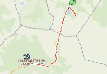

13,8 km | 24 km-effort


Benutzer


Kostenlosegpshiking-Anwendung
 SityTrail
IGN / Geografische Institute
SityTrail World
Die Welt öffnet sich für Sie
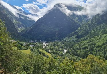
Tour Wandern von 14,8 km verfügbar auf Auvergne-Rhone-Alpen, Isère, Les Deux Alpes. Diese Tour wird von sofracoan vorgeschlagen.
Jour 2 d'un tour de 3 jours dans l'Oisans. Etape incluant une montée/descente à un point de vue vers le glacier de la Muzelle.
Wandern

Wandern
Wandern
Wandern

Wandern

Wandern

Wandern
Wandern
Wandern