


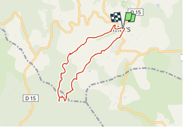

8,6 km | 11,9 km-effort


Benutzer


Kostenlosegpshiking-Anwendung
 SityTrail
IGN / Geografische Institute
SityTrail World
Die Welt öffnet sich für Sie
Tour Wandern von 6,8 km verfügbar auf Provence-Alpes-Côte d'Azur, Vaucluse, Murs. Diese Tour wird von Berpav vorgeschlagen.
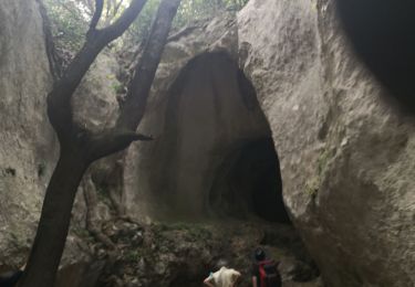
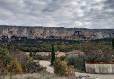
Le canyon creusé entre Murs et Joucas révèle un magnifique site naturel et d'anciens chefs d'œuvre hydrauliques du XVI° au XIX° siècle.
Wandern

Wandern

Zu Fuß
Wandern

Wandern

Mountainbike

Mountainbike

Wandern

Zu Fuß