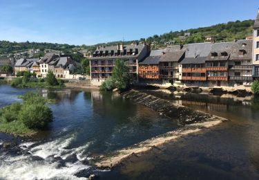
Tour Wandern Villecomtal - La Chapelle de Servières - Photo

La Chapelle de Servières

 jpb83
jpb83

Benutzer

© OpenStreetMap contributors
Länge
Länge
9,5 km
Maximale Höhe
Maximale Höhe
540 m
Positive Höhendifferenz
316 m
Km-Effort
Km-Effort  
13,7 km
Min. Höhe
Min. Höhe
304 m
Negative Höhendifferenz
307 m
Boucle
Boucle
Ja
Erstellungsdatum :
2022-08-17 07:14:51.399
Letzte Änderung :
2022-08-17 07:16:30.723

(0 Nachricht)

Wandern
Wandern
3h06
Schwierigkeit : Einfach

Scannen Sie diesen QR-Code, um die Tour in der SityTrail-Anwendung zu öffnen

Kostenlosegpshiking-Anwendung

Logo SityTrail SityTrail

IGN / Geografische Institute

SityTrail aus dem App Store herunterladen SityTrail von Google Play herunterladen

Logo SityTrail SityTrail World

Die Welt öffnet sich für Sie

SityTrail aus dem App Store herunterladen SityTrail von Google Play herunterladen SityTrail auf Huawei AppGallery herunterladen

Über SityTrail

Tour Wandern von 9,5 km verfügbar auf Okzitanien, Aveyron, Villecomtal. Diese Tour wird von jpb83 vorgeschlagen.

Höhenprofil

POIs

POI Mouret - Parking mairie - Photo
jpb83
POI Mouret - Le Mas Bas - Photo
jpb83
MOURET 
POI Villecomtal - Pabotiés - Photo
jpb83
VILLECOMTAL 
POI Villecomtal - Carrefou carral - Photo
jpb83
VILLECOMTAL 
POI Villecomtal - Chapelle de Servières - Photo
jpb83
POI Villecomtal - Carrefour avant le pont - Photo
jpb83
POI Villecomtal - Parking mairie. Proche du - Photo
jpb83

Ort

Land:
France
Region :
Okzitanien
Abteilung/Provinz :
Aveyron
Kommune :
Villecomtal
Standort:
Unknown
Gehen Sie:(UTM)
465340 ; 4931894 (31T) N.

Touren in der Umgebung

Tour Wandern Campuac - campuac - Photo
Wandern
yves12

Wandern

Medium
(1)
Campuac, Okzitanien, Aveyron, France
22 km | 32 km-effort
5h 8min
Ja
Tour Zu Fuß Muret-le-Château - Terra Trail 9 - Photo
Zu Fuß
GUIDE+

Zu Fuß

Einfach
Muret-le-Château, Okzitanien, Aveyron, France
11 km | 12,6 km-effort
2h 52min
Nein
Tour Zu Fuß Campuac - Le Plateau de Campuac - Photo
Zu Fuß
GUIDE+

Zu Fuß

Einfach
Campuac, Okzitanien, Aveyron, France
7,6 km | 9 km-effort
2h 2min
Nein
Tour Zu Fuß Mouret - La Chapelle de Servières - Photo
Zu Fuß
GUIDE+

Zu Fuß

Einfach
Mouret, Okzitanien, Aveyron, France
5,6 km | 7,2 km-effort
1h 38min
Nein
Tour Zu Fuß Muret-le-Château - Les Corniches des Douzes - Photo
Zu Fuß
GUIDE+

Zu Fuß

Einfach
Muret-le-Château, Okzitanien, Aveyron, France
12 km | 15,5 km-effort
3h 31min
Ja
Tour Elektrofahrrad Muret-le-Château - Villecomtal dans le 12 - Photo
Elektrofahrrad
papajp

Elektrofahrrad

Muret-le-Château, Okzitanien, Aveyron, France
5,7 km | 6,8 km-effort
21min
Nein
Tour Andere Aktivitäten Campuac - Atlamed campuac - espalion - Photo
Andere Aktivitäten
jbtregouet

Andere Aktivitäten

Sehr leicht
Campuac, Okzitanien, Aveyron, France
26 km | 35 km-effort
6h 6min
Nein
Tour Mountainbike Campuac - Site VTT FFC - Gorges Lot et Truyère - Circuit n°1 Les Deux Clochers - Photo
Mountainbike
tracegps

Mountainbike

Schwierig
Campuac, Okzitanien, Aveyron, France
25 km | 31 km-effort
1h 45min
Ja
Tour Wandern Campuac - Campuac à Conques  - Photo
Wandern
bernardecarnot

Wandern

Schwierig
Campuac, Okzitanien, Aveyron, France
22 km | 30 km-effort
7h 5min
Nein


Schließen
Meine Abonnements