![](/images/other/stat-length.png)
![Tour Wandern Villers-le-Lac - les brenets - Photo](https://media.geolcdn.com/t/1900/400/a20ac90c-06ca-4725-aa0c-13349df47b73.jpg&format=pjpeg&maxdim=2)
les brenets
eltonnermou
Benutzer
![Länge](/images/other/stat-length.png)
![Maximale Höhe](https://static1.geolcdn.com/siteimages/upload/files/1508320355ic_sort_altitude_max_24dp.png)
![Positive Höhendifferenz](https://static1.geolcdn.com/siteimages/upload/files/1508320355ic_sort_den_pos_24dp.png)
![Km-Effort](/images/other/stat-length.png)
![Min. Höhe](https://static1.geolcdn.com/siteimages/upload/files/1508320355ic_sort_altitude_min_24dp.png)
![Negative Höhendifferenz](https://static1.geolcdn.com/siteimages/upload/files/1508320355ic_sort_den_neg_24dp.png)
![Boucle](https://static1.geolcdn.com/siteimages/upload/files/16400158638029165_repeat_loop_refresh_sync_direction_icon.png)
![Wandern](https://static1.geolcdn.com/sitytour/trail-icons/101.png)
94h30
Schwierigkeit : Medium
![Scannen Sie diesen QR-Code, um die Tour in der SityTrail-Anwendung zu öffnen](https://capi.geolives.com/qq0zvz2zws4bq2lad0pu/sitytour/trails/3346740/qr.png?size=200)
Kostenlosegpshiking-Anwendung
Über SityTrail
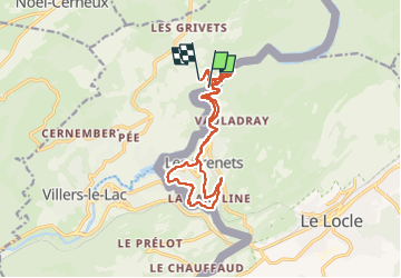
Tour Wandern von 15,2 km verfügbar auf Burgund und Freigrafschaft, Doubs, Villers-le-Lac. Diese Tour wird von eltonnermou vorgeschlagen.
Beschreibung
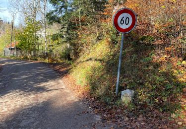
parking au saut du doubs (direction Maiche, suivre saut du doubs)
Attention, randonnée sur le territoire Helvétique, pensez à vos papiers d'identité.
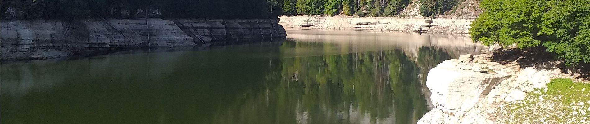
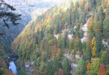
Très belle randonnée dans les massifs jurassiens, malgré (à mon goût)) la quantité de goudron entre le saut du Doubs et les Brenets. Une fois la traversée des Brenets, après la Caroline dépassée et avant d'arriver à la grande route, repérez sur votre gauche (à 120°) le sentier pour aller aux ruines du château Jurgensen à ne pas manquer (l'aller et retour en moins de 10').
Sur le chemin du retour, après avoir traversez Les Brenets ne manquer pas le sentier de la tête de Calvin, formidable point de vue sur les bassins du Doubs.
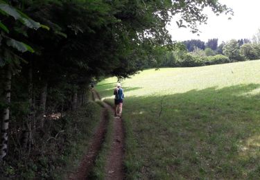
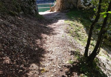
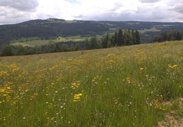
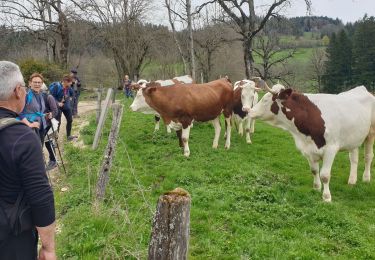
Vous traversez de nombreux espaces où vivent des animaux sauvages, profitez en.
Ort
Kommentare
Touren in der Umgebung
![Tour Wandern Villers-le-Lac - Le saut du Doubs et le Châtelard - Photo](https://media.geolcdn.com/t/375/260/ext.jpg?maxdim=2&url=https%3A%2F%2Fservices.sitytrail.com%2FGeolivesWS%2FDownloadMedia.ashx%3FTrailID%3D792633%26Media%3Dfix__20170717135052.jpg)
![Wandern Wandern](https://static1.geolcdn.com/sitytour/trail-icons/101.png)
Wandern
![](/images/other/stat-length.png)
![](https://static1.geolcdn.com/siteimages/upload/files/16400158638029165_repeat_loop_refresh_sync_direction_icon.png)
![Tour Zu Fuß Le Locle - Hôtel du Saut du Doubs - Gare des Brenets - Photo](https://media.geolcdn.com/t/375/260/4e2b223b-5d1f-4722-b3d5-d37a87436a7c.jpeg&format=jpg&maxdim=2)
![Zu Fuß Zu Fuß](https://static1.geolcdn.com/sitytour/trail-icons/100.png)
Zu Fuß
![](/images/other/stat-length.png)
![](https://static1.geolcdn.com/siteimages/upload/files/16400158638029165_repeat_loop_refresh_sync_direction_icon.png)
![Tour Zu Fuß Le Locle - Les Frêtes - fixme - Photo](https://media.geolcdn.com/t/375/260/0dfa81c4-ea86-4670-a9e2-4edd9205728f.jpeg&format=jpg&maxdim=2)
![Zu Fuß Zu Fuß](https://static1.geolcdn.com/sitytour/trail-icons/100.png)
Zu Fuß
![](/images/other/stat-length.png)
![](https://static1.geolcdn.com/siteimages/upload/files/16400158638029165_repeat_loop_refresh_sync_direction_icon.png)
![Tour Zu Fuß Les Planchettes - Barrage du Châtelot - Saut du Doubs - Photo](https://media.geolcdn.com/t/375/260/c02ae770-bade-4d71-b842-d1ab9da9220c.jpeg&format=jpg&maxdim=2)
![Zu Fuß Zu Fuß](https://static1.geolcdn.com/sitytour/trail-icons/100.png)
Zu Fuß
![](/images/other/stat-length.png)
![](https://static1.geolcdn.com/siteimages/upload/files/16400158638029165_repeat_loop_refresh_sync_direction_icon.png)
![Tour Wandern Villers-le-Lac - 25 saut du Doubs jura 08.08.24 - Photo](https://media.geolcdn.com/t/375/260/69ae39c7-0bce-4ef7-9703-c0fe844c8fa9.jpg&format=jpg&maxdim=2)
![Wandern Wandern](https://static1.geolcdn.com/sitytour/trail-icons/101.png)
Wandern
![](/images/other/stat-length.png)
![](https://static1.geolcdn.com/siteimages/upload/files/16400158638029165_repeat_loop_refresh_sync_direction_icon.png)
![Tour Wandern Villers-le-Lac - barrage chatelot saut du doubs le pissoux - Photo](https://media.geolcdn.com/t/375/260/9ddc7c9d-2c55-4135-9d10-7ad8ed129ab8.jpg&format=jpg&maxdim=2)
![Wandern Wandern](https://static1.geolcdn.com/sitytour/trail-icons/101.png)
Wandern
![](/images/other/stat-length.png)
![](https://static1.geolcdn.com/siteimages/upload/files/16400158638029165_repeat_loop_refresh_sync_direction_icon.png)
![Tour Wandern Villers-le-Lac - Le Pisoux - Photo](https://media.geolcdn.com/t/375/260/4a715c23-f970-4542-83cb-bb9163df6e0f.jpg&format=jpg&maxdim=2)
![Wandern Wandern](https://static1.geolcdn.com/sitytour/trail-icons/101.png)
Wandern
![](/images/other/stat-length.png)
![](https://static1.geolcdn.com/siteimages/upload/files/16400158638029165_repeat_loop_refresh_sync_direction_icon.png)
![Tour Wandern Villers-le-Lac - Saut du Doubs - Photo](https://media.geolcdn.com/t/375/260/5bf04ea4-00d2-4096-ab82-e6f5e7455237.jpg&format=jpg&maxdim=2)
![Wandern Wandern](https://static1.geolcdn.com/sitytour/trail-icons/101.png)
Wandern
![](/images/other/stat-length.png)
![](https://static1.geolcdn.com/siteimages/upload/files/16400158638029165_repeat_loop_refresh_sync_direction_icon.png)