![](/images/other/stat-length.png)
![Tour Wandern Wellin - Rogifosse_Variante 1 (WE 08) - Photo](https://media.geolcdn.com/t/1900/400/ext.pjpeg?maxdim=2&url=https%3A%2F%2Fservices.sitytrail.com%2FGeolivesWS%2FDownloadMedia.ashx%3FTrailID%3D334444%26Media%3Deaed1872-6150-453d-9c7e-4b9ef0917692.jpg)
Rogifosse_Variante 1 (WE 08)
La Grande Forêt de Saint-Hubert
Randonnées de la Grande Forêt de Saint-Hubert GUIDE+
![Länge](/images/other/stat-length.png)
Länge
8,1 km
![Maximale Höhe](https://static1.geolcdn.com/siteimages/upload/files/1508320355ic_sort_altitude_max_24dp.png)
Maximale Höhe
415 m
![Positive Höhendifferenz](https://static1.geolcdn.com/siteimages/upload/files/1508320355ic_sort_den_pos_24dp.png)
Positive Höhendifferenz
222 m
![Km-Effort](/images/other/stat-length.png)
Km-Effort
11,1 km
![Min. Höhe](https://static1.geolcdn.com/siteimages/upload/files/1508320355ic_sort_altitude_min_24dp.png)
Min. Höhe
249 m
![Negative Höhendifferenz](https://static1.geolcdn.com/siteimages/upload/files/1508320355ic_sort_den_neg_24dp.png)
Negative Höhendifferenz
222 m
![Boucle](https://static1.geolcdn.com/siteimages/upload/files/16400158638029165_repeat_loop_refresh_sync_direction_icon.png)
Boucle
Ja
Erstellungsdatum :
2016-11-10 00:00:00.0
Letzte Änderung :
2016-11-10 00:00:00.0
![Wandern](https://static1.geolcdn.com/sitytour/trail-icons/101.png)
2h10
Schwierigkeit : Medium
![Scannen Sie diesen QR-Code, um die Tour in der SityTrail-Anwendung zu öffnen](https://capi.geolives.com/qq0zvz2zws4bq2lad0pu/sitytour/trails/334444/qr.png?size=200)
Kostenlosegpshiking-Anwendung
Über SityTrail
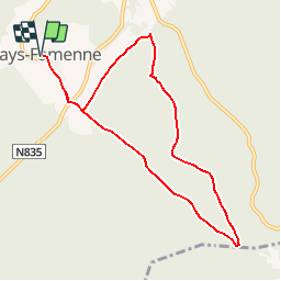
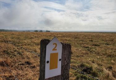
Tour Wandern von 8,1 km verfügbar auf Wallonien, Luxemburg, Wellin. Diese Tour wird von La Grande Forêt de Saint-Hubert vorgeschlagen.
Beschreibung
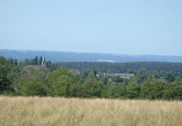
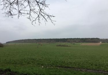
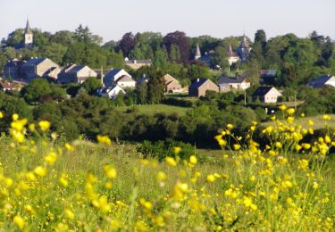
Wandeling vanaf Fays-Famenne tussen bossen en rivier.
POIs
Ort
Land:
Belgium
Region :
Wallonien
Abteilung/Provinz :
Luxemburg
Kommune :
Wellin
Standort:
Sohier
Gehen Sie:(Dec)
Gehen Sie:(UTM)
648231 ; 5545464 (31U) N.
Kommentare
Touren in der Umgebung
![Wandern Wandern](https://static1.geolcdn.com/sitytour/trail-icons/101.png)
RB-Lu-25_Wellin
Wandern
Sehr leicht
(6)
Wellin,
Wallonien,
Luxemburg,
Belgium
![](/images/other/stat-length.png)
26 km | 33 km-effort
6h 46min
![](https://static1.geolcdn.com/siteimages/upload/files/16400158638029165_repeat_loop_refresh_sync_direction_icon.png)
Ja
![Tour Wandern Wellin - Wéry_Variante (WE 06) - Photo](https://media.geolcdn.com/t/375/260/ext.jpg?maxdim=2&url=https%3A%2F%2Fservices.sitytrail.com%2FGeolivesWS%2FDownloadMedia.ashx%3FTrailID%3D334441%26Media%3D69ef9e8a-0435-41bc-a5d3-d329c2516b48.JPG)
![Wandern Wandern](https://static1.geolcdn.com/sitytour/trail-icons/101.png)
Wéry_Variante (WE 06)
Wandern
Schwierig
(5)
Wellin,
Wallonien,
Luxemburg,
Belgium
![](/images/other/stat-length.png)
11,4 km | 15,5 km-effort
3h 30min
![](https://static1.geolcdn.com/siteimages/upload/files/16400158638029165_repeat_loop_refresh_sync_direction_icon.png)
Ja
![Tour Zu Fuß Daverdisse - SityTrail - HF 2 - Sclassin - Photo](https://media.geolcdn.com/t/375/260/a939f2bf-d01d-4679-8080-aa7e1bc351e7.jpg&format=jpg&maxdim=2)
![Zu Fuß Zu Fuß](https://static1.geolcdn.com/sitytour/trail-icons/100.png)
SityTrail - HF 2 - Sclassin
Zu Fuß
Einfach
(1)
Daverdisse,
Wallonien,
Luxemburg,
Belgium
![](/images/other/stat-length.png)
6,4 km | 7,8 km-effort
1h 46min
![](https://static1.geolcdn.com/siteimages/upload/files/16400158638029165_repeat_loop_refresh_sync_direction_icon.png)
Ja
![Tour Wandern Wellin - Balade de Wellin à Froidlieu - Photo](https://media.geolcdn.com/t/375/260/ext.jpg?maxdim=2&url=https%3A%2F%2Fservices.sitytrail.com%2FGeolivesWS%2FDownloadMedia.ashx%3FTrailID%3D550482%26Media%3D6bfae291-bc04-4a99-8008-dd078d6a2b97.jpg)
![Wandern Wandern](https://static1.geolcdn.com/sitytour/trail-icons/101.png)
Balade de Wellin à Froidlieu
Wandern
Einfach
(3)
Wellin,
Wallonien,
Luxemburg,
Belgium
![](/images/other/stat-length.png)
8,8 km | 10,9 km-effort
2h 20min
![](https://static1.geolcdn.com/siteimages/upload/files/16400158638029165_repeat_loop_refresh_sync_direction_icon.png)
Ja
![Wandern Wandern](https://static1.geolcdn.com/sitytour/trail-icons/101.png)
RB-Lu-25_Wellin_via-racc-1-et-var
Wandern
Sehr schwierig
(1)
Wellin,
Wallonien,
Luxemburg,
Belgium
![](/images/other/stat-length.png)
25 km | 33 km-effort
7h 23min
![](https://static1.geolcdn.com/siteimages/upload/files/16400158638029165_repeat_loop_refresh_sync_direction_icon.png)
Ja
![Tour Zu Fuß Wellin - Wellin, A la découverte de la Calestienne - Photo](https://media.geolcdn.com/t/375/260/edbffe01-088a-4464-814f-81b660e2febb.jpg&format=jpg&maxdim=2)
![Zu Fuß Zu Fuß](https://static1.geolcdn.com/sitytour/trail-icons/100.png)
Wellin, A la découverte de la Calestienne
Zu Fuß
Sehr leicht
(4)
Wellin,
Wallonien,
Luxemburg,
Belgium
![](/images/other/stat-length.png)
7,6 km | 9,5 km-effort
Unbekannt
![](https://static1.geolcdn.com/siteimages/upload/files/16400158638029165_repeat_loop_refresh_sync_direction_icon.png)
Ja
![Wandern Wandern](https://static1.geolcdn.com/sitytour/trail-icons/101.png)
RB-Lu-25_Wellin_via-racc-2
Wandern
Sehr schwierig
(1)
Wellin,
Wallonien,
Luxemburg,
Belgium
![](/images/other/stat-length.png)
19,5 km | 26 km-effort
5h 48min
![](https://static1.geolcdn.com/siteimages/upload/files/16400158638029165_repeat_loop_refresh_sync_direction_icon.png)
Ja
![Tour Wandern Wellin - Molinchamps (WE 09) - Photo](https://media.geolcdn.com/t/375/260/ext.jpg?maxdim=2&url=https%3A%2F%2Fservices.sitytrail.com%2FGeolivesWS%2FDownloadMedia.ashx%3FTrailID%3D334447%26Media%3Db767bb81-ddcb-4855-ac9a-38d9bb9528a3.JPG)
![Wandern Wandern](https://static1.geolcdn.com/sitytour/trail-icons/101.png)
Molinchamps (WE 09)
Wandern
Medium
(1)
Wellin,
Wallonien,
Luxemburg,
Belgium
![](/images/other/stat-length.png)
5,1 km | 6,4 km-effort
1h 27min
![](https://static1.geolcdn.com/siteimages/upload/files/16400158638029165_repeat_loop_refresh_sync_direction_icon.png)
Ja
![Tour Wandern Wellin - Croix Victoire (WE 07) - Photo](https://media.geolcdn.com/t/375/260/ext.jpg?maxdim=2&url=https%3A%2F%2Fservices.sitytrail.com%2FGeolivesWS%2FDownloadMedia.ashx%3FTrailID%3D334442%26Media%3Dcac70fbd-4e44-4001-acfb-64c156e03ff0.JPG)
![Wandern Wandern](https://static1.geolcdn.com/sitytour/trail-icons/101.png)
Croix Victoire (WE 07)
Wandern
Medium
(2)
Wellin,
Wallonien,
Luxemburg,
Belgium
![](/images/other/stat-length.png)
7,9 km | 10 km-effort
2h 9min
![](https://static1.geolcdn.com/siteimages/upload/files/16400158638029165_repeat_loop_refresh_sync_direction_icon.png)
Ja
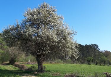
Heel mooi en pittig.
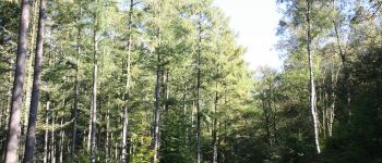
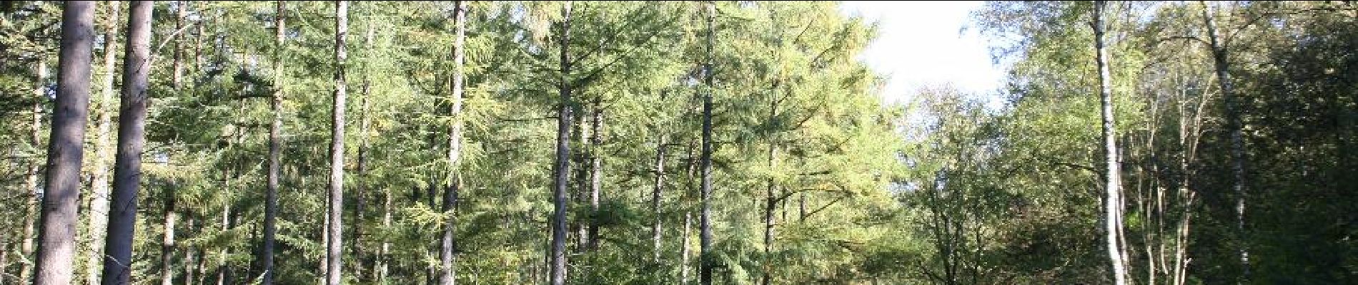
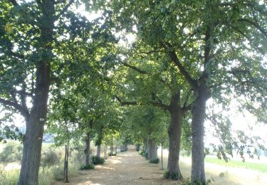
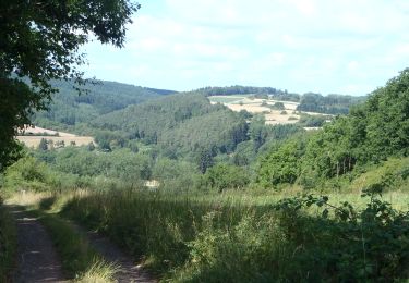
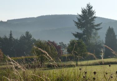
magnifique balade dans la forêt, ça descend vers l'Almache, ensuite une longue remontée dans le bois toujours, on a vu une biche et une belette :), on termine en traversant une sapinière.
Belle ballade au parcours très forestier (du feuillu essentiellement). La distance est plutôt de 9km et se fait en moins de 2h car le parcours est facile voire très facile. La seule difficulté est une courte descente un peu raide qui pourrait être glissante par temps humide.