


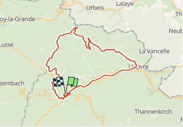

14,1 km | 21 km-effort


Benutzer


Kostenlosegpshiking-Anwendung
 SityTrail
IGN / Geografische Institute
SityTrail World
Die Welt öffnet sich für Sie
Tour Elektrofahrrad von 35 km verfügbar auf Großer Osten, Oberelsass, Markirch. Diese Tour wird von patandre vorgeschlagen.
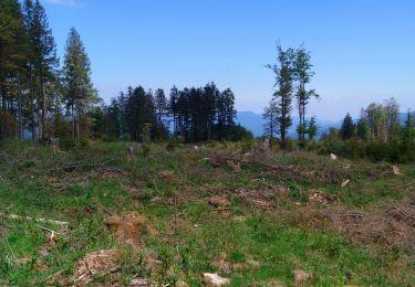
Départ de Ste Marie aux Mines, piste cyclable jusqu'à Lièpvre, Rombach le Franc, Route de la Hingrie, Creux Chêne, Col de la Hingrie, col de Ralaine, Grand Sterpois, Chaume de Lusse, et retour sur Ste Marie aux Mines par le Fenarupt

Wandern

Wandern

Wandern
Wandern

Wandern

Wandern
Wandern
Wandern
Nordic Walking