21 km | 22 km-effort
Jour 1 equirando
jcvmax
Benutzer
Länge
26 km
Maximale Höhe
137 m
Positive Höhendifferenz
277 m
Km-Effort
29 km
Min. Höhe
34 m
Negative Höhendifferenz
232 m
Boucle
Nein
Erstellungsdatum :
2022-07-26 07:32:45.0
Letzte Änderung :
2022-07-26 13:34:38.94
5h29
Schwierigkeit : Medium
Kostenlosegpshiking-Anwendung
Über SityTrail
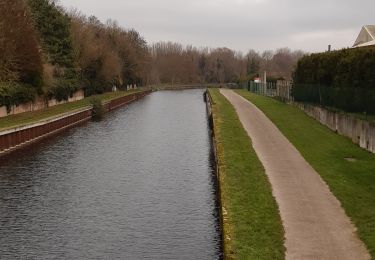
Tour Reiten von 26 km verfügbar auf Nordfrankreich, Somme, Pont-Noyelles. Diese Tour wird von jcvmax vorgeschlagen.
Ort
Land:
France
Region :
Nordfrankreich
Abteilung/Provinz :
Somme
Kommune :
Pont-Noyelles
Standort:
Unknown
Gehen Sie:(Dec)
Gehen Sie:(UTM)
459593 ; 5530872 (31U) N.
Kommentare
Touren in der Umgebung
Les rives de Somme de Corbie à Amiens
Wandern
Medium
Corbie,
Nordfrankreich,
Somme,
France
4h 31min
Nein
Le Passage aux Loups
Zu Fuß
Einfach
Daours,
Nordfrankreich,
Somme,
France
13,9 km | 15,9 km-effort
3h 36min
Ja
30 juil. 2019 14:04:21
Quad
Medium
(1)
Fouilloy,
Nordfrankreich,
Somme,
France
103 km | 122 km-effort
Unbekannt
Nein
Le passage aux loups - Pont-Noyelles
Mountainbike
Medium
Pont-Noyelles,
Nordfrankreich,
Somme,
France
13,8 km | 15,7 km-effort
1h 15min
Ja
Le passage aux loups - Pont-Noyelles
Wandern
Schwierig
(1)
Pont-Noyelles,
Nordfrankreich,
Somme,
France
13,8 km | 15,7 km-effort
4h 40min
Ja
Le passage aux loups - Pont-Noyelles
Mountainbike
Medium
Pont-Noyelles,
Nordfrankreich,
Somme,
France
13,8 km | 15,8 km-effort
1h 15min
Ja
frechencourt
Wandern
Medium
Fréchencourt,
Nordfrankreich,
Somme,
France
20 km | 24 km-effort
4h 5min
Ja
VTT BLANGY CORBIE
Mountainbike
Sehr schwierig
Blangy-Tronville,
Nordfrankreich,
Somme,
France
64 km | 72 km-effort
5h 1min
Nein
2022-04-29_12h34m02_SityTrail - 2967731 - lxargentine
sport
Sehr leicht
Blangy-Tronville,
Nordfrankreich,
Somme,
France
10,6 km | 11,5 km-effort
Unbekannt
Ja