


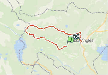

13,3 km | 19,3 km-effort


Benutzer GUIDE


Kostenlosegpshiking-Anwendung
 SityTrail
IGN / Geografische Institute
SityTrail World
Die Welt öffnet sich für Sie
Tour Wandern von 14,5 km verfügbar auf Okzitanien, Ostpyrenäen, Les Angles. Diese Tour wird von nadinebondoux vorgeschlagen.
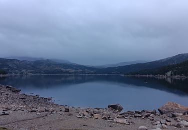
montée cabine les Pelerins roc d'Aude Mont Llaret , lac de la Balmette retour station
Eviter grosse chaleur


Wandern

Schneeschuhwandern

Wandern

Wandern
Wandern

Wandern
Wandern

Wandern
Wandern