


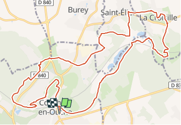

21 km | 24 km-effort


Benutzer


Kostenlosegpshiking-Anwendung
 SityTrail
IGN / Geografische Institute
SityTrail World
Die Welt öffnet sich für Sie
Tour Wandern von 15 km verfügbar auf Normandie, Eure, Conches-en-Ouche. Diese Tour wird von Marie-Claire-mcp vorgeschlagen.
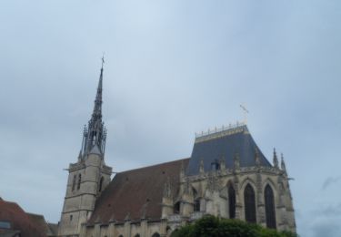
Depuis la place Aristide Briand, rejoindre la square, le traverser, passer devant le donjon et contourner par la droite de la mairie
Wandern

Wandern
Wandern
Wandern

Zu Fuß

Mountainbike
Mountainbike
Wandern