![](/images/other/stat-length.png)
![Tour Wandern Viroinval - Balade à Oignies-en-Thiérache - Le Ry d'Alise - Photo](https://media.geolcdn.com/t/1900/400/87d4fc47-9859-4088-b6f4-a15d14542517.jpeg&format=pjpeg&maxdim=2)
Balade à Oignies-en-Thiérache - Le Ry d'Alise
Desrumaux
Benutzer GUIDE
![Länge](/images/other/stat-length.png)
![Maximale Höhe](https://static1.geolcdn.com/siteimages/upload/files/1508320355ic_sort_altitude_max_24dp.png)
![Positive Höhendifferenz](https://static1.geolcdn.com/siteimages/upload/files/1508320355ic_sort_den_pos_24dp.png)
![Km-Effort](/images/other/stat-length.png)
![Min. Höhe](https://static1.geolcdn.com/siteimages/upload/files/1508320355ic_sort_altitude_min_24dp.png)
![Negative Höhendifferenz](https://static1.geolcdn.com/siteimages/upload/files/1508320355ic_sort_den_neg_24dp.png)
![Boucle](https://static1.geolcdn.com/siteimages/upload/files/16400158638029165_repeat_loop_refresh_sync_direction_icon.png)
![Wandern](https://static1.geolcdn.com/sitytour/trail-icons/101.png)
2h40
Schwierigkeit : Medium
![Scannen Sie diesen QR-Code, um die Tour in der SityTrail-Anwendung zu öffnen](https://capi.geolives.com/qq0zvz2zws4bq2lad0pu/sitytour/trails/3323141/qr.png?size=200)
Kostenlosegpshiking-Anwendung
Über SityTrail
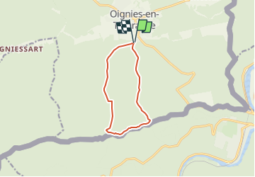
Tour Wandern von 8,6 km verfügbar auf Wallonien, Namur, Viroinval. Diese Tour wird von Desrumaux vorgeschlagen.
Beschreibung
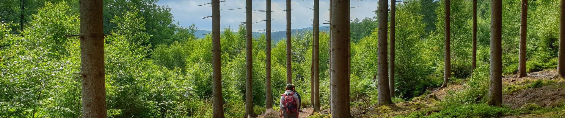
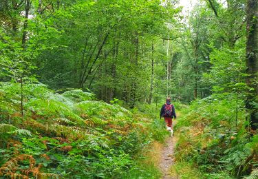
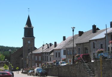
Autrefois connu pour ses ardoises, OIGNIES-EN-THIÉRACHE est aujourd'hui un joli village clairière de plus ou moins 800 habitants, niché au cœur de la grande forêt ardennaise, véritable écrin de verdure.
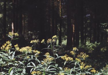
Cette ceinture verte est large de près de sept kilomètres autour du village, jusqu'à OLLOY au nord, la petite ville française de FUMAY au sud et la vallée de la Meuse à l'est.
Juché à 365 mètres d'altitude, OIGNIES-EN-THIÉRACHE est le village le plus haut et le plus méridional de l'entité de Viroinval.
Extrait du guide touristique de la Commune de Viroinval
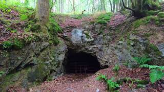
Le ruisseau d'Alysse est un petit cours d'eau de la Thiérache faisant frontière entre le sud de l'entre-Sambre-et-Meuse et les Ardennes françaises. ©
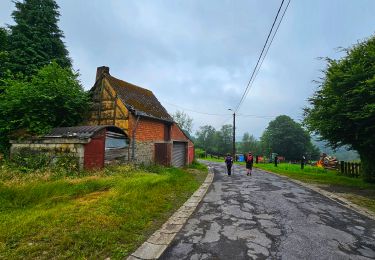
Départ: croisement de la rue de Revin et la rue de l'Ardoisière.
Ort
Kommentare
Touren in der Umgebung
![Wandern Wandern](https://static1.geolcdn.com/sitytour/trail-icons/101.png)
Wandern
![](/images/other/stat-length.png)
![](https://static1.geolcdn.com/siteimages/upload/files/16400158638029165_repeat_loop_refresh_sync_direction_icon.png)
![Tour Wandern Viroinval - RF-Na-12 Oignies - Grande-boucle - Photo](https://media.geolcdn.com/t/375/260/ext.jpg?maxdim=2&url=https%3A%2F%2Fstatic1.geolcdn.com%2Fsiteimages%2Fupload%2Ffiles%2F1553511878bg_sport_marche.png)
![Wandern Wandern](https://static1.geolcdn.com/sitytour/trail-icons/101.png)
Wandern
![](/images/other/stat-length.png)
![](https://static1.geolcdn.com/siteimages/upload/files/16400158638029165_repeat_loop_refresh_sync_direction_icon.png)
![Tour Wandern Viroinval - Balade à Le Mesnil - Viroinval - Photo](https://media.geolcdn.com/t/375/260/040808b9-fcd8-4fc3-8c4a-eb6f326e6772.jpeg&format=jpg&maxdim=2)
![Wandern Wandern](https://static1.geolcdn.com/sitytour/trail-icons/101.png)
Wandern
![](/images/other/stat-length.png)
![](https://static1.geolcdn.com/siteimages/upload/files/16400158638029165_repeat_loop_refresh_sync_direction_icon.png)
![Tour Wandern Viroinval - 2024-03-19_14h55m08_OTH-A0-008T-2Z7M - Photo](https://media.geolcdn.com/t/375/260/3b9face2-c744-4af6-a62d-817b6f505d56.jpg&format=jpg&maxdim=2)
![Wandern Wandern](https://static1.geolcdn.com/sitytour/trail-icons/101.png)
Wandern
![](/images/other/stat-length.png)
![](https://static1.geolcdn.com/siteimages/upload/files/16400158638029165_repeat_loop_refresh_sync_direction_icon.png)
![Tour Wandern Viroinval - Balade à Regniessart - Viroinval - Photo](https://media.geolcdn.com/t/375/260/a5d602e3-469f-47f0-b83f-6a311b5da224.jpeg&format=jpg&maxdim=2)
![Wandern Wandern](https://static1.geolcdn.com/sitytour/trail-icons/101.png)
Wandern
![](/images/other/stat-length.png)
![](https://static1.geolcdn.com/siteimages/upload/files/16400158638029165_repeat_loop_refresh_sync_direction_icon.png)
![Tour Zu Fuß Fumay - Les Ardoisières de Fumay - Photo](https://media.geolcdn.com/t/375/260/0be384a9-b742-44ce-bbb3-4994f25cd7ac.jpeg&format=jpg&maxdim=2)
![Zu Fuß Zu Fuß](https://static1.geolcdn.com/sitytour/trail-icons/100.png)
Zu Fuß
![](/images/other/stat-length.png)
![](https://static1.geolcdn.com/siteimages/upload/files/16400158638029165_repeat_loop_refresh_sync_direction_icon.png)
![Tour Zu Fuß Viroinval - Les Bornes - Photo](https://media.geolcdn.com/t/375/260/017373ad-a55f-4063-a87f-c762cd7880fd.jpeg&format=jpg&maxdim=2)
![Zu Fuß Zu Fuß](https://static1.geolcdn.com/sitytour/trail-icons/100.png)
![Tour Zu Fuß Viroinval - Le Centre de l'Europe des 15 - Photo](https://media.geolcdn.com/t/375/260/1a7c1b9a-14f4-4ae7-af17-534dfbd74e08.jpeg&format=jpg&maxdim=2)
![Zu Fuß Zu Fuß](https://static1.geolcdn.com/sitytour/trail-icons/100.png)
Zu Fuß
![](/images/other/stat-length.png)
![](https://static1.geolcdn.com/siteimages/upload/files/16400158638029165_repeat_loop_refresh_sync_direction_icon.png)
![Tour Zu Fuß Viroinval - Centre de l'Europe des 15 - Photo](https://media.geolcdn.com/t/375/260/ext.jpg?maxdim=2&url=https%3A%2F%2Fpivotmedia.tourismewallonie.be%2FOTH-A0-004E-2QK1%2FOTH-A0-004E-2QK1.jpg)
![Zu Fuß Zu Fuß](https://static1.geolcdn.com/sitytour/trail-icons/100.png)
Zu Fuß
![](/images/other/stat-length.png)
![](https://static1.geolcdn.com/siteimages/upload/files/16400158638029165_repeat_loop_refresh_sync_direction_icon.png)