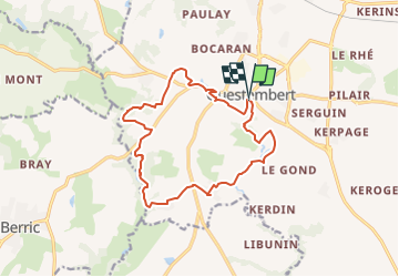
![](/images/other/stat-length.png)
![Tour Questembert - SityTrail - 3312871 - sentier-des-popinettesx-questembert - Photo](https://media.geolcdn.com/t/1900/400/ext.pjpeg?maxdim=2&url=https%3A%2F%2Fsecurestorage.geolives.com%2Fsitytour%2Ftrail-bg%2Fdefault.jpg)
SityTrail - 3312871 - sentier-des-popinettesx-questembert
leho.yannick@orange.fr
Benutzer
![Länge](/images/other/stat-length.png)
![Maximale Höhe](https://static1.geolcdn.com/siteimages/upload/files/1508320355ic_sort_altitude_max_24dp.png)
![Positive Höhendifferenz](https://static1.geolcdn.com/siteimages/upload/files/1508320355ic_sort_den_pos_24dp.png)
![Km-Effort](/images/other/stat-length.png)
![Min. Höhe](https://static1.geolcdn.com/siteimages/upload/files/1508320355ic_sort_altitude_min_24dp.png)
![Negative Höhendifferenz](https://static1.geolcdn.com/siteimages/upload/files/1508320355ic_sort_den_neg_24dp.png)
![Boucle](https://static1.geolcdn.com/siteimages/upload/files/16400158638029165_repeat_loop_refresh_sync_direction_icon.png)
![Scannen Sie diesen QR-Code, um die Tour in der SityTrail-Anwendung zu öffnen](https://capi.geolives.com/qq0zvz2zws4bq2lad0pu/sitytour/trails/3322323/qr.png?size=200)
Kostenlosegpshiking-Anwendung
Über SityTrail
Tour von 14,5 km verfügbar auf Bretagne, Morbihan, Questembert. Diese Tour wird von leho.yannick@orange.fr vorgeschlagen.
Beschreibung
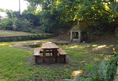
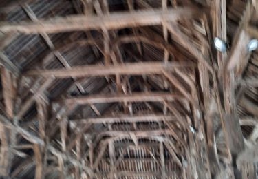
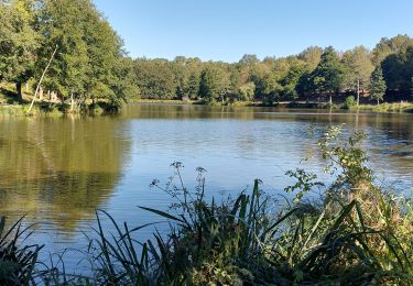
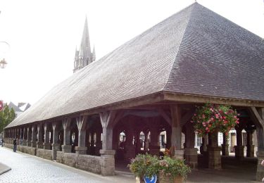
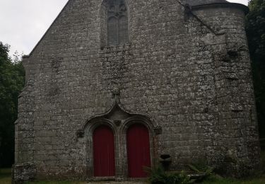
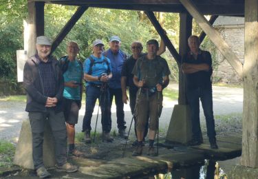
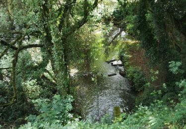
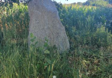
Le nom de Questembert vient de Kisten Beh qui signifie Pays des Châtaignes en breton. Tout près du centre-ville, ce circuit vous emmène le long des chemins creux vers le ruisseau de Cohignac puis la Chapelle St Jean. Sur les talus ou dans les bois, au printemps, fleurissent les asphodèles, hautes sur tige avec une hampe florale blanche. Leur nom local est « popinettes » d’où le nom du sentier. Balisage jaune. A partir de ce circuit, il est possible de rejoindre Berric par des chemins balisés.
POIs
Ort
Kommentare
Touren in der Umgebung
![Tour Wandern Questembert - PR_56_Questembert_AA_01_Circuit1b_Sentier-Des-Popinettes_20200521 - Photo](https://media.geolcdn.com/t/375/260/8a6cc9c1-1a36-4087-863e-60a39a6c581a.jpg&format=jpg&maxdim=2)
![Wandern Wandern](https://static1.geolcdn.com/sitytour/trail-icons/101.png)
Wandern
![](/images/other/stat-length.png)
![](https://static1.geolcdn.com/siteimages/upload/files/16400158638029165_repeat_loop_refresh_sync_direction_icon.png)
![Tour Wandern Questembert - AUDAX 50 KMS QUESTEMBERT - Photo](https://media.geolcdn.com/t/375/260/a6562aab-35aa-4c4f-aa2d-671056bc7778.jpg&format=jpg&maxdim=2)
![Wandern Wandern](https://static1.geolcdn.com/sitytour/trail-icons/101.png)
Wandern
![](/images/other/stat-length.png)
![](https://static1.geolcdn.com/siteimages/upload/files/16400158638029165_repeat_loop_refresh_sync_direction_icon.png)
![Tour Wandern Questembert - PR_56_Questembert_BA_02_Circuit1b_La-Boucle-Du-St-Eloi_20220807 - Photo](https://media.geolcdn.com/t/375/260/4b588668-3cbe-4b4a-b8e2-52d369ef1476.jpg&format=jpg&maxdim=2)
![Wandern Wandern](https://static1.geolcdn.com/sitytour/trail-icons/101.png)
Wandern
![](/images/other/stat-length.png)
![](https://static1.geolcdn.com/siteimages/upload/files/16400158638029165_repeat_loop_refresh_sync_direction_icon.png)
![Tour Zu Fuß Questembert - Boucles du Bois de St Martin - Photo](https://media.geolcdn.com/t/375/260/580e6622-a3f2-4b7b-ade4-4511184eac56.jpeg&format=jpg&maxdim=2)
![Zu Fuß Zu Fuß](https://static1.geolcdn.com/sitytour/trail-icons/100.png)
Zu Fuß
![](/images/other/stat-length.png)
![](https://static1.geolcdn.com/siteimages/upload/files/16400158638029165_repeat_loop_refresh_sync_direction_icon.png)
![Tour Wandern Questembert - 228 - rando de Cela à Saint Doué par la Vraie Croix - Photo](https://media.geolcdn.com/t/375/260/f30505d5-3e72-4a67-afea-95442ba7db42.jpg&format=jpg&maxdim=2)
![Wandern Wandern](https://static1.geolcdn.com/sitytour/trail-icons/101.png)
Wandern
![](/images/other/stat-length.png)
![](https://static1.geolcdn.com/siteimages/upload/files/16400158638029165_repeat_loop_refresh_sync_direction_icon.png)
![Tour Wandern Questembert - 188- la boucle de Saint Eloi - Photo](https://media.geolcdn.com/t/375/260/f07ae92b-00df-4cd0-805e-36bccb449673.jpg&format=jpg&maxdim=2)
![Wandern Wandern](https://static1.geolcdn.com/sitytour/trail-icons/101.png)
Wandern
![](/images/other/stat-length.png)
![](https://static1.geolcdn.com/siteimages/upload/files/16400158638029165_repeat_loop_refresh_sync_direction_icon.png)
![Tour Wandern Questembert - 181 La boucle de Brangolo - Photo](https://media.geolcdn.com/t/375/260/b7b3446e-266b-4b93-8f5c-6e49ba47c6ad.jpg&format=jpg&maxdim=2)
![Wandern Wandern](https://static1.geolcdn.com/sitytour/trail-icons/101.png)
Wandern
![](/images/other/stat-length.png)
![](https://static1.geolcdn.com/siteimages/upload/files/16400158638029165_repeat_loop_refresh_sync_direction_icon.png)
![Tour Wandern Questembert - castel - Photo](https://media.geolcdn.com/t/375/260/dd5a5316-a5b0-4f45-b47e-dfc03f26faeb.jpg&format=jpg&maxdim=2)
![Wandern Wandern](https://static1.geolcdn.com/sitytour/trail-icons/101.png)
Wandern
![](/images/other/stat-length.png)
![](https://static1.geolcdn.com/siteimages/upload/files/16400158638029165_repeat_loop_refresh_sync_direction_icon.png)
![Tour Wandern Questembert - questembert - Photo](https://media.geolcdn.com/t/375/260/ext.jpg?maxdim=2&url=https%3A%2F%2Fstatic1.geolcdn.com%2Fsiteimages%2Fupload%2Ffiles%2F1553511878bg_sport_marche.png)
![Wandern Wandern](https://static1.geolcdn.com/sitytour/trail-icons/101.png)
Wandern
![](/images/other/stat-length.png)
![](https://static1.geolcdn.com/siteimages/upload/files/16400158638029165_repeat_loop_refresh_sync_direction_icon.png)