![](/images/other/stat-length.png)
![Tour Wandern Vexaincourt - Vexaincourt - lac et chapelle de la Maix - Photo](https://media.geolcdn.com/t/1900/400/b6a0a555-0c6b-480c-999e-1bea2f6bffd7.jpg&format=pjpeg&maxdim=2)
Vexaincourt - lac et chapelle de la Maix
Bart2015
Benutzer
![Länge](/images/other/stat-length.png)
![Maximale Höhe](https://static1.geolcdn.com/siteimages/upload/files/1508320355ic_sort_altitude_max_24dp.png)
![Positive Höhendifferenz](https://static1.geolcdn.com/siteimages/upload/files/1508320355ic_sort_den_pos_24dp.png)
![Km-Effort](/images/other/stat-length.png)
![Min. Höhe](https://static1.geolcdn.com/siteimages/upload/files/1508320355ic_sort_altitude_min_24dp.png)
![Negative Höhendifferenz](https://static1.geolcdn.com/siteimages/upload/files/1508320355ic_sort_den_neg_24dp.png)
![Boucle](https://static1.geolcdn.com/siteimages/upload/files/16400158638029165_repeat_loop_refresh_sync_direction_icon.png)
![Wandern](https://static1.geolcdn.com/sitytour/trail-icons/101.png)
3h50
Schwierigkeit : Medium
![Scannen Sie diesen QR-Code, um die Tour in der SityTrail-Anwendung zu öffnen](https://capi.geolives.com/qq0zvz2zws4bq2lad0pu/sitytour/trails/3301723/qr.png?size=200)
Kostenlosegpshiking-Anwendung
Über SityTrail
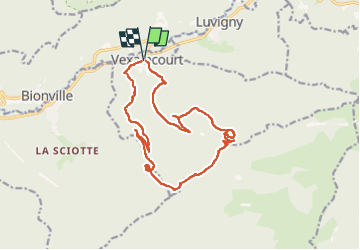
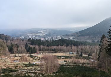
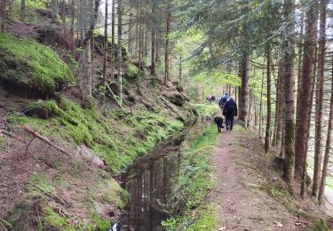
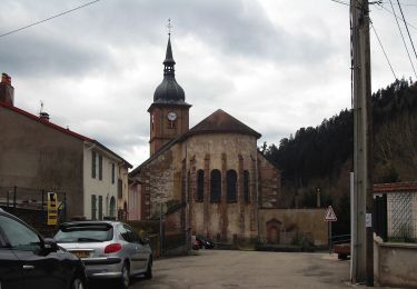
Tour Wandern von 16,3 km verfügbar auf Großer Osten, Vogesen, Vexaincourt. Diese Tour wird von Bart2015 vorgeschlagen.
Beschreibung
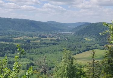
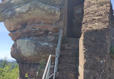
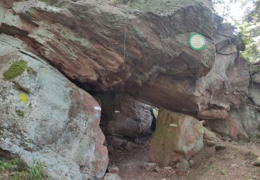
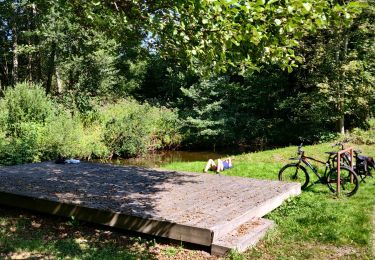
Belle randonnée pour rejoindre le beau lac de la Maix, l'un des derniers lacs naturels de formation glaciaire du massif vosgien, plus confidentiel depuis que les voitures ne peuvent y accéder. A visiter également sa chapelle où les enfants n'oublieront pas de faire sonner la cloche ... Poursuite de la rando pour découvrir quelques pierres à cupules et une roche à colonnes et un dolmen ...
Bonne rando ...
Ort
Kommentare
Touren in der Umgebung
![Tour Zu Fuß Michelbrunn - Circuit du Chemin d'Allemagne - Photo](https://media.geolcdn.com/t/375/260/d97b757e-2993-4139-a2d2-59b8ba5b2377.jpeg&format=jpg&maxdim=2)
![Zu Fuß Zu Fuß](https://static1.geolcdn.com/sitytour/trail-icons/100.png)
Zu Fuß
![](/images/other/stat-length.png)
![](https://static1.geolcdn.com/siteimages/upload/files/16400158638029165_repeat_loop_refresh_sync_direction_icon.png)
![Tour Wandern Allarmont - 2019-06-08 Marche Allarmont et ses rochers - Photo](https://media.geolcdn.com/t/375/260/b4eab987-1d3a-475a-8836-184432a12f13.jpg&format=jpg&maxdim=2)
![Wandern Wandern](https://static1.geolcdn.com/sitytour/trail-icons/101.png)
Wandern
![](/images/other/stat-length.png)
![](https://static1.geolcdn.com/siteimages/upload/files/16400158638029165_repeat_loop_refresh_sync_direction_icon.png)
![Tour Wandern Michelbrunn - suuntoapp-Hiking-2024-01-13T07-49-52Z - Photo](https://media.geolcdn.com/t/375/260/8bee9e80-747f-41c1-b4f7-2597dd854978.jpg&format=jpg&maxdim=2)
![Wandern Wandern](https://static1.geolcdn.com/sitytour/trail-icons/101.png)
Wandern
![](/images/other/stat-length.png)
![](https://static1.geolcdn.com/siteimages/upload/files/16400158638029165_repeat_loop_refresh_sync_direction_icon.png)
![Tour Wandern Celles-sur-Plaine - Tête du coquin - Photo](https://media.geolcdn.com/t/375/260/823dbf4a-10a3-4993-82dd-25752f0acee9.jpg&format=jpg&maxdim=2)
![Wandern Wandern](https://static1.geolcdn.com/sitytour/trail-icons/101.png)
Wandern
![](/images/other/stat-length.png)
![](https://static1.geolcdn.com/siteimages/upload/files/16400158638029165_repeat_loop_refresh_sync_direction_icon.png)
![Tour Wandern Celles-sur-Plaine - tête du coquin - Photo](https://media.geolcdn.com/t/375/260/5db3449b-2d2f-4ed3-a66e-7cc2919dfb83.jpg&format=jpg&maxdim=2)
![Wandern Wandern](https://static1.geolcdn.com/sitytour/trail-icons/101.png)
Wandern
![](/images/other/stat-length.png)
![](https://static1.geolcdn.com/siteimages/upload/files/16400158638029165_repeat_loop_refresh_sync_direction_icon.png)
![Tour Wandern Saint-Sauveur - scierie Machet - Photo](https://media.geolcdn.com/t/375/260/2e0604ba-914e-4067-84da-d6f42189a7b2.jpg&format=jpg&maxdim=2)
![Wandern Wandern](https://static1.geolcdn.com/sitytour/trail-icons/101.png)
Wandern
![](/images/other/stat-length.png)
![](https://static1.geolcdn.com/siteimages/upload/files/16400158638029165_repeat_loop_refresh_sync_direction_icon.png)
![Tour Zu Fuß Celles-sur-Plaine - Sentier des Sources - Photo](https://media.geolcdn.com/t/375/260/7009a814-297e-439c-ae16-bf304bd45cca.jpeg&format=jpg&maxdim=2)
![Zu Fuß Zu Fuß](https://static1.geolcdn.com/sitytour/trail-icons/100.png)
Zu Fuß
![](/images/other/stat-length.png)
![](https://static1.geolcdn.com/siteimages/upload/files/16400158638029165_repeat_loop_refresh_sync_direction_icon.png)
![Tour Reiten Moussey - fady col de praye - Photo](https://media.geolcdn.com/t/375/260/8e0e9e46-1ff5-4705-b615-c694bb127e7a.jpg&format=jpg&maxdim=2)
![Reiten Reiten](https://static1.geolcdn.com/sitytour/trail-icons/301.png)
Reiten
![](/images/other/stat-length.png)
![](https://static1.geolcdn.com/siteimages/upload/files/16400158638029165_repeat_loop_refresh_sync_direction_icon.png)
![Tour Mountainbike Raon-sur-Plaine - 2021-09-06 Sortie VTT Raon sur Plaine Raon Etape - Photo](https://media.geolcdn.com/t/375/260/a2531a1f-db4b-4f93-bf93-5aa37474f2ca.jpg&format=jpg&maxdim=2)
![Mountainbike Mountainbike](https://static1.geolcdn.com/sitytour/trail-icons/202.png)
Mountainbike
![](/images/other/stat-length.png)
![](https://static1.geolcdn.com/siteimages/upload/files/16400158638029165_repeat_loop_refresh_sync_direction_icon.png)