![](/images/other/stat-length.png)
![Tour Wandern Zonza - crêtes chainon de paliri sud - Photo](https://media.geolcdn.com/t/1900/400/cf294dbf-4bfb-4e2f-80be-608687120486.jpg&format=pjpeg&maxdim=2)
crêtes chainon de paliri sud
philippenl
Benutzer
![Länge](/images/other/stat-length.png)
![Maximale Höhe](https://static1.geolcdn.com/siteimages/upload/files/1508320355ic_sort_altitude_max_24dp.png)
![Positive Höhendifferenz](https://static1.geolcdn.com/siteimages/upload/files/1508320355ic_sort_den_pos_24dp.png)
![Km-Effort](/images/other/stat-length.png)
![Min. Höhe](https://static1.geolcdn.com/siteimages/upload/files/1508320355ic_sort_altitude_min_24dp.png)
![Negative Höhendifferenz](https://static1.geolcdn.com/siteimages/upload/files/1508320355ic_sort_den_neg_24dp.png)
![Boucle](https://static1.geolcdn.com/siteimages/upload/files/16400158638029165_repeat_loop_refresh_sync_direction_icon.png)
![Wandern](https://static1.geolcdn.com/sitytour/trail-icons/101.png)
7h00
Schwierigkeit : Sehr schwierig
![Scannen Sie diesen QR-Code, um die Tour in der SityTrail-Anwendung zu öffnen](https://capi.geolives.com/qq0zvz2zws4bq2lad0pu/sitytour/trails/3299515/qr.png?size=200)
Kostenlosegpshiking-Anwendung
Über SityTrail
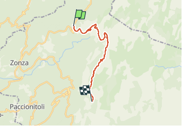
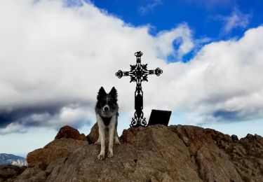
Tour Wandern von 10,3 km verfügbar auf Korsika, Südkorsika, Zonza. Diese Tour wird von philippenl vorgeschlagen.
Beschreibung
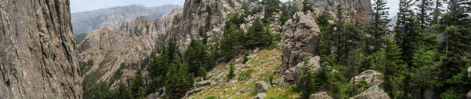
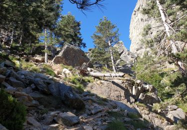
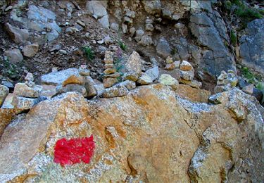
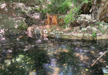
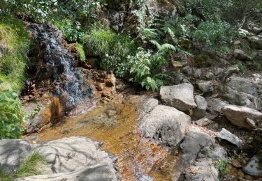
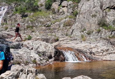
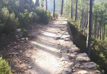
Un des derniers territoires du mouflon en Corse du Sud. Parcours superbe en ligne de crête parmi les aiguilles. A réserver aux randonneurs très expérimentés : pas de sentiers, quelques cairns, beaucoup de tâtonnements, parcours parfois exposé au vide qui ne nécessite toutefois pas d'équipement mais les deux mains, aucune possibilité de dégagement entre Bocca Fumisosa et Castelluciu car il n'y a que des ravins. Pas d'eau et jamais personne ! Sauf exception, ne jamais s'engager dans les ravins est au dessus de la vallée du Cavu qui sont les plus vertigineux. Attention à la météo sur ce chaînon où les nuages accrochent souvent et rendent les pelouses en pente aussi glissantes qu'un glacier. Mais le prix de ces efforts est de parcourir l'un des plus beaux endroits de Bavella et de Corse : col de Fumicosa, Punta di Feru, aiguille de Samulaghja, Punta di Quercitella et la prairie de Castellucciu au pied du Monte Calva.
Ort
Kommentare
Touren in der Umgebung
![Tour Wandern Quenza - tour de bavella - Photo](https://media.geolcdn.com/t/375/260/91546040-d47b-499f-8f25-3061dbb3b1e0.jpg&format=jpg&maxdim=2)
![Wandern Wandern](https://static1.geolcdn.com/sitytour/trail-icons/101.png)
Wandern
![](/images/other/stat-length.png)
![](https://static1.geolcdn.com/siteimages/upload/files/16400158638029165_repeat_loop_refresh_sync_direction_icon.png)
![Tour Wandern Zonza - Boucle du trou de la bombe - Bavella - Photo](https://media.geolcdn.com/t/375/260/57ec4c61-a922-4825-a53b-adb705edbd02.jpg&format=jpg&maxdim=2)
![Wandern Wandern](https://static1.geolcdn.com/sitytour/trail-icons/101.png)
Wandern
![](/images/other/stat-length.png)
![](https://static1.geolcdn.com/siteimages/upload/files/16400158638029165_repeat_loop_refresh_sync_direction_icon.png)
![Tour Wandern Zonza - Bavella_trou de la bombe - Photo](https://media.geolcdn.com/t/375/260/ext.jpg?maxdim=2&url=https%3A%2F%2Fservices.sitytrail.com%2FGeolivesWS%2FDownloadMedia.ashx%3FTrailID%3D198331%26Media%3D1886eeb5-9e06-40d9-ad21-e8df8d175266.jpg)
![Wandern Wandern](https://static1.geolcdn.com/sitytour/trail-icons/101.png)
Wandern
![](/images/other/stat-length.png)
![](https://static1.geolcdn.com/siteimages/upload/files/16400158638029165_repeat_loop_refresh_sync_direction_icon.png)
![Tour Wandern Quenza - Les aiguilles de Bavella - Photo](https://media.geolcdn.com/t/375/260/ext.jpg?maxdim=2&url=https%3A%2F%2Fstatic1.geolcdn.com%2Fsiteimages%2Fupload%2Ffiles%2F1553511878bg_sport_marche.png)
![Wandern Wandern](https://static1.geolcdn.com/sitytour/trail-icons/101.png)
Wandern
![](/images/other/stat-length.png)
![](https://static1.geolcdn.com/siteimages/upload/files/16400158638029165_repeat_loop_refresh_sync_direction_icon.png)
![Tour Wandern Conca - Paliri Conca - Photo](https://media.geolcdn.com/t/375/260/8129a798-c8a0-4a1d-9b4b-9f49d3407a5a.jpg&format=jpg&maxdim=2)
![Wandern Wandern](https://static1.geolcdn.com/sitytour/trail-icons/101.png)
Wandern
![](/images/other/stat-length.png)
![](https://static1.geolcdn.com/siteimages/upload/files/16400158638029165_repeat_loop_refresh_sync_direction_icon.png)
![Tour Wandern Conca - eta 2 - Photo](https://media.geolcdn.com/t/375/260/2e5824f5-cee9-4ee9-b75e-599680df0276.jpg&format=jpg&maxdim=2)
![Wandern Wandern](https://static1.geolcdn.com/sitytour/trail-icons/101.png)
![Tour Wandern Conca - Corse - GR20 Paliri à Conca - Photo](https://media.geolcdn.com/t/375/260/374a964b-6d4e-4e78-8a0e-bd563fc5fe7d.jpg&format=jpg&maxdim=2)
![Wandern Wandern](https://static1.geolcdn.com/sitytour/trail-icons/101.png)
Wandern
![](/images/other/stat-length.png)
![](https://static1.geolcdn.com/siteimages/upload/files/16400158638029165_repeat_loop_refresh_sync_direction_icon.png)
![Tour Wandern Zonza - Trou de la bombe et Punta Velacu - Photo](https://media.geolcdn.com/t/375/260/d5bb3da4-e374-49ec-b561-b8a65b36615c.jpg&format=jpg&maxdim=2)
![Wandern Wandern](https://static1.geolcdn.com/sitytour/trail-icons/101.png)
Wandern
![](/images/other/stat-length.png)
![](https://static1.geolcdn.com/siteimages/upload/files/16400158638029165_repeat_loop_refresh_sync_direction_icon.png)
![Tour Wandern Conca - GR20 Etape 15 Paliri Conca - Photo](https://media.geolcdn.com/t/375/260/6eca872c-e9ba-41e5-a4c7-e7ea694aaee8.jpg&format=jpg&maxdim=2)
![Wandern Wandern](https://static1.geolcdn.com/sitytour/trail-icons/101.png)
Wandern
![](/images/other/stat-length.png)
![](https://static1.geolcdn.com/siteimages/upload/files/16400158638029165_repeat_loop_refresh_sync_direction_icon.png)