


8,3 km | 10,6 km-effort


Benutzer


Kostenlosegpshiking-Anwendung
 SityTrail
IGN / Geografische Institute
SityTrail World
Die Welt öffnet sich für Sie
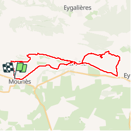
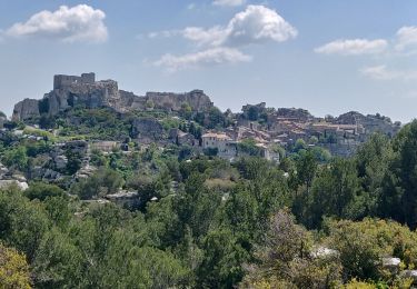
Tour Mountainbike von 36 km verfügbar auf Provence-Alpes-Côte d'Azur, Bouches-du-Rhône. Diese Tour wird von Vin100@33 vorgeschlagen.
Le mont des Opies est le point culminant des Alpilles, dont il prend le nom Provençal. Voici une balade à la fois agréable par son point de vue et par son coté technique VTT tout en restant accessible. Comme il s'agit d'une partie du ©GR6, elle est souvent indiqué au départ d'Aureille. Attention la grimpette vers la vigie au sommet est, elle, plus que hard. Aussi comme après être monté à la vigie, on est obligé de rebrousser chemin, je vous conseille de prendre un anti-vol, laisser 1/2h les vélos attachés au pied du raidillon et faire les derniers 600m jusqu'au sommet à pied. On reprendra les vélos en descendant pour continuer le chemin en redescendant vers le vallon des Glauges. Un vrai régal. le retour vers Mouriès est roulant. remplissage des gourdes à la fontaine, à la sortie de d'Aureille, sur l'air de pique-nique sur la droite. Egalement en entrant dans le golf sur la droite, à la source de l'olivier.


Wandern

Wandern
Wandern
Wandern


sport
Wandern
Wandern
Reiten
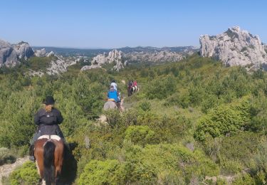
Reiten