![](/images/other/stat-length.png)
![Tour Wandern Le Thoronet - Trace_Thoronet - Photo](https://media.geolcdn.com/t/1900/400/8ba50d89-4322-43c3-92b6-dad72fbe2d40.jpg&format=pjpeg&maxdim=2)
Trace_Thoronet
affinetataille
Benutzer GUIDE
![Länge](/images/other/stat-length.png)
Länge
13,8 km
![Maximale Höhe](https://static1.geolcdn.com/siteimages/upload/files/1508320355ic_sort_altitude_max_24dp.png)
Maximale Höhe
229 m
![Positive Höhendifferenz](https://static1.geolcdn.com/siteimages/upload/files/1508320355ic_sort_den_pos_24dp.png)
Positive Höhendifferenz
306 m
![Km-Effort](/images/other/stat-length.png)
Km-Effort
17,9 km
![Min. Höhe](https://static1.geolcdn.com/siteimages/upload/files/1508320355ic_sort_altitude_min_24dp.png)
Min. Höhe
95 m
![Negative Höhendifferenz](https://static1.geolcdn.com/siteimages/upload/files/1508320355ic_sort_den_neg_24dp.png)
Negative Höhendifferenz
307 m
![Boucle](https://static1.geolcdn.com/siteimages/upload/files/16400158638029165_repeat_loop_refresh_sync_direction_icon.png)
Boucle
Ja
Erstellungsdatum :
2022-06-28 10:56:39.542
Letzte Änderung :
2024-04-04 23:26:04.46
![Wandern](https://static1.geolcdn.com/sitytour/trail-icons/101.png)
6h00
Schwierigkeit : Einfach
![Scannen Sie diesen QR-Code, um die Tour in der SityTrail-Anwendung zu öffnen](https://capi.geolives.com/qq0zvz2zws4bq2lad0pu/sitytour/trails/3297508/qr.png?size=200)
Kostenlosegpshiking-Anwendung
Über SityTrail
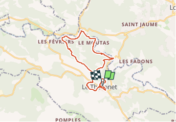
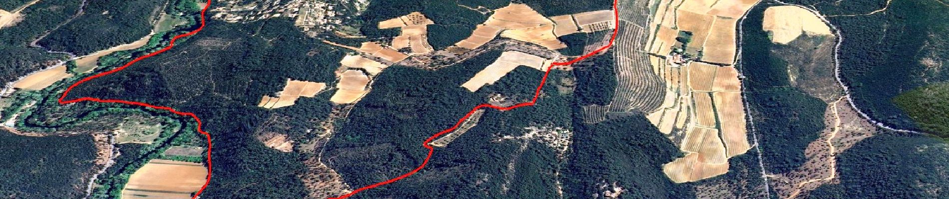
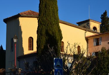
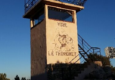
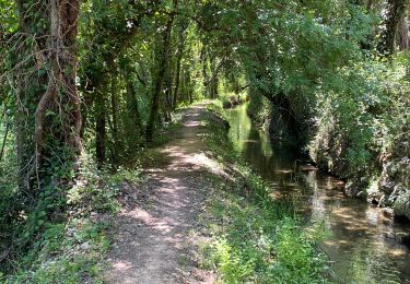
Tour Wandern von 13,8 km verfügbar auf Provence-Alpes-Côte d'Azur, Var, Le Thoronet. Diese Tour wird von affinetataille vorgeschlagen.
Beschreibung
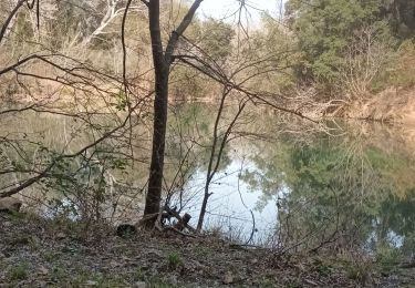
!!!! Entre les Kms 6.0 et 7.5 utiliser la chemin qui longe le canal. Ne passer par la piste en bordure de l'Argens, propriétaires irascibles et chiens peu sympathiques refusant le passage.
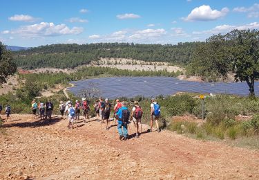
Ort
Land:
France
Region :
Provence-Alpes-Côte d'Azur
Abteilung/Provinz :
Var
Kommune :
Le Thoronet
Standort:
Unknown
Gehen Sie:(Dec)
Gehen Sie:(UTM)
281929 ; 4814609 (32T) N.
Kommentare
Touren in der Umgebung
![Tour Wandern Le Thoronet - SityTrail - Abbayie de Torronet - Photo](https://media.geolcdn.com/t/375/260/c1345155-8a53-4785-b8e1-556f37370f25.jpg&format=jpg&maxdim=2)
![Wandern Wandern](https://static1.geolcdn.com/sitytour/trail-icons/101.png)
SityTrail - Abbayie de Torronet
Wandern
Medium
(1)
Le Thoronet,
Provence-Alpes-Côte d'Azur,
Var,
France
![](/images/other/stat-length.png)
12,3 km | 16,5 km-effort
6h 0min
![](https://static1.geolcdn.com/siteimages/upload/files/16400158638029165_repeat_loop_refresh_sync_direction_icon.png)
Ja
![Tour Wandern Le Thoronet - 2023-01-12 Le Thoronet- Chemin des moines - Photo](https://media.geolcdn.com/t/375/260/a61d5b67-2b87-4718-8049-a50916c47930.jpg&format=jpg&maxdim=2)
![Wandern Wandern](https://static1.geolcdn.com/sitytour/trail-icons/101.png)
2023-01-12 Le Thoronet- Chemin des moines
Wandern
Schwierig
Le Thoronet,
Provence-Alpes-Côte d'Azur,
Var,
France
![](/images/other/stat-length.png)
16,5 km | 23 km-effort
5h 17min
![](https://static1.geolcdn.com/siteimages/upload/files/16400158638029165_repeat_loop_refresh_sync_direction_icon.png)
Ja
![Tour Wandern Lorgues - Lorgues et l'Ermitage Saint-Ferréol - Photo](https://media.geolcdn.com/t/375/260/e62c5b83-8a2e-4772-82d8-7fdc4c20c935.jpg&format=jpg&maxdim=2)
![Wandern Wandern](https://static1.geolcdn.com/sitytour/trail-icons/101.png)
Lorgues et l'Ermitage Saint-Ferréol
Wandern
Medium
Lorgues,
Provence-Alpes-Côte d'Azur,
Var,
France
![](/images/other/stat-length.png)
5,5 km | 8 km-effort
1h 48min
![](https://static1.geolcdn.com/siteimages/upload/files/16400158638029165_repeat_loop_refresh_sync_direction_icon.png)
Ja
![Tour Wandern Le Thoronet - Abbayie de Torronet - Photo](https://media.geolcdn.com/t/375/260/8fc4cfe5-b20b-4ac4-95db-dfa07c3edf80.jpg&format=jpg&maxdim=2)
![Wandern Wandern](https://static1.geolcdn.com/sitytour/trail-icons/101.png)
Abbayie de Torronet
Wandern
Einfach
Le Thoronet,
Provence-Alpes-Côte d'Azur,
Var,
France
![](/images/other/stat-length.png)
11,9 km | 15,6 km-effort
6h 13min
![](https://static1.geolcdn.com/siteimages/upload/files/16400158638029165_repeat_loop_refresh_sync_direction_icon.png)
Ja
![Wandern Wandern](https://static1.geolcdn.com/sitytour/trail-icons/101.png)
Le Thoronet - Mine de bauxite - Église de Béthléem - Les Camails - Clapier - ...
Wandern
Einfach
Le Thoronet,
Provence-Alpes-Côte d'Azur,
Var,
France
![](/images/other/stat-length.png)
18,4 km | 25 km-effort
4h 17min
![](https://static1.geolcdn.com/siteimages/upload/files/16400158638029165_repeat_loop_refresh_sync_direction_icon.png)
Ja
![Tour Nordic Walking Le Thoronet - Le Thoronet - La vigie des Ubacs - Photo](https://media.geolcdn.com/t/375/260/ext.jpg?maxdim=2&url=https%3A%2F%2Fservices.sitytrail.com%2FGeolivesWS%2FDownloadMedia.ashx%3FTrailID%3D512603%26Media%3Dfix__20160112162511.jpg)
![Nordic Walking Nordic Walking](https://static1.geolcdn.com/sitytour/trail-icons/102.png)
Le Thoronet - La vigie des Ubacs
Nordic Walking
Sehr leicht
Le Thoronet,
Provence-Alpes-Côte d'Azur,
Var,
France
![](/images/other/stat-length.png)
7,9 km | 12 km-effort
2h 20min
![](https://static1.geolcdn.com/siteimages/upload/files/16400158638029165_repeat_loop_refresh_sync_direction_icon.png)
Nein
![Tour Wandern Le Thoronet - Abbaye Thoronet - Lac de Carcès rando - Photo](https://media.geolcdn.com/t/375/260/ext.jpg?maxdim=2&url=https%3A%2F%2Fservices.sitytrail.com%2FGeolivesWS%2FDownloadMedia.ashx%3FTrailID%3D405651%26Media%3Dfix__20150408104649.jpg)
![Wandern Wandern](https://static1.geolcdn.com/sitytour/trail-icons/101.png)
Abbaye Thoronet - Lac de Carcès rando
Wandern
Medium
Le Thoronet,
Provence-Alpes-Côte d'Azur,
Var,
France
![](/images/other/stat-length.png)
17,3 km | 24 km-effort
5h 3min
![](https://static1.geolcdn.com/siteimages/upload/files/16400158638029165_repeat_loop_refresh_sync_direction_icon.png)
Nein
![Tour Wandern Le Thoronet - Thoronet Canal de Sainte-Croix - Photo](https://media.geolcdn.com/t/375/260/52be4161-0611-41dd-b691-680f0740539e.jpg&format=jpg&maxdim=2)
![Wandern Wandern](https://static1.geolcdn.com/sitytour/trail-icons/101.png)
Thoronet Canal de Sainte-Croix
Wandern
Schwierig
Le Thoronet,
Provence-Alpes-Côte d'Azur,
Var,
France
![](/images/other/stat-length.png)
11,8 km | 15,1 km-effort
3h 52min
![](https://static1.geolcdn.com/siteimages/upload/files/16400158638029165_repeat_loop_refresh_sync_direction_icon.png)
Ja
![Tour sport Lorgues - Tour St Jaumes pont d’argens thoronet - Photo](https://media.geolcdn.com/t/375/260/da27d9c9-7a62-4565-93c2-e4ae64855591.jpg&format=jpg&maxdim=2)
Tour St Jaumes pont d’argens thoronet
sport
Sehr leicht
Lorgues,
Provence-Alpes-Côte d'Azur,
Var,
France
![](/images/other/stat-length.png)
18,1 km | 23 km-effort
Unbekannt
![](https://static1.geolcdn.com/siteimages/upload/files/16400158638029165_repeat_loop_refresh_sync_direction_icon.png)
Ja