![](/images/other/stat-length.png)
![Tour Wandern Saint-Baudille-et-Pipet - Esclops Trièves le menil - Photo](https://media.geolcdn.com/t/1900/400/5bb8ecad-99cd-449d-afd0-81eb49d00e95.jpg&format=pjpeg&maxdim=2)
Esclops Trièves le menil
TOULAUDIN
Benutzer
![Länge](/images/other/stat-length.png)
Länge
15,5 km
![Maximale Höhe](https://static1.geolcdn.com/siteimages/upload/files/1508320355ic_sort_altitude_max_24dp.png)
Maximale Höhe
1579 m
![Positive Höhendifferenz](https://static1.geolcdn.com/siteimages/upload/files/1508320355ic_sort_den_pos_24dp.png)
Positive Höhendifferenz
810 m
![Km-Effort](/images/other/stat-length.png)
Km-Effort
26 km
![Min. Höhe](https://static1.geolcdn.com/siteimages/upload/files/1508320355ic_sort_altitude_min_24dp.png)
Min. Höhe
810 m
![Negative Höhendifferenz](https://static1.geolcdn.com/siteimages/upload/files/1508320355ic_sort_den_neg_24dp.png)
Negative Höhendifferenz
815 m
![Boucle](https://static1.geolcdn.com/siteimages/upload/files/16400158638029165_repeat_loop_refresh_sync_direction_icon.png)
Boucle
Ja
Erstellungsdatum :
2022-06-27 08:17:01.1
Letzte Änderung :
2022-07-15 08:50:49.288
![Wandern](https://static1.geolcdn.com/sitytour/trail-icons/101.png)
5h57
Schwierigkeit : Medium
![Scannen Sie diesen QR-Code, um die Tour in der SityTrail-Anwendung zu öffnen](https://capi.geolives.com/qq0zvz2zws4bq2lad0pu/sitytour/trails/3296713/qr.png?size=200)
Kostenlosegpshiking-Anwendung
Über SityTrail
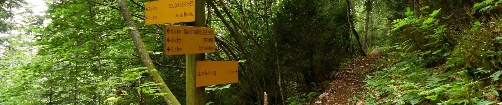
Tour Wandern von 15,5 km verfügbar auf Auvergne-Rhone-Alpen, Isère, Saint-Baudille-et-Pipet. Diese Tour wird von TOULAUDIN vorgeschlagen.
Beschreibung
rando effectuée dans la brume lors séjour rando club Esclops.montée très raide au départ pas de difficulté .
Ort
Land:
France
Region :
Auvergne-Rhone-Alpen
Abteilung/Provinz :
Isère
Kommune :
Saint-Baudille-et-Pipet
Standort:
Unknown
Gehen Sie:(Dec)
Gehen Sie:(UTM)
718993 ; 4962786 (31T) N.
Kommentare
Touren in der Umgebung
![Tour Wandern Châtel-en-Trièves - Arête de Rattier depuis le col de la brêche - Photo](https://media.geolcdn.com/t/375/260/645aac14-c825-4b01-9c22-da781fdfea33.jpg&format=jpg&maxdim=2)
![Wandern Wandern](https://static1.geolcdn.com/sitytour/trail-icons/101.png)
Arête de Rattier depuis le col de la brêche
Wandern
Schwierig
(1)
Châtel-en-Trièves,
Auvergne-Rhone-Alpen,
Isère,
France
![](/images/other/stat-length.png)
10,3 km | 24 km-effort
8h 12min
![](https://static1.geolcdn.com/siteimages/upload/files/16400158638029165_repeat_loop_refresh_sync_direction_icon.png)
Ja
![Tour Wandern Mens - Bonnet Calvin reco - Photo](https://media.geolcdn.com/t/375/260/71237d58-2b29-4521-9351-2dded8929675.jpg&format=jpg&maxdim=2)
![Wandern Wandern](https://static1.geolcdn.com/sitytour/trail-icons/101.png)
Bonnet Calvin reco
Wandern
Schwierig
(1)
Mens,
Auvergne-Rhone-Alpen,
Isère,
France
![](/images/other/stat-length.png)
10,7 km | 21 km-effort
4h 25min
![](https://static1.geolcdn.com/siteimages/upload/files/16400158638029165_repeat_loop_refresh_sync_direction_icon.png)
Nein
![Tour Wandern Saint-Baudille-et-Pipet - Bonnet de Calvin - Photo](https://media.geolcdn.com/t/375/260/b711d778-2624-48ca-9a09-33141db7aca2.jpg&format=jpg&maxdim=2)
![Wandern Wandern](https://static1.geolcdn.com/sitytour/trail-icons/101.png)
Bonnet de Calvin
Wandern
Medium
Saint-Baudille-et-Pipet,
Auvergne-Rhone-Alpen,
Isère,
France
![](/images/other/stat-length.png)
15 km | 31 km-effort
6h 35min
![](https://static1.geolcdn.com/siteimages/upload/files/16400158638029165_repeat_loop_refresh_sync_direction_icon.png)
Ja
![Tour Wandern Saint-Baudille-et-Pipet - Des Lames d'Arçon au Col de l'Aiguille - Photo](https://media.geolcdn.com/t/375/260/6a7d919f-0a46-4fb6-a03a-1cd4dec1d339.jpg&format=jpg&maxdim=2)
![Wandern Wandern](https://static1.geolcdn.com/sitytour/trail-icons/101.png)
Des Lames d'Arçon au Col de l'Aiguille
Wandern
Sehr schwierig
Saint-Baudille-et-Pipet,
Auvergne-Rhone-Alpen,
Isère,
France
![](/images/other/stat-length.png)
14,9 km | 31 km-effort
6h 56min
![](https://static1.geolcdn.com/siteimages/upload/files/16400158638029165_repeat_loop_refresh_sync_direction_icon.png)
Ja
![Tour Wandern Mens - bonnet de Calvin - Photo](https://media.geolcdn.com/t/375/260/809ecc75-03b4-4bae-9bda-776611be3043.jpg&format=jpg&maxdim=2)
![Wandern Wandern](https://static1.geolcdn.com/sitytour/trail-icons/101.png)
bonnet de Calvin
Wandern
Medium
Mens,
Auvergne-Rhone-Alpen,
Isère,
France
![](/images/other/stat-length.png)
8,3 km | 16,9 km-effort
6h 10min
![](https://static1.geolcdn.com/siteimages/upload/files/16400158638029165_repeat_loop_refresh_sync_direction_icon.png)
Ja
![Tour Wandern Mens - Esclops Trièves Tour de Mens - Photo](https://media.geolcdn.com/t/375/260/009e9f5f-8365-4132-9701-b10e3311f406.jpg&format=jpg&maxdim=2)
![Wandern Wandern](https://static1.geolcdn.com/sitytour/trail-icons/101.png)
Esclops Trièves Tour de Mens
Wandern
Einfach
Mens,
Auvergne-Rhone-Alpen,
Isère,
France
![](/images/other/stat-length.png)
17,7 km | 26 km-effort
6h 40min
![](https://static1.geolcdn.com/siteimages/upload/files/16400158638029165_repeat_loop_refresh_sync_direction_icon.png)
Ja
![Tour Wandern Saint-Baudille-et-Pipet - Esclops Trièves Col de l'Aiguille - Photo](https://media.geolcdn.com/t/375/260/c1c5675d-bfe6-4e05-80f5-bbfac132efec.jpg&format=jpg&maxdim=2)
![Wandern Wandern](https://static1.geolcdn.com/sitytour/trail-icons/101.png)
Esclops Trièves Col de l'Aiguille
Wandern
Schwierig
Saint-Baudille-et-Pipet,
Auvergne-Rhone-Alpen,
Isère,
France
![](/images/other/stat-length.png)
13,3 km | 27 km-effort
5h 46min
![](https://static1.geolcdn.com/siteimages/upload/files/16400158638029165_repeat_loop_refresh_sync_direction_icon.png)
Ja
![Tour Wandern Saint-Baudille-et-Pipet - Col de la l'Aiguille - Photo](https://media.geolcdn.com/t/375/260/2743f076-6474-4350-bcdf-a04402ad0013.jpg&format=jpg&maxdim=2)
![Wandern Wandern](https://static1.geolcdn.com/sitytour/trail-icons/101.png)
Col de la l'Aiguille
Wandern
Medium
Saint-Baudille-et-Pipet,
Auvergne-Rhone-Alpen,
Isère,
France
![](/images/other/stat-length.png)
13,3 km | 26 km-effort
4h 10min
![](https://static1.geolcdn.com/siteimages/upload/files/16400158638029165_repeat_loop_refresh_sync_direction_icon.png)
Ja
![Tour Elektrofahrrad Saint-Baudille-et-Pipet - Sainte Baudille de Pipet - St Pancrasse - Photo](https://media.geolcdn.com/t/375/260/98775b0d-8be1-4414-b804-8cc2ea33e09e.jpg&format=jpg&maxdim=2)
![Elektrofahrrad Elektrofahrrad](https://static1.geolcdn.com/sitytour/trail-icons/205.png)
Sainte Baudille de Pipet - St Pancrasse
Elektrofahrrad
Einfach
Saint-Baudille-et-Pipet,
Auvergne-Rhone-Alpen,
Isère,
France
![](/images/other/stat-length.png)
34 km | 46 km-effort
3h 36min
![](https://static1.geolcdn.com/siteimages/upload/files/16400158638029165_repeat_loop_refresh_sync_direction_icon.png)
Ja