


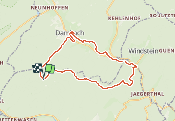

9,5 km | 14,4 km-effort


Benutzer


Kostenlosegpshiking-Anwendung
 SityTrail
IGN / Geografische Institute
SityTrail World
Die Welt öffnet sich für Sie
Tour Wandern von 16,1 km verfügbar auf Großer Osten, Unterelsass, Bad Niederbronn. Diese Tour wird von Dominique Baudelocque vorgeschlagen.
Retour par losange jaune, rect rouge et blanc disque vert rectangle rouge.
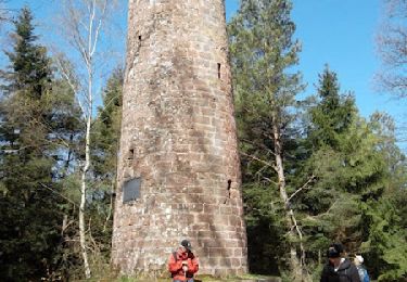
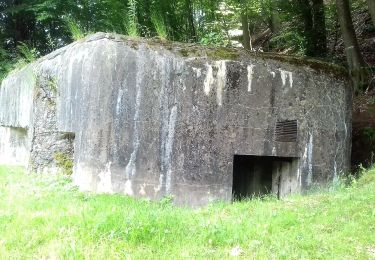
Examen travaux forestier sur Finsterthal
Wandern
Zu Fuß

Zu Fuß

Zu Fuß
Zu Fuß

Zu Fuß

Zu Fuß
Zu Fuß

Zu Fuß