![](/images/other/stat-length.png)
![Tour Wandern Riols - Sentier des légendes (1000 marches) par Langlade (Riols) - Photo](https://media.geolcdn.com/t/1900/400/54a1db2f-0acd-4445-b86b-7d60602f5031.jpg&format=pjpeg&maxdim=2)
Sentier des légendes (1000 marches) par Langlade (Riols)
PiloudeBamako
Benutzer
![Länge](/images/other/stat-length.png)
![Maximale Höhe](https://static1.geolcdn.com/siteimages/upload/files/1508320355ic_sort_altitude_max_24dp.png)
![Positive Höhendifferenz](https://static1.geolcdn.com/siteimages/upload/files/1508320355ic_sort_den_pos_24dp.png)
![Km-Effort](/images/other/stat-length.png)
![Min. Höhe](https://static1.geolcdn.com/siteimages/upload/files/1508320355ic_sort_altitude_min_24dp.png)
![Negative Höhendifferenz](https://static1.geolcdn.com/siteimages/upload/files/1508320355ic_sort_den_neg_24dp.png)
![Boucle](https://static1.geolcdn.com/siteimages/upload/files/16400158638029165_repeat_loop_refresh_sync_direction_icon.png)
![Wandern](https://static1.geolcdn.com/sitytour/trail-icons/101.png)
5h06
Schwierigkeit : Schwierig
![Scannen Sie diesen QR-Code, um die Tour in der SityTrail-Anwendung zu öffnen](https://capi.geolives.com/qq0zvz2zws4bq2lad0pu/sitytour/trails/3275855/qr.png?size=200)
Kostenlosegpshiking-Anwendung
Über SityTrail
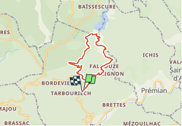
Tour Wandern von 13,4 km verfügbar auf Okzitanien, Hérault, Riols. Diese Tour wird von PiloudeBamako vorgeschlagen.
Beschreibung
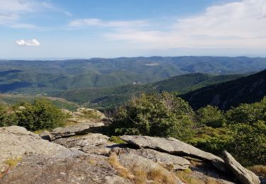
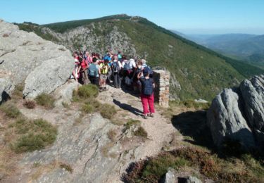
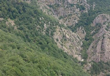
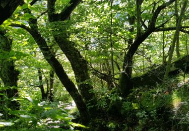
Départ du col des Sept frères (croisement de pistes - accessible en voiture). Descente vers le hameau de Langlade (commune de Riols). Sentier balisé. Difficile du fait du dénivelé principalement. Quelques passages en balcon mais assez larges (pas de gros risque de vertige sauf sensibilité très élevée). Quelques passages techniques mais ils sont équipés de câbles aidant à la montée.
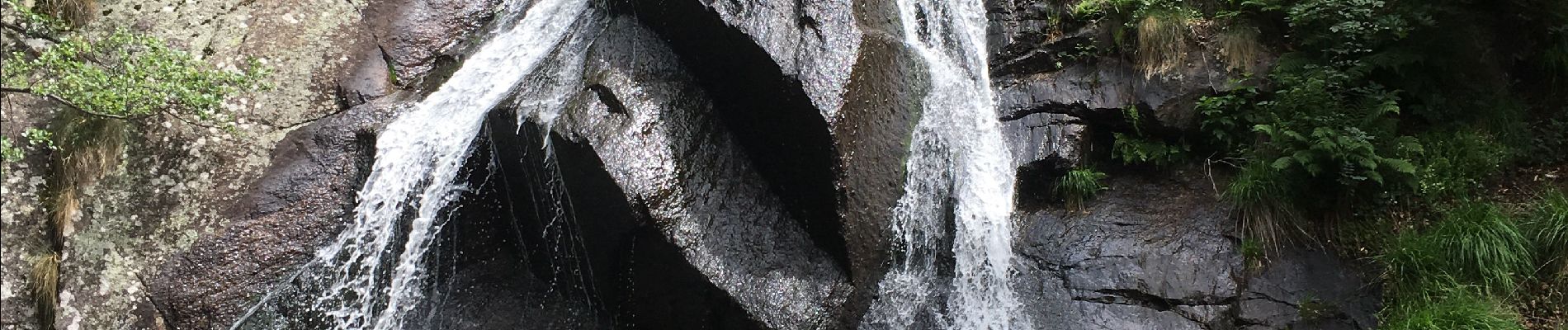
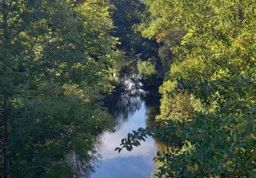
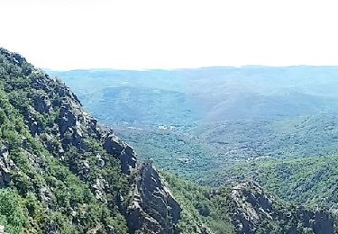
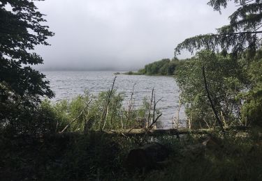
Retour par un sentier et des pistes faciles. Un belvédère offre une vue magnifique sur le cascades du ruisseau du Buraut suivi à l'ascension.
Ort
Kommentare
Touren in der Umgebung
![Tour Wandern Fraisse-sur-Agout - Lac de Vésoles - Photo](https://media.geolcdn.com/t/375/260/44e1f175-1be9-4201-a598-541aa36f3c7d.jpg&format=jpg&maxdim=2)
![Wandern Wandern](https://static1.geolcdn.com/sitytour/trail-icons/101.png)
Wandern
![](/images/other/stat-length.png)
![](https://static1.geolcdn.com/siteimages/upload/files/16400158638029165_repeat_loop_refresh_sync_direction_icon.png)
![Tour Wandern Fraisse-sur-Agout - Tour du lac de Vésoles - Photo](https://media.geolcdn.com/t/375/260/ext.jpg?maxdim=2&url=https%3A%2F%2Fservices.sitytrail.com%2FGeolivesWS%2FDownloadMedia.ashx%3FTrailID%3D139840%26Media%3D20120718114611.jpeg)
![Wandern Wandern](https://static1.geolcdn.com/sitytour/trail-icons/101.png)
Wandern
![](/images/other/stat-length.png)
![](https://static1.geolcdn.com/siteimages/upload/files/16400158638029165_repeat_loop_refresh_sync_direction_icon.png)
![Tour Wandern Riols - Le sentier des mille marche et le tour du lac de Vézoles - Saint Pons - Photo](https://media.geolcdn.com/t/375/260/ext.jpg?maxdim=2&url=https%3A%2F%2Fservices.sitytrail.com%2FGeolivesWS%2FDownloadMedia.ashx%3FTrailID%3D107404%26Media%3D12313_6.jpg)
![Wandern Wandern](https://static1.geolcdn.com/sitytour/trail-icons/101.png)
Wandern
![](/images/other/stat-length.png)
![](https://static1.geolcdn.com/siteimages/upload/files/16400158638029165_repeat_loop_refresh_sync_direction_icon.png)
![Tour Wandern Riols - Autour d'Olargues 2 - Photo](https://media.geolcdn.com/t/375/260/65dc6720-fc5c-43b9-8927-7867e5c86bd4.jpg&format=jpg&maxdim=2)
![Wandern Wandern](https://static1.geolcdn.com/sitytour/trail-icons/101.png)
Wandern
![](/images/other/stat-length.png)
![](https://static1.geolcdn.com/siteimages/upload/files/16400158638029165_repeat_loop_refresh_sync_direction_icon.png)
![Tour Zu Fuß Riols - Saut de Vezoles - Photo](https://media.geolcdn.com/t/375/260/e9b391ea-7291-4edf-9f47-49d06673b7cb.jpeg&format=jpg&maxdim=2)
![Zu Fuß Zu Fuß](https://static1.geolcdn.com/sitytour/trail-icons/100.png)
![Tour Wandern Riols - saut de vesole - Photo](https://media.geolcdn.com/t/375/260/616db02e-2644-4387-b371-c7927448a440.jpg&format=jpg&maxdim=2)
![Wandern Wandern](https://static1.geolcdn.com/sitytour/trail-icons/101.png)
Wandern
![](/images/other/stat-length.png)
![](https://static1.geolcdn.com/siteimages/upload/files/16400158638029165_repeat_loop_refresh_sync_direction_icon.png)
![Tour Wandern Fraisse-sur-Agout - Tour du lac de Vesoles - Photo](https://media.geolcdn.com/t/375/260/d3f5ff23-7639-4341-b025-8cb31c132179.jpg&format=jpg&maxdim=2)
![Wandern Wandern](https://static1.geolcdn.com/sitytour/trail-icons/101.png)
Wandern
![](/images/other/stat-length.png)
![](https://static1.geolcdn.com/siteimages/upload/files/16400158638029165_repeat_loop_refresh_sync_direction_icon.png)
![Tour Nordic Walking Riols - Langlade Saut de Vésole - Photo](https://media.geolcdn.com/t/375/260/2ec562b3-87fc-479e-907d-ff13d99c4228.jpg&format=jpg&maxdim=2)
![Nordic Walking Nordic Walking](https://static1.geolcdn.com/sitytour/trail-icons/102.png)
Nordic Walking
![](/images/other/stat-length.png)
![](https://static1.geolcdn.com/siteimages/upload/files/16400158638029165_repeat_loop_refresh_sync_direction_icon.png)
![Tour Zu Fuß Riols - Notre-Dame de Tredos - Photo](https://media.geolcdn.com/t/375/260/add3e184-ee16-4484-b059-9139dfec197d.jpeg&format=jpg&maxdim=2)
![Zu Fuß Zu Fuß](https://static1.geolcdn.com/sitytour/trail-icons/100.png)
Zu Fuß
![](/images/other/stat-length.png)
![](https://static1.geolcdn.com/siteimages/upload/files/16400158638029165_repeat_loop_refresh_sync_direction_icon.png)