![](/images/other/stat-length.png)
![Tour Reiten Gerbamont - 2022-06-04 Rando CVA Gerbamont Boucle Foret de Noire Goutte - Photo](https://media.geolcdn.com/t/1900/400/44bce39b-ceb9-4dae-b553-730e48ff9ece.jpg&format=pjpeg&maxdim=2)
2022-06-04 Rando CVA Gerbamont Boucle Foret de Noire Goutte
holtzv
Benutzer GUIDE
![Länge](/images/other/stat-length.png)
![Maximale Höhe](https://static1.geolcdn.com/siteimages/upload/files/1508320355ic_sort_altitude_max_24dp.png)
![Positive Höhendifferenz](https://static1.geolcdn.com/siteimages/upload/files/1508320355ic_sort_den_pos_24dp.png)
![Km-Effort](/images/other/stat-length.png)
![Min. Höhe](https://static1.geolcdn.com/siteimages/upload/files/1508320355ic_sort_altitude_min_24dp.png)
![Negative Höhendifferenz](https://static1.geolcdn.com/siteimages/upload/files/1508320355ic_sort_den_neg_24dp.png)
![Boucle](https://static1.geolcdn.com/siteimages/upload/files/16400158638029165_repeat_loop_refresh_sync_direction_icon.png)
![Reiten](https://static1.geolcdn.com/sitytour/trail-icons/301.png)
6h02
Schwierigkeit : Sehr schwierig
![Scannen Sie diesen QR-Code, um die Tour in der SityTrail-Anwendung zu öffnen](https://capi.geolives.com/qq0zvz2zws4bq2lad0pu/sitytour/trails/3269633/qr.png?size=200)
Kostenlosegpshiking-Anwendung
Über SityTrail
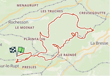
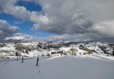
Tour Reiten von 31 km verfügbar auf Großer Osten, Vogesen, Gerbamont. Diese Tour wird von holtzv vorgeschlagen.
Beschreibung
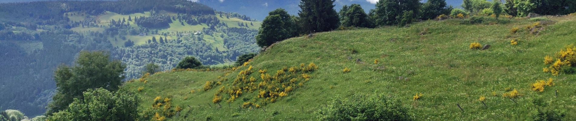
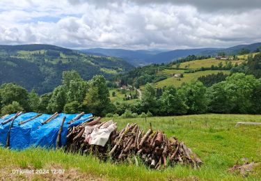
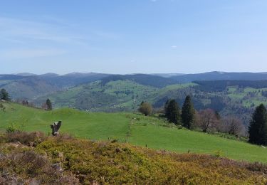
Boucle au départ de la Ferme des Plateaux à Gerbamont en passant par les hauts de La Bresse offrant de magnifiques points de vues, l'étang tourbière de Jemnaufaing, l'étang de Xauxonfaing, l'étang Noire goutte puis son chalet, le chalet de Battion, le chalet des Charmes et la Piquante Pierre
Ort
Kommentare
Touren in der Umgebung
![Tour Wandern Woll - Le Couchetat - Photo](https://media.geolcdn.com/t/375/260/ext.jpg?maxdim=2&url=https%3A%2F%2Fservices.sitytrail.com%2FGeolivesWS%2FDownloadMedia.ashx%3FTrailID%3D441671%26Media%3D20150706110250.jpg)
![Wandern Wandern](https://static1.geolcdn.com/sitytour/trail-icons/101.png)
Wandern
![](/images/other/stat-length.png)
![](https://static1.geolcdn.com/siteimages/upload/files/16400158638029165_repeat_loop_refresh_sync_direction_icon.png)
![Tour Reiten Gerbamont - 2022-06-05 Rando CVA Gerbamont Dommartin les Remiremont - Photo](https://media.geolcdn.com/t/375/260/fd6e9bbc-68c7-4aa5-ac35-74c2c082f858.jpg&format=jpg&maxdim=2)
![Reiten Reiten](https://static1.geolcdn.com/sitytour/trail-icons/301.png)
Reiten
![](/images/other/stat-length.png)
![](https://static1.geolcdn.com/siteimages/upload/files/16400158638029165_repeat_loop_refresh_sync_direction_icon.png)
![Tour Nordic Walking Basse-sur-le-Rupt - Planois - Le haut du Roc - Photo](https://media.geolcdn.com/t/375/260/af8f8d2a-d292-43d1-b86d-319eb7dfa3bc.jpg&format=jpg&maxdim=2)
![Nordic Walking Nordic Walking](https://static1.geolcdn.com/sitytour/trail-icons/102.png)
Nordic Walking
![](/images/other/stat-length.png)
![](https://static1.geolcdn.com/siteimages/upload/files/16400158638029165_repeat_loop_refresh_sync_direction_icon.png)
![Tour Wandern Woll - la montagne aux Lamas - Photo](https://media.geolcdn.com/t/375/260/d17f0df7-d406-4278-bce4-bfd31c24eafd.jpg&format=jpg&maxdim=2)
![Wandern Wandern](https://static1.geolcdn.com/sitytour/trail-icons/101.png)
Wandern
![](/images/other/stat-length.png)
![](https://static1.geolcdn.com/siteimages/upload/files/16400158638029165_repeat_loop_refresh_sync_direction_icon.png)
![Tour Wandern Cornimont - Croix des Moinats - Photo](https://media.geolcdn.com/t/375/260/ca2e91a2-4aa7-4b64-a421-a0f91eabaf46.jpg&format=jpg&maxdim=2)
![Wandern Wandern](https://static1.geolcdn.com/sitytour/trail-icons/101.png)
Wandern
![](/images/other/stat-length.png)
![](https://static1.geolcdn.com/siteimages/upload/files/16400158638029165_repeat_loop_refresh_sync_direction_icon.png)
![Tour Wandern Saulxures-sur-Moselotte - circuit depuis col des Hayes - Photo](https://media.geolcdn.com/t/375/260/cd39dddf-0c17-4c42-b853-306b20ab1bd1.jpg&format=jpg&maxdim=2)
![Wandern Wandern](https://static1.geolcdn.com/sitytour/trail-icons/101.png)
Wandern
![](/images/other/stat-length.png)
![](https://static1.geolcdn.com/siteimages/upload/files/16400158638029165_repeat_loop_refresh_sync_direction_icon.png)
![Tour sport Woll - Lac du pré Thia Auberge du Couchetat au nord ouest de La Bresse jour 6 - Photo](https://media.geolcdn.com/t/375/260/ext.jpg?maxdim=2&url=https%3A%2F%2Fsecurestorage.geolives.com%2Fsitytour%2Ftrail-bg%2Fdefault.jpg)
sport
![](/images/other/stat-length.png)
![](https://static1.geolcdn.com/siteimages/upload/files/16400158638029165_repeat_loop_refresh_sync_direction_icon.png)
![Tour Wandern Thiéfosse - tiens vagbey gorge de croqery - Photo](https://media.geolcdn.com/t/375/260/b2d3ee90-59a2-49f5-a8e0-615370d2ce55.jpg&format=jpg&maxdim=2)
![Wandern Wandern](https://static1.geolcdn.com/sitytour/trail-icons/101.png)
Wandern
![](/images/other/stat-length.png)
![](https://static1.geolcdn.com/siteimages/upload/files/16400158638029165_repeat_loop_refresh_sync_direction_icon.png)
![Tour Wandern Basse-sur-le-Rupt - Col de menufosse-chalet des charmes-pierre 4 communes - Photo](https://media.geolcdn.com/t/375/260/ext.jpg?maxdim=2&url=https%3A%2F%2Fstatic1.geolcdn.com%2Fsiteimages%2Fupload%2Ffiles%2F1553511878bg_sport_marche.png)
![Wandern Wandern](https://static1.geolcdn.com/sitytour/trail-icons/101.png)
Wandern
![](/images/other/stat-length.png)
![](https://static1.geolcdn.com/siteimages/upload/files/16400158638029165_repeat_loop_refresh_sync_direction_icon.png)