![](/images/other/stat-length.png)
![Tour Wandern Villeneuve-en-Montagne - Villeneuve en montagne - Photo](https://media.geolcdn.com/t/1900/400/ext.pjpeg?maxdim=2&url=https%3A%2F%2Fstatic1.geolcdn.com%2Fsiteimages%2Fupload%2Ffiles%2F1553511878bg_sport_marche.png)
Villeneuve en montagne
pensionisten71
Benutzer
![Länge](/images/other/stat-length.png)
Länge
13,6 km
![Maximale Höhe](https://static1.geolcdn.com/siteimages/upload/files/1508320355ic_sort_altitude_max_24dp.png)
Maximale Höhe
498 m
![Positive Höhendifferenz](https://static1.geolcdn.com/siteimages/upload/files/1508320355ic_sort_den_pos_24dp.png)
Positive Höhendifferenz
359 m
![Km-Effort](/images/other/stat-length.png)
Km-Effort
18,4 km
![Min. Höhe](https://static1.geolcdn.com/siteimages/upload/files/1508320355ic_sort_altitude_min_24dp.png)
Min. Höhe
327 m
![Negative Höhendifferenz](https://static1.geolcdn.com/siteimages/upload/files/1508320355ic_sort_den_neg_24dp.png)
Negative Höhendifferenz
358 m
![Boucle](https://static1.geolcdn.com/siteimages/upload/files/16400158638029165_repeat_loop_refresh_sync_direction_icon.png)
Boucle
Ja
Erstellungsdatum :
2022-05-29 14:44:03.178
Letzte Änderung :
2022-05-29 14:50:45.338
![Wandern](https://static1.geolcdn.com/sitytour/trail-icons/101.png)
4h11
Schwierigkeit : Schwierig
![Scannen Sie diesen QR-Code, um die Tour in der SityTrail-Anwendung zu öffnen](https://capi.geolives.com/qq0zvz2zws4bq2lad0pu/sitytour/trails/3262177/qr.png?size=200)
Kostenlosegpshiking-Anwendung
Über SityTrail
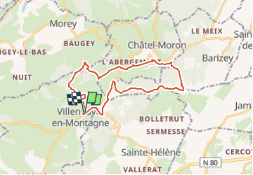
Tour Wandern von 13,6 km verfügbar auf Burgund und Freigrafschaft, Saône-et-Loire, Villeneuve-en-Montagne. Diese Tour wird von pensionisten71 vorgeschlagen.
Beschreibung
parcours établi par l'association La Rose des Vents.
Dommage les bons ravitos ne restent que ce jour.
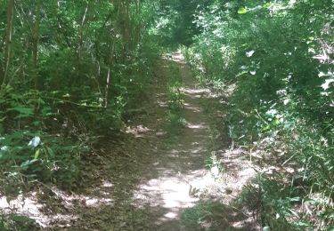
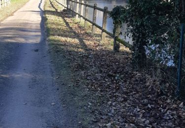
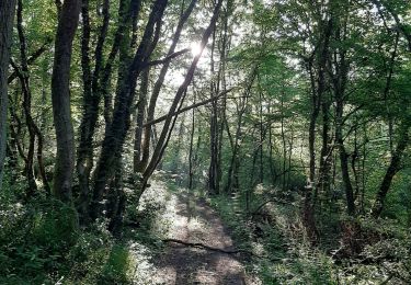
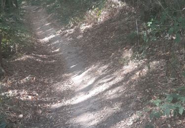
terrains variés.C'est magnifique.
Durée 3h environ.
Ort
Land:
France
Region :
Burgund und Freigrafschaft
Abteilung/Provinz :
Saône-et-Loire
Kommune :
Villeneuve-en-Montagne
Standort:
Unknown
Gehen Sie:(Dec)
Gehen Sie:(UTM)
623066 ; 5180870 (31T) N.
Kommentare
Touren in der Umgebung
![Tour Wandern Châtel-Moron - Chatel Moron - Photo](https://media.geolcdn.com/t/375/260/ext.jpg?maxdim=2&url=https%3A%2F%2Fstatic1.geolcdn.com%2Fsiteimages%2Fupload%2Ffiles%2F1553511878bg_sport_marche.png)
![Wandern Wandern](https://static1.geolcdn.com/sitytour/trail-icons/101.png)
Chatel Moron
Wandern
Einfach
(1)
Châtel-Moron,
Burgund und Freigrafschaft,
Saône-et-Loire,
France
![](/images/other/stat-length.png)
9 km | 12,3 km-effort
Unbekannt
![](https://static1.geolcdn.com/siteimages/upload/files/16400158638029165_repeat_loop_refresh_sync_direction_icon.png)
Ja
![Tour Wandern Barizey - Barizey la vallée des Vaux (houx)page 35 - Photo](https://media.geolcdn.com/t/375/260/ext.jpg?maxdim=2&url=https%3A%2F%2Fmedia.geolcdn.com%2Ff%2F26c01cf0-78aa-430d-bd19-eb036793c7da.jpg)
![Wandern Wandern](https://static1.geolcdn.com/sitytour/trail-icons/101.png)
Barizey la vallée des Vaux (houx)page 35
Wandern
Medium
Barizey,
Burgund und Freigrafschaft,
Saône-et-Loire,
France
![](/images/other/stat-length.png)
12,1 km | 16,2 km-effort
4h 16min
![](https://static1.geolcdn.com/siteimages/upload/files/16400158638029165_repeat_loop_refresh_sync_direction_icon.png)
Ja
![Tour Wandern Sainte-Hélène - Sainte Hélène - Photo](https://media.geolcdn.com/t/375/260/ext.jpg?maxdim=2&url=https%3A%2F%2Fmedia.geolcdn.com%2Ff%2F1301789a-52fc-4f51-93d7-c9f04eaa753b.jpg)
![Wandern Wandern](https://static1.geolcdn.com/sitytour/trail-icons/101.png)
Sainte Hélène
Wandern
Schwierig
Sainte-Hélène,
Burgund und Freigrafschaft,
Saône-et-Loire,
France
![](/images/other/stat-length.png)
21 km | 28 km-effort
4h 16min
![](https://static1.geolcdn.com/siteimages/upload/files/16400158638029165_repeat_loop_refresh_sync_direction_icon.png)
Ja
![Tour Wandern Sainte-Hélène - Sainte Hélène - Photo](https://media.geolcdn.com/t/375/260/ext.jpg?maxdim=2&url=https%3A%2F%2Fmedia.geolcdn.com%2Ff%2Ff4d812b5-676e-40c4-8eb4-d5a387c756f4.jpg)
![Wandern Wandern](https://static1.geolcdn.com/sitytour/trail-icons/101.png)
Sainte Hélène
Wandern
Medium
Sainte-Hélène,
Burgund und Freigrafschaft,
Saône-et-Loire,
France
![](/images/other/stat-length.png)
14,6 km | 20 km-effort
2h 53min
![](https://static1.geolcdn.com/siteimages/upload/files/16400158638029165_repeat_loop_refresh_sync_direction_icon.png)
Nein
![Tour Wandern Moroges - Moroges - Photo](https://media.geolcdn.com/t/375/260/ext.jpg?maxdim=2&url=https%3A%2F%2Fmedia.geolcdn.com%2Ff%2F515cb75a-87c8-483f-8f22-a82a869338c1.jpg)
![Wandern Wandern](https://static1.geolcdn.com/sitytour/trail-icons/101.png)
Moroges
Wandern
Sehr leicht
Moroges,
Burgund und Freigrafschaft,
Saône-et-Loire,
France
![](/images/other/stat-length.png)
6 km | 8,7 km-effort
1h 43min
![](https://static1.geolcdn.com/siteimages/upload/files/16400158638029165_repeat_loop_refresh_sync_direction_icon.png)
Ja
![Tour Wandern Villeneuve-en-Montagne - Chapelle de Villard boucle en 8 - Photo](https://media.geolcdn.com/t/375/260/ext.jpg?maxdim=2&url=https%3A%2F%2Fmedia.geolcdn.com%2Ff%2Fb4a0166d-edcc-4df6-8ac7-03d921d062dc.jpg)
![Wandern Wandern](https://static1.geolcdn.com/sitytour/trail-icons/101.png)
Chapelle de Villard boucle en 8
Wandern
Medium
Villeneuve-en-Montagne,
Burgund und Freigrafschaft,
Saône-et-Loire,
France
![](/images/other/stat-length.png)
16 km | 21 km-effort
3h 54min
![](https://static1.geolcdn.com/siteimages/upload/files/16400158638029165_repeat_loop_refresh_sync_direction_icon.png)
Ja
![Tour Wandern Barizey - Bourgogne à pied - Photo](https://media.geolcdn.com/t/375/260/ext.jpg?maxdim=2&url=https%3A%2F%2Fmedia.geolcdn.com%2Ff%2F569158ce-f31c-443b-b572-2dbfe697d45d.jpg)
![Wandern Wandern](https://static1.geolcdn.com/sitytour/trail-icons/101.png)
Bourgogne à pied
Wandern
Medium
Barizey,
Burgund und Freigrafschaft,
Saône-et-Loire,
France
![](/images/other/stat-length.png)
7,1 km | 10,3 km-effort
2h 1min
![](https://static1.geolcdn.com/siteimages/upload/files/16400158638029165_repeat_loop_refresh_sync_direction_icon.png)
Ja
![Tour Wandern Villeneuve-en-Montagne - La Chapelle de Villard - Photo](https://media.geolcdn.com/t/375/260/ext.jpg?maxdim=2&url=https%3A%2F%2Fmedia.geolcdn.com%2Ff%2Fc5e29d8f-b1fe-4964-be65-2110cbd6c3cd.jpg)
![Wandern Wandern](https://static1.geolcdn.com/sitytour/trail-icons/101.png)
La Chapelle de Villard
Wandern
Medium
Villeneuve-en-Montagne,
Burgund und Freigrafschaft,
Saône-et-Loire,
France
![](/images/other/stat-length.png)
19,5 km | 26 km-effort
4h 49min
![](https://static1.geolcdn.com/siteimages/upload/files/16400158638029165_repeat_loop_refresh_sync_direction_icon.png)
Ja
![Tour Zu Fuß Moroges - G3 Moroges - Photo](https://media.geolcdn.com/t/375/260/ext.jpg?maxdim=2&url=https%3A%2F%2Fstatic1.geolcdn.com%2Fsiteimages%2Fupload%2Ffiles%2F1545311037marcheuse_200dpi.jpg)
![Zu Fuß Zu Fuß](https://static1.geolcdn.com/sitytour/trail-icons/100.png)
G3 Moroges
Zu Fuß
Einfach
(1)
Moroges,
Burgund und Freigrafschaft,
Saône-et-Loire,
France
![](/images/other/stat-length.png)
9,3 km | 11,6 km-effort
2h 45min
![](https://static1.geolcdn.com/siteimages/upload/files/16400158638029165_repeat_loop_refresh_sync_direction_icon.png)
Ja
bien