![](/images/other/stat-length.png)
![Tour Zu Fuß Villeneuve-en-Montagne - Villeneuve en Montagne 17 km - Photo](https://media.geolcdn.com/t/1900/400/ext.pjpeg?maxdim=2&url=https%3A%2F%2Fstatic1.geolcdn.com%2Fsiteimages%2Fupload%2Ffiles%2F1545311037marcheuse_200dpi.jpg)
Villeneuve en Montagne 17 km
pensionisten71
Benutzer
![Länge](/images/other/stat-length.png)
Länge
17,1 km
![Maximale Höhe](https://static1.geolcdn.com/siteimages/upload/files/1508320355ic_sort_altitude_max_24dp.png)
Maximale Höhe
498 m
![Positive Höhendifferenz](https://static1.geolcdn.com/siteimages/upload/files/1508320355ic_sort_den_pos_24dp.png)
Positive Höhendifferenz
468 m
![Km-Effort](/images/other/stat-length.png)
Km-Effort
23 km
![Min. Höhe](https://static1.geolcdn.com/siteimages/upload/files/1508320355ic_sort_altitude_min_24dp.png)
Min. Höhe
305 m
![Negative Höhendifferenz](https://static1.geolcdn.com/siteimages/upload/files/1508320355ic_sort_den_neg_24dp.png)
Negative Höhendifferenz
467 m
![Boucle](https://static1.geolcdn.com/siteimages/upload/files/16400158638029165_repeat_loop_refresh_sync_direction_icon.png)
Boucle
Ja
Erstellungsdatum :
2022-05-29 14:19:25.006
Letzte Änderung :
2022-05-29 14:32:14.412
![Zu Fuß](https://static1.geolcdn.com/sitytour/trail-icons/100.png)
5h18
Schwierigkeit : Medium
![Scannen Sie diesen QR-Code, um die Tour in der SityTrail-Anwendung zu öffnen](https://capi.geolives.com/qq0zvz2zws4bq2lad0pu/sitytour/trails/3262112/qr.png?size=200)
Kostenlosegpshiking-Anwendung
Über SityTrail
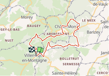
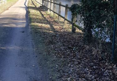
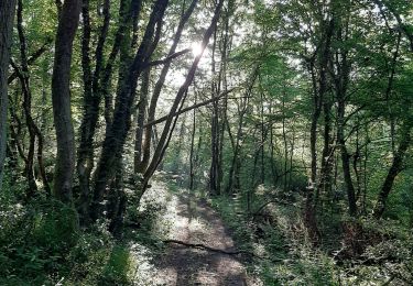
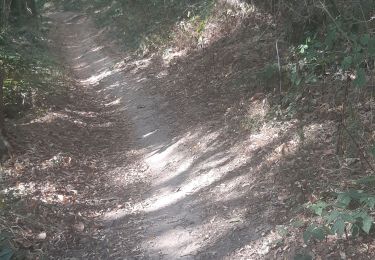
Tour Zu Fuß von 17,1 km verfügbar auf Burgund und Freigrafschaft, Saône-et-Loire, Villeneuve-en-Montagne. Diese Tour wird von pensionisten71 vorgeschlagen.
Beschreibung
Beau parcours de l'Association La Rose des Vents avec de bons ravitos
tous les ans avec des tracés différents à la même époque.le calculateur des durées évalule pour des randonneurs très lents.Il faut moins de 4 h.
Ort
Land:
France
Region :
Burgund und Freigrafschaft
Abteilung/Provinz :
Saône-et-Loire
Kommune :
Villeneuve-en-Montagne
Standort:
Unknown
Gehen Sie:(Dec)
Gehen Sie:(UTM)
623063 ; 5180860 (31T) N.
Kommentare
Touren in der Umgebung
![Tour Wandern Châtel-Moron - Chatel Moron - Photo](https://media.geolcdn.com/t/375/260/ext.jpg?maxdim=2&url=https%3A%2F%2Fstatic1.geolcdn.com%2Fsiteimages%2Fupload%2Ffiles%2F1553511878bg_sport_marche.png)
![Wandern Wandern](https://static1.geolcdn.com/sitytour/trail-icons/101.png)
Chatel Moron
Wandern
Einfach
(1)
Châtel-Moron,
Burgund und Freigrafschaft,
Saône-et-Loire,
France
![](/images/other/stat-length.png)
9 km | 12,3 km-effort
Unbekannt
![](https://static1.geolcdn.com/siteimages/upload/files/16400158638029165_repeat_loop_refresh_sync_direction_icon.png)
Ja
![Tour Wandern Barizey - Barizey la vallée des Vaux (houx)page 35 - Photo](https://media.geolcdn.com/t/375/260/ext.jpg?maxdim=2&url=https%3A%2F%2Fmedia.geolcdn.com%2Ff%2F26c01cf0-78aa-430d-bd19-eb036793c7da.jpg)
![Wandern Wandern](https://static1.geolcdn.com/sitytour/trail-icons/101.png)
Barizey la vallée des Vaux (houx)page 35
Wandern
Medium
Barizey,
Burgund und Freigrafschaft,
Saône-et-Loire,
France
![](/images/other/stat-length.png)
12,1 km | 16,2 km-effort
4h 16min
![](https://static1.geolcdn.com/siteimages/upload/files/16400158638029165_repeat_loop_refresh_sync_direction_icon.png)
Ja
![Tour Wandern Sainte-Hélène - Sainte Hélène - Photo](https://media.geolcdn.com/t/375/260/ext.jpg?maxdim=2&url=https%3A%2F%2Fmedia.geolcdn.com%2Ff%2F1301789a-52fc-4f51-93d7-c9f04eaa753b.jpg)
![Wandern Wandern](https://static1.geolcdn.com/sitytour/trail-icons/101.png)
Sainte Hélène
Wandern
Schwierig
Sainte-Hélène,
Burgund und Freigrafschaft,
Saône-et-Loire,
France
![](/images/other/stat-length.png)
21 km | 28 km-effort
4h 16min
![](https://static1.geolcdn.com/siteimages/upload/files/16400158638029165_repeat_loop_refresh_sync_direction_icon.png)
Ja
![Tour Wandern Sainte-Hélène - Sainte Hélène - Photo](https://media.geolcdn.com/t/375/260/ext.jpg?maxdim=2&url=https%3A%2F%2Fmedia.geolcdn.com%2Ff%2Ff4d812b5-676e-40c4-8eb4-d5a387c756f4.jpg)
![Wandern Wandern](https://static1.geolcdn.com/sitytour/trail-icons/101.png)
Sainte Hélène
Wandern
Medium
Sainte-Hélène,
Burgund und Freigrafschaft,
Saône-et-Loire,
France
![](/images/other/stat-length.png)
14,6 km | 20 km-effort
2h 53min
![](https://static1.geolcdn.com/siteimages/upload/files/16400158638029165_repeat_loop_refresh_sync_direction_icon.png)
Nein
![Tour Wandern Moroges - Moroges - Photo](https://media.geolcdn.com/t/375/260/ext.jpg?maxdim=2&url=https%3A%2F%2Fmedia.geolcdn.com%2Ff%2F515cb75a-87c8-483f-8f22-a82a869338c1.jpg)
![Wandern Wandern](https://static1.geolcdn.com/sitytour/trail-icons/101.png)
Moroges
Wandern
Sehr leicht
Moroges,
Burgund und Freigrafschaft,
Saône-et-Loire,
France
![](/images/other/stat-length.png)
6 km | 8,7 km-effort
1h 43min
![](https://static1.geolcdn.com/siteimages/upload/files/16400158638029165_repeat_loop_refresh_sync_direction_icon.png)
Ja
![Tour Wandern Villeneuve-en-Montagne - Chapelle de Villard boucle en 8 - Photo](https://media.geolcdn.com/t/375/260/ext.jpg?maxdim=2&url=https%3A%2F%2Fmedia.geolcdn.com%2Ff%2Fb4a0166d-edcc-4df6-8ac7-03d921d062dc.jpg)
![Wandern Wandern](https://static1.geolcdn.com/sitytour/trail-icons/101.png)
Chapelle de Villard boucle en 8
Wandern
Medium
Villeneuve-en-Montagne,
Burgund und Freigrafschaft,
Saône-et-Loire,
France
![](/images/other/stat-length.png)
16 km | 21 km-effort
3h 54min
![](https://static1.geolcdn.com/siteimages/upload/files/16400158638029165_repeat_loop_refresh_sync_direction_icon.png)
Ja
![Tour Wandern Barizey - Bourgogne à pied - Photo](https://media.geolcdn.com/t/375/260/ext.jpg?maxdim=2&url=https%3A%2F%2Fmedia.geolcdn.com%2Ff%2F569158ce-f31c-443b-b572-2dbfe697d45d.jpg)
![Wandern Wandern](https://static1.geolcdn.com/sitytour/trail-icons/101.png)
Bourgogne à pied
Wandern
Medium
Barizey,
Burgund und Freigrafschaft,
Saône-et-Loire,
France
![](/images/other/stat-length.png)
7,1 km | 10,3 km-effort
2h 1min
![](https://static1.geolcdn.com/siteimages/upload/files/16400158638029165_repeat_loop_refresh_sync_direction_icon.png)
Ja
![Tour Wandern Villeneuve-en-Montagne - La Chapelle de Villard - Photo](https://media.geolcdn.com/t/375/260/ext.jpg?maxdim=2&url=https%3A%2F%2Fmedia.geolcdn.com%2Ff%2Fc5e29d8f-b1fe-4964-be65-2110cbd6c3cd.jpg)
![Wandern Wandern](https://static1.geolcdn.com/sitytour/trail-icons/101.png)
La Chapelle de Villard
Wandern
Medium
Villeneuve-en-Montagne,
Burgund und Freigrafschaft,
Saône-et-Loire,
France
![](/images/other/stat-length.png)
19,5 km | 26 km-effort
4h 49min
![](https://static1.geolcdn.com/siteimages/upload/files/16400158638029165_repeat_loop_refresh_sync_direction_icon.png)
Ja
![Tour Zu Fuß Moroges - G3 Moroges - Photo](https://media.geolcdn.com/t/375/260/ext.jpg?maxdim=2&url=https%3A%2F%2Fstatic1.geolcdn.com%2Fsiteimages%2Fupload%2Ffiles%2F1545311037marcheuse_200dpi.jpg)
![Zu Fuß Zu Fuß](https://static1.geolcdn.com/sitytour/trail-icons/100.png)
G3 Moroges
Zu Fuß
Einfach
(1)
Moroges,
Burgund und Freigrafschaft,
Saône-et-Loire,
France
![](/images/other/stat-length.png)
9,3 km | 11,6 km-effort
2h 45min
![](https://static1.geolcdn.com/siteimages/upload/files/16400158638029165_repeat_loop_refresh_sync_direction_icon.png)
Ja