![](/images/other/stat-length.png)
![Tour Wandern Vétheuil - La petite Suisse - Photo](https://media.geolcdn.com/t/1900/400/e99e0c57-0b4a-47cd-bd30-03350fdbf495.jpg&format=pjpeg&maxdim=2)
La petite Suisse
pchr
Benutzer
![Länge](/images/other/stat-length.png)
Länge
16,2 km
![Maximale Höhe](https://static1.geolcdn.com/siteimages/upload/files/1508320355ic_sort_altitude_max_24dp.png)
Maximale Höhe
151 m
![Positive Höhendifferenz](https://static1.geolcdn.com/siteimages/upload/files/1508320355ic_sort_den_pos_24dp.png)
Positive Höhendifferenz
272 m
![Km-Effort](/images/other/stat-length.png)
Km-Effort
19,8 km
![Min. Höhe](https://static1.geolcdn.com/siteimages/upload/files/1508320355ic_sort_altitude_min_24dp.png)
Min. Höhe
27 m
![Negative Höhendifferenz](https://static1.geolcdn.com/siteimages/upload/files/1508320355ic_sort_den_neg_24dp.png)
Negative Höhendifferenz
272 m
![Boucle](https://static1.geolcdn.com/siteimages/upload/files/16400158638029165_repeat_loop_refresh_sync_direction_icon.png)
Boucle
Ja
Erstellungsdatum :
2022-05-01 09:05:20.0
Letzte Änderung :
2022-05-01 14:09:38.2
![Wandern](https://static1.geolcdn.com/sitytour/trail-icons/101.png)
4h27
Schwierigkeit : Medium
![Scannen Sie diesen QR-Code, um die Tour in der SityTrail-Anwendung zu öffnen](https://capi.geolives.com/qq0zvz2zws4bq2lad0pu/sitytour/trails/3225241/qr.png?size=200)
Kostenlosegpshiking-Anwendung
Über SityTrail
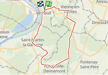
Tour Wandern von 16,2 km verfügbar auf Île-de-France, Val-d'Oise, Vétheuil. Diese Tour wird von pchr vorgeschlagen.
Beschreibung
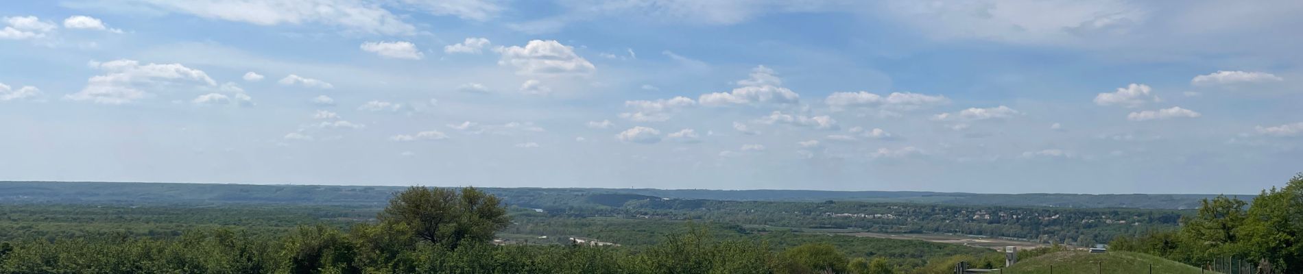
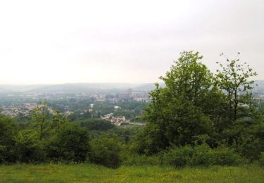
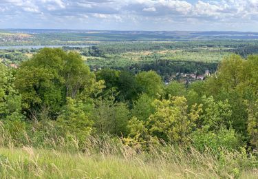
Très belle balade avec une belle forêt, de beaux sous-bois, des maisons avec une architecture d’époque et un petit village extraordinaire, Vienne en arthies
Ort
Land:
France
Region :
Île-de-France
Abteilung/Provinz :
Val-d'Oise
Kommune :
Vétheuil
Standort:
Unknown
Gehen Sie:(Dec)
Gehen Sie:(UTM)
405330 ; 5435489 (31U) N.
Kommentare
Touren in der Umgebung
![Zu Fuß Zu Fuß](https://static1.geolcdn.com/sitytour/trail-icons/100.png)
Vétheuil Bords de Seine et coteaux
Zu Fuß
Einfach
(1)
Vétheuil,
Île-de-France,
Val-d'Oise,
France
![](/images/other/stat-length.png)
9,5 km | 11,8 km-effort
2h 38min
![](https://static1.geolcdn.com/siteimages/upload/files/16400158638029165_repeat_loop_refresh_sync_direction_icon.png)
Ja
![Tour Mountainbike Saint-Martin-la-Garenne - La Garennoise 2005-47km - Photo](https://media.geolcdn.com/t/375/260/ext.jpg?maxdim=2&url=https%3A%2F%2Fservices.sitytrail.com%2FGeolivesWS%2FDownloadMedia.ashx%3FTrailID%3D100976%26Media%3D475_1.jpg)
![Mountainbike Mountainbike](https://static1.geolcdn.com/sitytour/trail-icons/202.png)
La Garennoise 2005-47km
Mountainbike
Schwierig
(2)
Saint-Martin-la-Garenne,
Île-de-France,
Yvelines,
France
![](/images/other/stat-length.png)
47 km | 60 km-effort
3h 30min
![](https://static1.geolcdn.com/siteimages/upload/files/16400158638029165_repeat_loop_refresh_sync_direction_icon.png)
Ja
![Tour Wandern La Roche-Guyon - La Roche Guyon - Chérence - Photo](https://media.geolcdn.com/t/375/260/ext.jpg?maxdim=2&url=https%3A%2F%2Fstatic1.geolcdn.com%2Fsiteimages%2Fupload%2Ffiles%2F1553511878bg_sport_marche.png)
![Wandern Wandern](https://static1.geolcdn.com/sitytour/trail-icons/101.png)
La Roche Guyon - Chérence
Wandern
Medium
(2)
La Roche-Guyon,
Île-de-France,
Val-d'Oise,
France
![](/images/other/stat-length.png)
8,8 km | 11,5 km-effort
2h 30min
![](https://static1.geolcdn.com/siteimages/upload/files/16400158638029165_repeat_loop_refresh_sync_direction_icon.png)
Ja
![Tour Wandern Vétheuil - La Roche Guyon depuis Vétheuil - Photo](https://media.geolcdn.com/t/375/260/ext.jpg?maxdim=2&url=https%3A%2F%2Fstatic1.geolcdn.com%2Fsiteimages%2Fupload%2Ffiles%2F1553511878bg_sport_marche.png)
![Wandern Wandern](https://static1.geolcdn.com/sitytour/trail-icons/101.png)
La Roche Guyon depuis Vétheuil
Wandern
Medium
(1)
Vétheuil,
Île-de-France,
Val-d'Oise,
France
![](/images/other/stat-length.png)
20 km | 27 km-effort
6h 0min
![](https://static1.geolcdn.com/siteimages/upload/files/16400158638029165_repeat_loop_refresh_sync_direction_icon.png)
Ja
![Tour Wandern Vétheuil - Vetheuil - la petite suisse - Photo](https://media.geolcdn.com/t/375/260/ext.jpg?maxdim=2&url=https%3A%2F%2Fstatic1.geolcdn.com%2Fsiteimages%2Fupload%2Ffiles%2F1553511878bg_sport_marche.png)
![Wandern Wandern](https://static1.geolcdn.com/sitytour/trail-icons/101.png)
Vetheuil - la petite suisse
Wandern
Einfach
(1)
Vétheuil,
Île-de-France,
Val-d'Oise,
France
![](/images/other/stat-length.png)
15,5 km | 20 km-effort
4h 20min
![](https://static1.geolcdn.com/siteimages/upload/files/16400158638029165_repeat_loop_refresh_sync_direction_icon.png)
Ja
![Tour Wandern La Roche-Guyon - La Roche Guyon - Forêt + falaises - Photo](https://media.geolcdn.com/t/375/260/ext.jpg?maxdim=2&url=https%3A%2F%2Fstatic1.geolcdn.com%2Fsiteimages%2Fupload%2Ffiles%2F1553511878bg_sport_marche.png)
![Wandern Wandern](https://static1.geolcdn.com/sitytour/trail-icons/101.png)
La Roche Guyon - Forêt + falaises
Wandern
Medium
(2)
La Roche-Guyon,
Île-de-France,
Val-d'Oise,
France
![](/images/other/stat-length.png)
12,1 km | 15,3 km-effort
3h 22min
![](https://static1.geolcdn.com/siteimages/upload/files/16400158638029165_repeat_loop_refresh_sync_direction_icon.png)
Ja
![Tour Wandern Haute-Isle - cherence vetheuil - Photo](https://media.geolcdn.com/t/375/260/30489cd7-a8cf-4c9a-96b0-b376801dc544.jpg&format=jpg&maxdim=2)
![Wandern Wandern](https://static1.geolcdn.com/sitytour/trail-icons/101.png)
cherence vetheuil
Wandern
Haute-Isle,
Île-de-France,
Val-d'Oise,
France
![](/images/other/stat-length.png)
11,1 km | 14,5 km-effort
3h 21min
![](https://static1.geolcdn.com/siteimages/upload/files/16400158638029165_repeat_loop_refresh_sync_direction_icon.png)
Ja
![Tour Wandern La Roche-Guyon - La Roche Guyon - Photo](https://media.geolcdn.com/t/375/260/435b2e08-c75f-415f-8c45-43907ed8c4dd.jpg&format=jpg&maxdim=2)
![Wandern Wandern](https://static1.geolcdn.com/sitytour/trail-icons/101.png)
La Roche Guyon
Wandern
Sehr leicht
La Roche-Guyon,
Île-de-France,
Val-d'Oise,
France
![](/images/other/stat-length.png)
8,6 km | 11,4 km-effort
2h 53min
![](https://static1.geolcdn.com/siteimages/upload/files/16400158638029165_repeat_loop_refresh_sync_direction_icon.png)
Ja
![Tour Wandern Saint-Martin-la-Garenne - 160117 - Saint-Martin la Garenne - Photo](https://media.geolcdn.com/t/375/260/ext.jpg?maxdim=2&url=https%3A%2F%2Fstatic1.geolcdn.com%2Fsiteimages%2Fupload%2Ffiles%2F1553511878bg_sport_marche.png)
![Wandern Wandern](https://static1.geolcdn.com/sitytour/trail-icons/101.png)
160117 - Saint-Martin la Garenne
Wandern
Einfach
(1)
Saint-Martin-la-Garenne,
Île-de-France,
Yvelines,
France
![](/images/other/stat-length.png)
14,2 km | 15,7 km-effort
3h 27min
![](https://static1.geolcdn.com/siteimages/upload/files/16400158638029165_repeat_loop_refresh_sync_direction_icon.png)
Ja