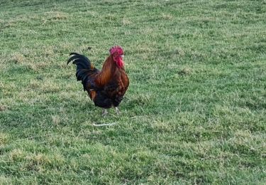
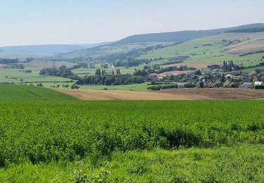
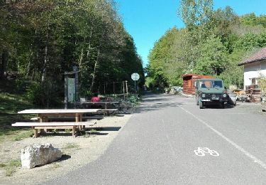
Tour Nordic Walking Amance - Amance 11 370m +209M - Photo
 DanielROLLET
DanielROLLET

Benutzer

© OpenStreetMap contributors
Länge
Länge
11,4 km
Maximale Höhe
Maximale Höhe
345 m
Positive Höhendifferenz
209 m
Km-Effort
Km-Effort  
14,2 km
Min. Höhe
Min. Höhe
214 m
Negative Höhendifferenz
209 m
Boucle
Boucle
Ja
Erstellungsdatum :
2022-04-28 06:59:32.139
Letzte Änderung :
2022-04-28 10:45:55.026

(0 Nachricht)

Nordic Walking
Nordic Walking
2h20
Schwierigkeit : Sehr leicht

Scannen Sie diesen QR-Code, um die Tour in der SityTrail-Anwendung zu öffnen

Kostenlosegpshiking-Anwendung

Logo SityTrail SityTrail

IGN / Geografische Institute

SityTrail aus dem App Store herunterladen SityTrail von Google Play herunterladen

Logo SityTrail SityTrail World

Die Welt öffnet sich für Sie

SityTrail aus dem App Store herunterladen SityTrail von Google Play herunterladen SityTrail auf Huawei AppGallery herunterladen

Über SityTrail

Tour Nordic Walking von 11,4 km verfügbar auf Großer Osten, Mörthe und Mosel, Amance. Diese Tour wird von DanielROLLET vorgeschlagen.

Beschreibung

2022 04 28 - MND - 10 participants - Grand beau temps
Départ/retour silo Fleur Fontaine (parking de merde)
Grosse erreur dans la forêt d'Amance
Une grimpette pour le plaisir, suivie d'une descente pour faire de la dénivelée et augmenter la distance!!!
Pas de circuit préparé à l'avance sur papier
Pas de trace du circuit sur smartphone
Pas de trace en cours sur smartphone
Guidage pifométrique sur le smartphone.
Seul objectif : l'horaire
MAUVAISE MARCHE

Höhenprofil

Ort

Land:
France
Region :
Großer Osten
Abteilung/Provinz :
Mörthe und Mosel
Kommune :
Amance
Standort:
Unknown
Gehen Sie:(UTM)
301685 ; 5404369 (32U) N.

Touren in der Umgebung

Tour Zu Fuß Agincourt - Circuit M - Photo
Zu Fuß
GUIDE+

Zu Fuß

Einfach
Agincourt, Großer Osten, Mörthe und Mosel, France
13,3 km | 17,8 km-effort
4h 3min
Nein
Tour Wandern Leyr - LEYR - LE PLATEAU DE LA ROCHETTE - Photo
Wandern
jean-marie.parachini

Wandern

Einfach
Leyr, Großer Osten, Mörthe und Mosel, France
12,1 km | 15,5 km-effort
5h 59min
Ja
Tour Wandern Bouxières-aux-Chênes - tour crany 29/5/2019 - Photo
Wandern
Morel54

Wandern

Sehr leicht
(1)
Bouxières-aux-Chênes, Großer Osten, Mörthe und Mosel, France
11,1 km | 14 km-effort
3h 42min
Ja
Tour Wandern Bouxières-aux-Chênes - bouxieres aux chênes - Blanzey - Photo
Wandern
jean-marie.parachini

Wandern

Medium
Bouxières-aux-Chênes, Großer Osten, Mörthe und Mosel, France
12 km | 14,7 km-effort
19h 32min
Ja
Tour Wandern Bouxières-aux-Chênes - bouxieres aux chênes - la tour de crany - Photo
Wandern
jean-marie.parachini

Wandern

Einfach
Bouxières-aux-Chênes, Großer Osten, Mörthe und Mosel, France
11,2 km | 14,2 km-effort
4h 52min
Ja
Tour Wandern Leyr - Leyr Villers les Moivrons - Photo
Wandern
jean-marie.parachini

Wandern

Medium
Leyr, Großer Osten, Mörthe und Mosel, France
32 km | 42 km-effort
6h 38min
Nein
Tour Wandern Leyr - Leyr - plateau de la Rochette - Photo
Wandern
jean-marie.parachini

Wandern

Einfach
Leyr, Großer Osten, Mörthe und Mosel, France
11,8 km | 15,1 km-effort
6h 4min
Ja
Tour Wandern Amance - Bouzule 13400m + 290m - Photo
Wandern
DanielROLLET

Wandern

Einfach
Amance, Großer Osten, Mörthe und Mosel, France
13,2 km | 16,9 km-effort
3h 41min
Ja
Tour Wandern Amance - Brin - Photo
Wandern
DanielROLLET

Wandern

Einfach
Amance, Großer Osten, Mörthe und Mosel, France
11,4 km | 13,1 km-effort
2h 57min
Ja


Schließen
Meine Abonnements