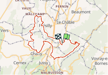
![](/images/other/stat-length.png)
![Tour Wandern Présilly - 27-04-2022 Maison et Plan du Salève-Mont Sion - Photo](https://media.geolcdn.com/t/1900/400/405e27da-a367-4a23-bdae-461ea923adb5.jpg&format=pjpeg&maxdim=2)
27-04-2022 Maison et Plan du Salève-Mont Sion
Kargil
Benutzer GUIDE
![Länge](/images/other/stat-length.png)
![Maximale Höhe](https://static1.geolcdn.com/siteimages/upload/files/1508320355ic_sort_altitude_max_24dp.png)
![Positive Höhendifferenz](https://static1.geolcdn.com/siteimages/upload/files/1508320355ic_sort_den_pos_24dp.png)
![Km-Effort](/images/other/stat-length.png)
![Min. Höhe](https://static1.geolcdn.com/siteimages/upload/files/1508320355ic_sort_altitude_min_24dp.png)
![Negative Höhendifferenz](https://static1.geolcdn.com/siteimages/upload/files/1508320355ic_sort_den_neg_24dp.png)
![Boucle](https://static1.geolcdn.com/siteimages/upload/files/16400158638029165_repeat_loop_refresh_sync_direction_icon.png)
![Wandern](https://static1.geolcdn.com/sitytour/trail-icons/101.png)
5h15
Schwierigkeit : Schwierig
![Scannen Sie diesen QR-Code, um die Tour in der SityTrail-Anwendung zu öffnen](https://capi.geolives.com/qq0zvz2zws4bq2lad0pu/sitytour/trails/3220064/qr.png?size=200)
Kostenlosegpshiking-Anwendung
Über SityTrail
Tour Wandern von 20 km verfügbar auf Auvergne-Rhone-Alpen, Hochsavoyen, Présilly. Diese Tour wird von Kargil vorgeschlagen.
Beschreibung
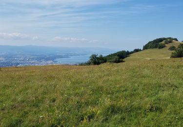
Le GR Balcon du Léman est à prendre un peu plus en aval des Convers. Le tracé GR de la carte IGN est toujours utilisable mais un peu encombré de sapins abattus.
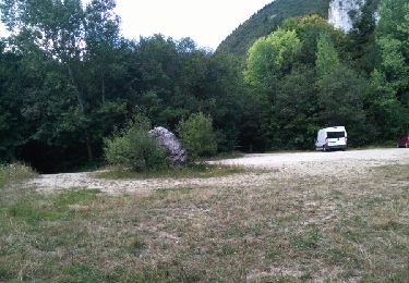
Dans l'ensemble, le tracé réel dévie légèrement du tracé cartographique. Toutefois rien de préjudiciable.
Ort
Kommentare
Touren in der Umgebung
![Tour Wandern Cruseilles - 15-04-2022 Les Dronières - Plan du Salève - Photo](https://media.geolcdn.com/t/375/260/49b79cd7-0770-47d3-a4e5-6c315b2350b7.jpg&format=jpg&maxdim=2)
![Wandern Wandern](https://static1.geolcdn.com/sitytour/trail-icons/101.png)
Wandern
![](/images/other/stat-length.png)
![](https://static1.geolcdn.com/siteimages/upload/files/16400158638029165_repeat_loop_refresh_sync_direction_icon.png)
![Tour Wandern Cruseilles - becon - Photo](https://media.geolcdn.com/t/375/260/77a3288c-38a1-450a-8cd6-481ccba76621.jpg&format=jpg&maxdim=2)
![Wandern Wandern](https://static1.geolcdn.com/sitytour/trail-icons/101.png)
Wandern
![](/images/other/stat-length.png)
![](https://static1.geolcdn.com/siteimages/upload/files/16400158638029165_repeat_loop_refresh_sync_direction_icon.png)
![Tour Wandern Cruseilles - suet - Photo](https://media.geolcdn.com/t/375/260/dbabbe77-f7eb-45b5-9157-b52982936354.jpg&format=jpg&maxdim=2)
![Wandern Wandern](https://static1.geolcdn.com/sitytour/trail-icons/101.png)
Wandern
![](/images/other/stat-length.png)
![](https://static1.geolcdn.com/siteimages/upload/files/16400158638029165_repeat_loop_refresh_sync_direction_icon.png)
![Tour Wandern Cruseilles - au dessus de cruseilles - Photo](https://media.geolcdn.com/t/375/260/fbe5b8a3-d775-4ea1-8d1d-979c850c7817.jpg&format=jpg&maxdim=2)
![Wandern Wandern](https://static1.geolcdn.com/sitytour/trail-icons/101.png)
Wandern
![](/images/other/stat-length.png)
![](https://static1.geolcdn.com/siteimages/upload/files/16400158638029165_repeat_loop_refresh_sync_direction_icon.png)
![Tour Wandern Beaumont - Le SALEVE - Photo](https://media.geolcdn.com/t/375/260/c9189c80-1d96-428b-972e-6a912afdf69e.jpg&format=jpg&maxdim=2)
![Wandern Wandern](https://static1.geolcdn.com/sitytour/trail-icons/101.png)
Wandern
![](/images/other/stat-length.png)
![](https://static1.geolcdn.com/siteimages/upload/files/16400158638029165_repeat_loop_refresh_sync_direction_icon.png)
![Tour Wandern Cruseilles - saleve 21 05 20 - Photo](https://media.geolcdn.com/t/375/260/a105e726-b7f5-4f54-a149-4a731d517b2d.jpg&format=jpg&maxdim=2)
![Wandern Wandern](https://static1.geolcdn.com/sitytour/trail-icons/101.png)
Wandern
![](/images/other/stat-length.png)
![](https://static1.geolcdn.com/siteimages/upload/files/16400158638029165_repeat_loop_refresh_sync_direction_icon.png)
![Tour Mountainbike Saint-Blaise - Tour du saleve depuis saint blaise - Photo](https://media.geolcdn.com/t/375/260/a350c714-e31b-4509-9bb9-d9b97d1750c5.jpg&format=jpg&maxdim=2)
![Mountainbike Mountainbike](https://static1.geolcdn.com/sitytour/trail-icons/202.png)
Mountainbike
![](/images/other/stat-length.png)
![](https://static1.geolcdn.com/siteimages/upload/files/16400158638029165_repeat_loop_refresh_sync_direction_icon.png)
![Tour Klettersteig Présilly - via ferrata revaclier st Julien en Genevois - Photo](https://media.geolcdn.com/t/375/260/ext.jpg?maxdim=2&url=https%3A%2F%2Fservices.sitytrail.com%2FGeolivesWS%2FDownloadMedia.ashx%3FTrailID%3D616540%26Media%3Dfix__20160816173201.jpg)
![Klettersteig Klettersteig](https://static1.geolcdn.com/sitytour/trail-icons/902.png)
Klettersteig
![](/images/other/stat-length.png)
![](https://static1.geolcdn.com/siteimages/upload/files/16400158638029165_repeat_loop_refresh_sync_direction_icon.png)
![Tour Wandern Cruseilles - Tour de l'Iselet - Photo](https://media.geolcdn.com/t/375/260/ext.jpg?maxdim=2&url=https%3A%2F%2Fservices.sitytrail.com%2FGeolivesWS%2FDownloadMedia.ashx%3FTrailID%3D433497%26Media%3Dfix__20150614132333.jpg)
![Wandern Wandern](https://static1.geolcdn.com/sitytour/trail-icons/101.png)
Wandern
![](/images/other/stat-length.png)
![](https://static1.geolcdn.com/siteimages/upload/files/16400158638029165_repeat_loop_refresh_sync_direction_icon.png)