![](/images/other/stat-length.png)
![Tour Wandern Étables - 07 - chemin de la levé - Photo](https://media.geolcdn.com/t/1900/400/ext.pjpeg?maxdim=2&url=https%3A%2F%2Fstatic1.geolcdn.com%2Fsiteimages%2Fupload%2Ffiles%2F1553511878bg_sport_marche.png)
07 - chemin de la levé
guilmanu
Benutzer
![Länge](/images/other/stat-length.png)
Länge
5,1 km
![Maximale Höhe](https://static1.geolcdn.com/siteimages/upload/files/1508320355ic_sort_altitude_max_24dp.png)
Maximale Höhe
493 m
![Positive Höhendifferenz](https://static1.geolcdn.com/siteimages/upload/files/1508320355ic_sort_den_pos_24dp.png)
Positive Höhendifferenz
155 m
![Km-Effort](/images/other/stat-length.png)
Km-Effort
7,2 km
![Min. Höhe](https://static1.geolcdn.com/siteimages/upload/files/1508320355ic_sort_altitude_min_24dp.png)
Min. Höhe
349 m
![Negative Höhendifferenz](https://static1.geolcdn.com/siteimages/upload/files/1508320355ic_sort_den_neg_24dp.png)
Negative Höhendifferenz
159 m
![Boucle](https://static1.geolcdn.com/siteimages/upload/files/16400158638029165_repeat_loop_refresh_sync_direction_icon.png)
Boucle
Ja
Erstellungsdatum :
2022-04-10 09:26:47.842
Letzte Änderung :
2022-04-15 20:27:25.251
![Wandern](https://static1.geolcdn.com/sitytour/trail-icons/101.png)
2h07
Schwierigkeit : Sehr leicht
![Scannen Sie diesen QR-Code, um die Tour in der SityTrail-Anwendung zu öffnen](https://capi.geolives.com/qq0zvz2zws4bq2lad0pu/sitytour/trails/3206132/qr.png?size=200)
Kostenlosegpshiking-Anwendung
Über SityTrail
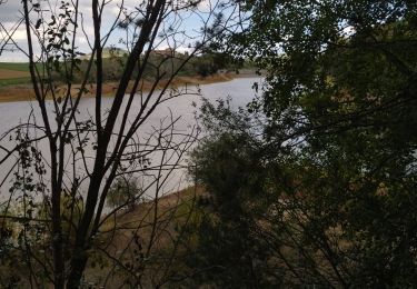
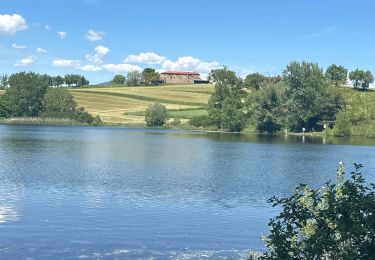
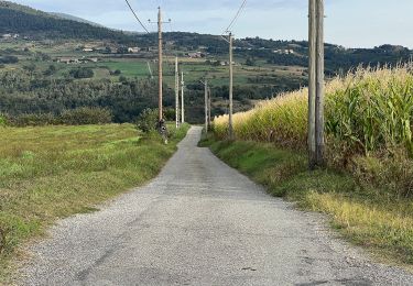
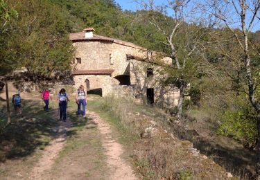
Tour Wandern von 5,1 km verfügbar auf Auvergne-Rhone-Alpen, Ardèche, Étables. Diese Tour wird von guilmanu vorgeschlagen.
Beschreibung
Rando faite avec une enfant de 4 ans sans soucis mais elle marche plutôt bien
Source : https://rando-ardeche-hermitage.fr/pedestre/circuit-de-la-levee/
Ort
Land:
France
Region :
Auvergne-Rhone-Alpen
Abteilung/Provinz :
Ardèche
Kommune :
Étables
Standort:
Unknown
Gehen Sie:(Dec)
Gehen Sie:(UTM)
635776 ; 4995662 (31T) N.
Kommentare
Touren in der Umgebung
![Tour Wandern Sécheras - 07 secheras organise - Photo](https://media.geolcdn.com/t/375/260/9d4f34c3-95ec-4bc5-bde1-7e8f073c60ca.jpg&format=jpg&maxdim=2)
![Wandern Wandern](https://static1.geolcdn.com/sitytour/trail-icons/101.png)
07 secheras organise
Wandern
Einfach
Sécheras,
Auvergne-Rhone-Alpen,
Ardèche,
France
![](/images/other/stat-length.png)
18,8 km | 25 km-effort
5h 4min
![](https://static1.geolcdn.com/siteimages/upload/files/16400158638029165_repeat_loop_refresh_sync_direction_icon.png)
Ja
![Tour Motor Cheminas - quad 12/05/2013 - Photo](https://media.geolcdn.com/t/375/260/ext.jpg?maxdim=2&url=https%3A%2F%2Fstatic1.geolcdn.com%2Fsiteimages%2Fupload%2Ffiles%2F15247431544x4.jpg)
![Motor Motor](https://static1.geolcdn.com/sitytour/trail-icons/400.png)
quad 12/05/2013
Motor
Medium
(3)
Cheminas,
Auvergne-Rhone-Alpen,
Ardèche,
France
![](/images/other/stat-length.png)
11,8 km | 14,8 km-effort
33min
![](https://static1.geolcdn.com/siteimages/upload/files/16400158638029165_repeat_loop_refresh_sync_direction_icon.png)
Ja
![Tour sport Cheminas - Lac de Meinettes de Cheminas - Photo](https://media.geolcdn.com/t/375/260/510171ce-0c2a-4e3e-b1a6-577303de6121.jpg&format=jpg&maxdim=2)
Lac de Meinettes de Cheminas
sport
Sehr leicht
Cheminas,
Auvergne-Rhone-Alpen,
Ardèche,
France
![](/images/other/stat-length.png)
13,5 km | 16,1 km-effort
Unbekannt
![](https://static1.geolcdn.com/siteimages/upload/files/16400158638029165_repeat_loop_refresh_sync_direction_icon.png)
Ja
![Tour Zu Fuß Saint-Victor - Randonnée : Montplot - Photo](https://media.geolcdn.com/t/375/260/3e3075bd-4ef8-4bf2-b291-1b8cf58ebaf6.jpeg&format=jpg&maxdim=2)
![Zu Fuß Zu Fuß](https://static1.geolcdn.com/sitytour/trail-icons/100.png)
Randonnée : Montplot
Zu Fuß
Einfach
Saint-Victor,
Auvergne-Rhone-Alpen,
Ardèche,
France
![](/images/other/stat-length.png)
7,5 km | 10,9 km-effort
2h 28min
![](https://static1.geolcdn.com/siteimages/upload/files/16400158638029165_repeat_loop_refresh_sync_direction_icon.png)
Ja
![Tour Zu Fuß Saint-Victor - Randonnée : Tour du Pays de Saint-Félicien - Jour 3 - Photo](https://media.geolcdn.com/t/375/260/61d8ce39-87ac-4e46-bad7-109fc9caaec1.jpeg&format=jpg&maxdim=2)
![Zu Fuß Zu Fuß](https://static1.geolcdn.com/sitytour/trail-icons/100.png)
Randonnée : Tour du Pays de Saint-Félicien - Jour 3
Zu Fuß
Medium
Saint-Victor,
Auvergne-Rhone-Alpen,
Ardèche,
France
![](/images/other/stat-length.png)
17,5 km | 24 km-effort
5h 32min
![](https://static1.geolcdn.com/siteimages/upload/files/16400158638029165_repeat_loop_refresh_sync_direction_icon.png)
Nein
![Tour Zu Fuß Colombier-le-Vieux - Randonnée : Les Gorges de la Daronne - Photo](https://media.geolcdn.com/t/375/260/7d5bf8d7-536d-4ec6-b9e5-10c88c4ee681.jpeg&format=jpg&maxdim=2)
![Zu Fuß Zu Fuß](https://static1.geolcdn.com/sitytour/trail-icons/100.png)
Randonnée : Les Gorges de la Daronne
Zu Fuß
Medium
Colombier-le-Vieux,
Auvergne-Rhone-Alpen,
Ardèche,
France
![](/images/other/stat-length.png)
14,8 km | 21 km-effort
4h 46min
![](https://static1.geolcdn.com/siteimages/upload/files/16400158638029165_repeat_loop_refresh_sync_direction_icon.png)
Ja
![Tour Wandern Saint-Barthélemy-le-Plain - 07 daronne - Photo](https://media.geolcdn.com/t/375/260/c9bac9ce-4c0a-45bc-89f2-f8b8cc4dc9ff.jpg&format=jpg&maxdim=2)
![Wandern Wandern](https://static1.geolcdn.com/sitytour/trail-icons/101.png)
07 daronne
Wandern
Medium
Saint-Barthélemy-le-Plain,
Auvergne-Rhone-Alpen,
Ardèche,
France
![](/images/other/stat-length.png)
17,9 km | 26 km-effort
4h 59min
![](https://static1.geolcdn.com/siteimages/upload/files/16400158638029165_repeat_loop_refresh_sync_direction_icon.png)
Ja
![Tour Wandern Cheminas - lac des meinettes - Photo](https://media.geolcdn.com/t/375/260/ext.jpg?maxdim=2&url=https%3A%2F%2Fstatic1.geolcdn.com%2Fsiteimages%2Fupload%2Ffiles%2F1553511878bg_sport_marche.png)
![Wandern Wandern](https://static1.geolcdn.com/sitytour/trail-icons/101.png)
lac des meinettes
Wandern
Sehr leicht
(1)
Cheminas,
Auvergne-Rhone-Alpen,
Ardèche,
France
![](/images/other/stat-length.png)
10,3 km | 12,4 km-effort
3h 6min
![](https://static1.geolcdn.com/siteimages/upload/files/16400158638029165_repeat_loop_refresh_sync_direction_icon.png)
Ja
![Tour Wandern Colombier-le-Vieux - Gorges Daronne - Photo](https://media.geolcdn.com/t/375/260/ext.jpg?maxdim=2&url=https%3A%2F%2Fstatic1.geolcdn.com%2Fsiteimages%2Fupload%2Ffiles%2F1553511878bg_sport_marche.png)
![Wandern Wandern](https://static1.geolcdn.com/sitytour/trail-icons/101.png)
Gorges Daronne
Wandern
Medium
(2)
Colombier-le-Vieux,
Auvergne-Rhone-Alpen,
Ardèche,
France
![](/images/other/stat-length.png)
10,4 km | 16,3 km-effort
3h 32min
![](https://static1.geolcdn.com/siteimages/upload/files/16400158638029165_repeat_loop_refresh_sync_direction_icon.png)
Ja